Category:Albourne
Jump to navigation
Jump to search
village in United Kingdom  | |||||
| Upload media | |||||
| Instance of | |||||
|---|---|---|---|---|---|
| Location | Mid Sussex, West Sussex, South East England, England | ||||
| Population |
| ||||
| Area |
| ||||
| Said to be the same as | Albourne (Wikimedia duplicated page, civil parish) | ||||
| official website | |||||
 | |||||
Subcategories
This category has the following 3 subcategories, out of 3 total.
A
P
- Albourne Place (2 F)
Media in category "Albourne"
The following 200 files are in this category, out of 472 total.
(previous page) (next page)-
 5-6, Wick Farm, Truslers Hill Lane - geograph.org.uk - 3961635.jpg 640 × 480; 68 KB
-
 A deserted Singing Hills Golf Cousre - geograph.org.uk - 2265027.jpg 4,000 × 3,000; 2.66 MB
-
 A gathering of rams - geograph.org.uk - 5256529.jpg 800 × 600; 161 KB
-
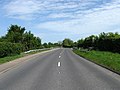
 A23 (T) - geograph.org.uk - 1106957.jpg 640 × 479; 48 KB
-
 A23 (T) - geograph.org.uk - 1298685.jpg 480 × 640; 64 KB
-
 A23 heading north - geograph.org.uk - 2866260.jpg 640 × 480; 49 KB
-
 A23 northbound - geograph.org.uk - 6166038.jpg 1,024 × 684; 240 KB
-
 A23 northbound - geograph.org.uk - 6166051.jpg 1,024 × 684; 272 KB
-
 A23 northbound - geograph.org.uk - 6166183.jpg 1,024 × 684; 262 KB
-
 A23(T) - geograph.org.uk - 4005995.jpg 480 × 640; 60 KB
-
 A23(T) - geograph.org.uk - 4005999.jpg 640 × 480; 56 KB
-
 A23(T) - geograph.org.uk - 4074318.jpg 640 × 480; 70 KB
-
 A23(T) - geograph.org.uk - 4079094.jpg 640 × 480; 66 KB
-
 A23, north - geograph.org.uk - 3649818.jpg 640 × 430; 49 KB
-
 A23, northbound - geograph.org.uk - 4746958.jpg 640 × 351; 40 KB
-
 A281 east to Poynings Crossways - geograph.org.uk - 2264646.jpg 4,000 × 3,000; 2.5 MB
-
 Acre Plat - geograph.org.uk - 4005760.jpg 640 × 480; 82 KB
-
 Agricultural machinery suppliers - geograph.org.uk - 2386814.jpg 4,000 × 3,000; 2.12 MB
-
 Airstrip north of High Cross - geograph.org.uk - 1908354.jpg 1,600 × 1,200; 312 KB
-

-

-
 Albourne Court, Albourne - geograph.org.uk - 3982126.jpg 640 × 480; 54 KB
-
 Albourne Equestrian Centre - geograph.org.uk - 3980676.jpg 640 × 480; 60 KB
-
 Albourne Farm Cottages - geograph.org.uk - 3980347.jpg 480 × 640; 76 KB
-
 Albourne Place Farm - geograph.org.uk - 2302683.jpg 640 × 480; 98 KB
-
 Albourne Place Farm - geograph.org.uk - 3980327.jpg 640 × 480; 87 KB
-
 Albourne Place Lodge, Truslers Hill Lane - geograph.org.uk - 3961663.jpg 640 × 480; 105 KB
-
 Albourne Recreation Ground - geograph.org.uk - 3962749.jpg 640 × 480; 85 KB
-
 Albourne Road - geograph.org.uk - 1298741.jpg 640 × 480; 81 KB
-
 Albourne Road - geograph.org.uk - 4005992.jpg 480 × 640; 47 KB
-
 Albourne Village Hall - geograph.org.uk - 1298810.jpg 480 × 640; 87 KB
-
 Albourne Village Hall - geograph.org.uk - 3980212.jpg 640 × 480; 80 KB
-
 Allotments, Albourne - geograph.org.uk - 3995156.jpg 640 × 480; 92 KB
-
 Approaching the Aviation Business Park - geograph.org.uk - 3878421.jpg 1,204 × 797; 296 KB
-

-

-
 AV Trade, Reeds Lane - geograph.org.uk - 3982073.jpg 640 × 480; 68 KB
-
 Aviation Business Park - geograph.org.uk - 3962605.jpg 480 × 640; 64 KB
-
 B2116 at High Cross, West Sussex - geograph.org.uk - 2242308.jpg 1,600 × 1,092; 448 KB
-
 B2116 bridge, A23 - geograph.org.uk - 3649825.jpg 640 × 430; 51 KB
-
 B2116 Bridge, A23 - geograph.org.uk - 4746956.jpg 640 × 333; 36 KB
-
 B2116 Bridge, A23 - geograph.org.uk - 5642862.jpg 640 × 458; 62 KB
-
 B2118 north to Sayers Common - geograph.org.uk - 2386824.jpg 4,000 × 3,000; 3.48 MB
-
 Barley Croft, Albourne - geograph.org.uk - 3980215.jpg 640 × 480; 118 KB
-
 Barn at Albourne Estate - geograph.org.uk - 6434948.jpg 1,633 × 918; 743 KB
-
 Barn at Albourne Estate - geograph.org.uk - 6435023.jpg 1,632 × 918; 644 KB
-
 Barn Close, Albourne - geograph.org.uk - 3980211.jpg 640 × 480; 71 KB
-
 Barn on the east side of Blackstone Lane - geograph.org.uk - 6436682.jpg 1,633 × 918; 725 KB
-
 Barn on the west side of Shaves Wood Lane - geograph.org.uk - 6404165.jpg 1,633 × 918; 683 KB
-
 Beautiful traditional barn at Albourne Place Farm - geograph.org.uk - 2264751.jpg 4,000 × 3,000; 1.98 MB
-
 Bellows Nose Field - geograph.org.uk - 3964641.jpg 640 × 480; 64 KB
-
 Bend in Reed's lane - geograph.org.uk - 2386337.jpg 4,000 × 3,000; 3.44 MB
-
 Bird Scarer near Bishop's Place - geograph.org.uk - 1305773.jpg 640 × 480; 79 KB
-
 Bishop's Place - geograph.org.uk - 2302711.jpg 640 × 428; 86 KB
-
 Bishop's Place - geograph.org.uk - 3980279.jpg 640 × 480; 92 KB
-
 Bishop's Place - geograph.org.uk - 6634350.jpg 3,640 × 2,047; 1.63 MB
-
 Bishops Place, near Albourne - geograph.org.uk - 74558.jpg 640 × 479; 158 KB
-
 Black Bush (1) - geograph.org.uk - 3980334.jpg 640 × 480; 76 KB
-
 Black Bush (2) - geograph.org.uk - 3980357.jpg 640 × 480; 88 KB
-
 Black Bush (3) - geograph.org.uk - 3980374.jpg 640 × 480; 80 KB
-
 Bounty Cottage - geograph.org.uk - 5169464.jpg 5,472 × 3,648; 4.3 MB
-
 Bounty Cottage, The Street, Albourne - geograph.org.uk - 3982191.jpg 640 × 466; 93 KB
-
 Bounty Cottage.jpg 4,608 × 3,456; 5.14 MB
-
 Brick Field-Park Field - geograph.org.uk - 3962690.jpg 640 × 480; 70 KB
-
 Bridleway from Holmbush Farm - geograph.org.uk - 2264661.jpg 4,000 × 3,000; 2.9 MB
-
 Britts - geograph.org.uk - 3962672.jpg 640 × 480; 87 KB
-
 Buildings at Albourne Estate - geograph.org.uk - 6434943.jpg 1,632 × 918; 633 KB
-
 Buildings at Albourne Estate - geograph.org.uk - 6434987.jpg 1,633 × 918; 707 KB
-
 Buildings at Albourne Estate - geograph.org.uk - 6435092.jpg 1,632 × 918; 578 KB
-
 Bungalow at entrance to Albourne Equestrian Centre - geograph.org.uk - 2386768.jpg 4,000 × 3,000; 2.83 MB
-
 Bushy Field - geograph.org.uk - 3964636.jpg 640 × 480; 65 KB
-
 Business offices off Henfield Road Albourne - geograph.org.uk - 2386802.jpg 4,000 × 3,000; 2.94 MB
-

-
 Cattle crossing, Cutlers Brook - geograph.org.uk - 2302697.jpg 640 × 480; 129 KB
-
 Checking The Route - geograph.org.uk - 4319499.jpg 1,799 × 1,199; 612 KB
-
 Choice of Routes - geograph.org.uk - 1305749.jpg 480 × 640; 68 KB
-
 Church and path at Albourne - geograph.org.uk - 5256220.jpg 800 × 600; 210 KB
-
 Church Lane - geograph.org.uk - 1299740.jpg 480 × 640; 132 KB
-
 Church Lane - geograph.org.uk - 3980452.jpg 480 × 640; 83 KB
-
 Church Lane - geograph.org.uk - 3995179.jpg 640 × 480; 84 KB
-
 Church Lane - geograph.org.uk - 3995218.jpg 640 × 480; 148 KB
-
 Church Lane Albourne - geograph.org.uk - 1908827.jpg 1,600 × 1,200; 575 KB
-
 Church Lane, Albourne - geograph.org.uk - 3980225.jpg 640 × 480; 82 KB
-
 Church of St Bartholomew, Albourne - geograph.org.uk - 6638174.jpg 3,545 × 1,994; 3.21 MB
-
 Church wall and rectory, Albourne - geograph.org.uk - 6634443.jpg 4,030 × 2,266; 2.12 MB
-
 Clappers Lane junction with the A281 - geograph.org.uk - 2264655.jpg 4,000 × 3,000; 2.62 MB
-
 Common Coppice - geograph.org.uk - 3962536.jpg 640 × 480; 126 KB
-
 Corner Field-Three Corner Field - geograph.org.uk - 3961052.jpg 640 × 480; 53 KB
-
 Corporate leisure company on the B 2118 - geograph.org.uk - 1909075.jpg 1,600 × 1,200; 614 KB
-

-

-
 Covered cultivation - geograph.org.uk - 5810167.jpg 1,024 × 768; 411 KB
-
 Crown Croft - geograph.org.uk - 3960972.jpg 640 × 480; 69 KB
-
 Cudding Brook Field-Barn Field - geograph.org.uk - 4079244.jpg 640 × 480; 61 KB
-
 Curtains, The Street, Albourne - geograph.org.uk - 3980218.jpg 640 × 480; 99 KB
-
 Cutler's Brook - geograph.org.uk - 3980590.jpg 640 × 480; 127 KB
-
 Cutler's Brook - geograph.org.uk - 3995192.jpg 480 × 640; 114 KB
-
 Cutler's Brook - geograph.org.uk - 3997088.jpg 480 × 640; 134 KB
-
 Cutler's Brook - geograph.org.uk - 3997100.jpg 480 × 640; 73 KB
-

-
 Cyclists on Trusler's Hill - geograph.org.uk - 1908640.jpg 1,600 × 1,200; 644 KB
-
 Dean Mead - geograph.org.uk - 3962717.jpg 640 × 480; 72 KB
-
 Deer-proof gate to vineyard - geograph.org.uk - 5256518.jpg 800 × 600; 178 KB
-

-
 Dockey Field - geograph.org.uk - 3980300.jpg 640 × 480; 71 KB
-
 Dragons Teeth - geograph.org.uk - 3878431.jpg 1,211 × 800; 367 KB
-
 Drive to Oatfield Cottage - geograph.org.uk - 3961713.jpg 640 × 480; 81 KB
-
 Dwelling at Albourne Place Farm - geograph.org.uk - 5256522.jpg 800 × 600; 136 KB
-
 East Field - geograph.org.uk - 3980311.jpg 640 × 480; 73 KB
-
 East Ham - geograph.org.uk - 3997053.jpg 640 × 480; 91 KB
-
 East Wood - geograph.org.uk - 3961732.jpg 640 × 480; 124 KB
-
 Eight Acres-Furze Field - geograph.org.uk - 3964759.jpg 640 × 480; 65 KB
-
 Electricity Pylons, High Cross - geograph.org.uk - 3961061.jpg 640 × 480; 64 KB
-

-

-
 Entrance to Colemans Park - geograph.org.uk - 2264691.jpg 4,000 × 3,000; 2.96 MB
-
 Entrance to East Wood Farm - geograph.org.uk - 3961772.jpg 640 × 480; 75 KB
-
 Entrance to Northpark Farm - geograph.org.uk - 1908807.jpg 1,600 × 1,200; 657 KB
-
 Entrance to the Rectory of St Bartholomew church - geograph.org.uk - 1908877.jpg 1,600 × 1,200; 705 KB
-

-
 Farm Bridge over the A23 - geograph.org.uk - 4078817.jpg 640 × 480; 95 KB
-
 Farm Bridge over the A23 - geograph.org.uk - 6551097.jpg 3,543 × 2,303; 2.4 MB
-
 Farm buildings south of Bishop's Place - geograph.org.uk - 6634363.jpg 4,002 × 1,936; 2.01 MB
-
 Farm road and footpath over the A23 - geograph.org.uk - 1907397.jpg 1,600 × 1,200; 404 KB
-
 Farm track north from A281 - geograph.org.uk - 5810106.jpg 1,024 × 768; 351 KB
-
 Farmhouse at Albourne Estate - geograph.org.uk - 6435032.jpg 1,632 × 918; 596 KB
-
 Farmhouse at Albourne Estate - geograph.org.uk - 6435136.jpg 1,633 × 918; 726 KB
-

-
 Field next to Church Lane - geograph.org.uk - 1299683.jpg 640 × 480; 104 KB
-
 Field Number 259 - geograph.org.uk - 3997064.jpg 640 × 480; 81 KB
-
 Finches, Albourne.jpg 4,608 × 3,456; 6.3 MB
-
 Finches, The Street, Albourne - geograph.org.uk - 4005702.jpg 640 × 480; 70 KB
-
 Fishing lake at Albourne Place - geograph.org.uk - 1908692.jpg 1,600 × 1,200; 744 KB
-
 Fishing lake with small island - geograph.org.uk - 5256219.jpg 800 × 600; 204 KB
-
 Fishpond, Wick Farm - geograph.org.uk - 3995532.jpg 640 × 480; 119 KB
-
 Fishponds, Albourne Place - geograph.org.uk - 3980427.jpg 640 × 480; 82 KB
-
 Fishponds, Albourne Place - geograph.org.uk - 3995266.jpg 640 × 480; 99 KB
-
 Five Acres - geograph.org.uk - 3969581.jpg 640 × 480; 78 KB
-
 Five Acres by Common - geograph.org.uk - 3961806.jpg 640 × 480; 61 KB
-
 Footbridge Over Cutlers Brook - geograph.org.uk - 1299696.jpg 640 × 480; 123 KB
-
 Footbridge over the A23 - geograph.org.uk - 3649828.jpg 640 × 430; 51 KB
-
 Footbridge over the A23 - geograph.org.uk - 4746952.jpg 640 × 351; 39 KB
-
 Footbridge, A23 - geograph.org.uk - 5642859.jpg 640 × 350; 55 KB
-
 Footbridge, Cutler's Brook - geograph.org.uk - 3962692.jpg 480 × 640; 113 KB
-

-

-

-
 Footpath from the B2118 going eastwards - geograph.org.uk - 5241875.jpg 800 × 600; 204 KB
-
 Footpath heading eastwards to Wick Farm - geograph.org.uk - 5256204.jpg 800 × 600; 153 KB
-
 Footpath junction by Albourne Lakes - geograph.org.uk - 5256216.jpg 800 × 600; 216 KB
-

-

-
 Footpath reaches the B2118 - geograph.org.uk - 5241736.jpg 800 × 600; 222 KB
-
 Footpath to Albourne Church - geograph.org.uk - 1299753.jpg 480 × 640; 187 KB
-
 Footpath to Albourne Church - geograph.org.uk - 1305744.jpg 640 × 480; 75 KB
-
 Footpath to Blackstone - geograph.org.uk - 3961601.jpg 640 × 469; 159 KB
-
 Footpath to Blackstone - geograph.org.uk - 3995294.jpg 480 × 640; 144 KB
-
 Footpath to Church Lane - geograph.org.uk - 1299691.jpg 480 × 640; 82 KB
-
 Footpath to Truslers Hill Lane - geograph.org.uk - 4005954.jpg 640 × 480; 148 KB
-
 Footpath, Albourne - geograph.org.uk - 3969681.jpg 480 × 640; 92 KB
-
 Four Acres-Long Field-House Field - geograph.org.uk - 3980245.jpg 640 × 480; 93 KB
-
 Foxgloves by path to Albourne - geograph.org.uk - 1908997.jpg 1,600 × 1,200; 741 KB
-
 Front Field - geograph.org.uk - 3995212.jpg 640 × 480; 83 KB
-
 Furze Field-Cutlers Field - geograph.org.uk - 3969592.jpg 640 × 480; 52 KB
-
 Furzes - geograph.org.uk - 3960953.jpg 640 × 480; 60 KB
-
 Furzes-Flat Field - geograph.org.uk - 3982051.jpg 640 × 480; 45 KB
-
 Gallops Barn, The Street, Albourne - geograph.org.uk - 4005714.jpg 640 × 480; 65 KB
-
 Gallops, The Street, Albourne - geograph.org.uk - 4005708.jpg 640 × 480; 79 KB
-
 Goldsmiths, Henfield Road, Albourne - geograph.org.uk - 3982173.jpg 480 × 640; 63 KB
-
 Gospel Hall (Exclusive Brethren), Albourne.jpg 4,608 × 3,456; 3.64 MB
-
 Graverleys - geograph.org.uk - 3961003.jpg 640 × 480; 48 KB
-
 Gravestones in St Bartholomew's churchyard - geograph.org.uk - 1908976.jpg 1,600 × 1,200; 436 KB
-
 Great Barn Field - geograph.org.uk - 3995249.jpg 640 × 480; 72 KB
-
 Great Copyhold (1) - geograph.org.uk - 3969649.jpg 640 × 480; 86 KB
-
 Great Copyhold (2) - geograph.org.uk - 3980609.jpg 640 × 480; 63 KB
-
 Great Marshalls - geograph.org.uk - 3995238.jpg 640 × 480; 93 KB
-
 Great Paddock-Little Paddock - geograph.org.uk - 3997097.jpg 640 × 480; 45 KB
-
 Green Field - geograph.org.uk - 3982163.jpg 640 × 480; 43 KB
-
 Green Knowles-Hilly Knowles-The Slip - geograph.org.uk - 3960912.jpg 640 × 480; 43 KB
-
 Green Mead - geograph.org.uk - 3982121.jpg 640 × 480; 50 KB
-

-
 Gulls - and view SSE towards Wolstonbury Hill - geograph.org.uk - 6638155.jpg 4,002 × 1,524; 1.76 MB
-

-

-
 Henfield Road - geograph.org.uk - 3960914.jpg 640 × 480; 65 KB
-
 Henfield Road - geograph.org.uk - 3980651.jpg 640 × 480; 87 KB
-
 Henfield Road - geograph.org.uk - 4005743.jpg 640 × 480; 55 KB
-
 Henfield Road - geograph.org.uk - 4005764.jpg 480 × 640; 63 KB
-
 Henfield Road, High Cross - geograph.org.uk - 3961039.jpg 480 × 640; 59 KB
-
 High Cross Cottages - geograph.org.uk - 5248545.jpg 800 × 600; 91 KB
-

-
 High Cross Farm - geograph.org.uk - 3961037.jpg 640 × 480; 49 KB
-
 Hilly Spurk - geograph.org.uk - 3962711.jpg 640 × 480; 76 KB
-
 Hog Croft - geograph.org.uk - 4078831.jpg 640 × 480; 60 KB
-
 Hogs Pudding-Gate Field - geograph.org.uk - 3961043.jpg 640 × 480; 67 KB
-
 Holders - geograph.org.uk - 1298767.jpg 480 × 640; 178 KB
-
 Hollow veteran Oak at Albourne Place Farm - geograph.org.uk - 2264979.jpg 4,000 × 3,000; 2.9 MB
-
 Hop Garden Field - geograph.org.uk - 3962726.jpg 640 × 480; 93 KB
-
 Hop Garden Field - geograph.org.uk - 3980322.jpg 640 × 480; 83 KB
-
 Hop Garden Lag - geograph.org.uk - 3980244.jpg 640 × 480; 97 KB


_-_geograph.org.uk_-_1106957.jpg)
_-_geograph.org.uk_-_1298685.jpg)


_-_geograph.org.uk_-_4005995.jpg)
_-_geograph.org.uk_-_4005999.jpg)
_-_geograph.org.uk_-_4074318.jpg)
_-_geograph.org.uk_-_4079094.jpg)


_-_geograph.org.uk_-_3980334.jpg)
_-_geograph.org.uk_-_3980357.jpg)
_-_geograph.org.uk_-_3980374.jpg)


,_Albourne.jpg)


_-_geograph.org.uk_-_3969649.jpg)
_-_geograph.org.uk_-_3980609.jpg)


