Category:Ajuntament d'Anglès
Jump to navigation
Jump to search
| Object location | | View all coordinates using: OpenStreetMap |
|---|
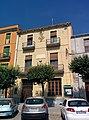
municipal building in Anglès, Spain  | |||||
| Upload media | |||||
| Instance of | |||||
|---|---|---|---|---|---|
| Location | Anglès, Selva, Comarques Gironines, Catalonia | ||||
| Architectural style | |||||
| Owned by |
| ||||
| Occupant |
| ||||
| Heritage designation |
| ||||
 | |||||
Català: Ajuntament d'Anglès
This is a category about a building listed in the Catalan heritage register as Bé Cultural d'Interès Local (BCIL) under the reference IPA-26631. |
Media in category "Ajuntament d'Anglès"
This category contains only the following file.
-
 Ajuntament d'Anglès 1.jpg 2,368 × 3,200; 2.43 MB