Category:Airton
Jump to navigation
Jump to search
village in United Kingdom  | |||||
| Upload media | |||||
| Instance of | |||||
|---|---|---|---|---|---|
| Location | Craven, North Yorkshire, Yorkshire and the Humber, England | ||||
| Population |
| ||||
| Said to be the same as | Airton (Wikimedia duplicated page, civil parish) | ||||
 | |||||
Airton (also known as Airton-in-Craven) is a small village and civil parish in the Craven district of North Yorkshire, England, situated 10 miles north-west of Skipton.
Subcategories
This category has the following 5 subcategories, out of 5 total.
A
- Friends' Meeting House, Airton (11 F)
- Airton Methodist Church (11 F)
B
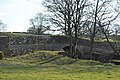
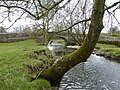
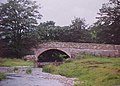
- Airton Bridge (9 F)
K
- Kirk Syke Lane (6 F)
Media in category "Airton"
The following 200 files are in this category, out of 377 total.
(previous page) (next page)-
 'Holme Barn', Hellifield Road - geograph.org.uk - 6138131.jpg 1,024 × 683; 204 KB
-
 17th Century Squatters' House, Airton - geograph.org.uk - 285095.jpg 640 × 480; 88 KB
-
 A little moorland valley - geograph.org.uk - 4119357.jpg 2,000 × 1,500; 1.22 MB
-
 Abbey Hill, near Winterburn - geograph.org.uk - 205393.jpg 640 × 427; 119 KB
-
 Access Lane from Crake Moor - geograph.org.uk - 2360943.jpg 4,320 × 3,240; 4.25 MB
-
 Aire in Airton 01.jpg 2,560 × 1,920; 2.42 MB
-
 Aire in Airton 02.jpg 2,560 × 1,920; 2.45 MB
-
 Airton - geograph.org.uk - 205388.jpg 640 × 427; 117 KB
-
 Airton - geograph.org.uk - 29239.jpg 640 × 480; 169 KB
-
 Airton - geograph.org.uk - 4548345.jpg 640 × 426; 66 KB
-
 Airton - geograph.org.uk - 4912417.jpg 5,472 × 3,648; 1.74 MB
-
 Airton - geograph.org.uk - 4912419.jpg 5,472 × 3,051; 1.93 MB
-
 Airton - geograph.org.uk - 599880.jpg 640 × 427; 60 KB
-
 Airton - geograph.org.uk - 599882.jpg 640 × 427; 56 KB
-
 Airton - geograph.org.uk - 599887.jpg 640 × 427; 71 KB
-
 Airton - geograph.org.uk - 6080738.jpg 5,184 × 3,456; 6.79 MB
-
 Airton - geograph.org.uk - 6173937.jpg 1,024 × 683; 471 KB
-
 Airton - geograph.org.uk - 6580639.jpg 2,000 × 1,078; 2.1 MB
-
 Airton - geograph.org.uk - 6580644.jpg 2,000 × 1,208; 2.17 MB
-
 Airton - panoramio.jpg 2,021 × 1,917; 717 KB
-
 Airton - village green - geograph.org.uk - 6485043.jpg 1,799 × 1,199; 313 KB
-
 Airton Andh.JPG 2,048 × 1,536; 658 KB
-
 Airton Green - geograph.org.uk - 48818.jpg 640 × 451; 106 KB
-
 Airton Green and Manor - geograph.org.uk - 6284923.jpg 1,024 × 768; 174 KB
-
 Airton Green and the Squatters' House - geograph.org.uk - 6284912.jpg 1,024 × 768; 150 KB
-
 Airton Manor - geograph.org.uk - 6280856.jpg 1,024 × 768; 256 KB
-
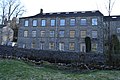
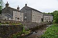 Airton Mill - geograph.org.uk - 2991426.jpg 3,872 × 2,592; 4.9 MB
-
 Airton Mill - geograph.org.uk - 4632600.jpg 640 × 426; 115 KB
-
 Airton Mill - geograph.org.uk - 4632602.jpg 640 × 426; 91 KB
-
 Airton Mill - geograph.org.uk - 6366168.jpg 2,592 × 1,944; 1.28 MB
-
 Airton Mill and Riverside Cottage - geograph.org.uk - 4130215.jpg 4,000 × 2,734; 4.63 MB
-
 Airton Mill on the River Aire - geograph.org.uk - 5854970.jpg 1,600 × 1,067; 368 KB
-
 Airton Old Mill Andh.JPG 2,048 × 1,536; 561 KB
-
 Airton village green (1) - geograph.org.uk - 6280862.jpg 1,024 × 768; 199 KB
-
 Airton village green (2) - geograph.org.uk - 6280866.jpg 1,024 × 768; 221 KB
-
 Allamere Laithe - geograph.org.uk - 205385.jpg 640 × 427; 144 KB
-
 Allamire Laithe - geograph.org.uk - 2060497.jpg 640 × 480; 165 KB
-

-
 Along Kirk Syke Lane - geograph.org.uk - 6080187.jpg 5,184 × 3,456; 4.31 MB
-
 Approaching Crake Moor - geograph.org.uk - 2360917.jpg 4,320 × 3,240; 3.75 MB
-
 Approaching Ingle Beck - geograph.org.uk - 2094816.jpg 640 × 480; 114 KB
-
 Approaching Well Head Laithe - geograph.org.uk - 6079223.jpg 5,184 × 3,456; 6.82 MB
-
 Bark Laithe - geograph.org.uk - 6476165.jpg 1,024 × 673; 176 KB
-
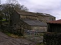 Barn at Kirk Syke - geograph.org.uk - 1773341.jpg 640 × 480; 87 KB
-
 Barn at Kirk Syke - geograph.org.uk - 4453008.jpg 4,320 × 3,240; 5.69 MB
-
 Barn at Kirk Syke near Airton - geograph.org.uk - 128575.jpg 640 × 480; 149 KB
-
 Barn at Tormire Laithe - geograph.org.uk - 5217919.jpg 1,600 × 1,199; 818 KB
-
 Barn at Well Head Laithe - geograph.org.uk - 2838234.jpg 3,072 × 2,304; 1.49 MB
-
 Barn near Brocka Laithe - geograph.org.uk - 1893370.jpg 4,224 × 3,168; 4.84 MB
-
 Barn near Robcross Hill - geograph.org.uk - 2838223.jpg 3,072 × 2,304; 1.34 MB
-
 Barn west of Bark Hill - geograph.org.uk - 2838240.jpg 2,640 × 1,980; 777 KB
-
 Barn, bridge and beck - geograph.org.uk - 4454089.jpg 4,320 × 3,240; 4.25 MB
-
 Bath conversion - geograph.org.uk - 543240.jpg 640 × 480; 198 KB
-
 Benchmark on a gatepost on Orms Gill Green Lane - geograph.org.uk - 2860461.jpg 3,072 × 2,304; 1.46 MB
-
 Benchmark on a gatepost south of Crake Moor Covert - geograph.org.uk - 2860443.jpg 3,072 × 2,304; 1.2 MB
-
 Benchmark on Airton Manor - geograph.org.uk - 6477791.jpg 683 × 1,024; 271 KB
-
 Benchmark on Brocka Laithe - geograph.org.uk - 6666875.jpg 683 × 1,024; 313 KB
-
 Benchmark on east face of Bark Laithe - geograph.org.uk - 6476152.jpg 1,024 × 652; 295 KB
-

-

-

-

-

-
 Benchmark on Kirk Syke Laithe - geograph.org.uk - 6477644.jpg 1,024 × 683; 303 KB
-
 Benchmark on Legrems Laithe - geograph.org.uk - 6477595.jpg 1,024 × 683; 296 KB
-

-
 Benchmark on northern parapet of Newfield Bridge - geograph.org.uk - 6478183.jpg 1,024 × 652; 237 KB
-
 Benchmark on south parapet of Newfield Bridge - geograph.org.uk - 6478167.jpg 1,024 × 683; 297 KB
-

-
 Benchmark on Tormire Laithe - geograph.org.uk - 6663052.jpg 683 × 1,024; 224 KB
-
 Benchmark on Well Head Laithe - geograph.org.uk - 6477559.jpg 683 × 1,024; 278 KB
-
 Black Gill Lane - geograph.org.uk - 969154.jpg 640 × 480; 68 KB
-
 Black Gill Lane towards Airton - geograph.org.uk - 2464745.jpg 1,600 × 1,200; 463 KB
-
 Black Gill Lane towards Airton - geograph.org.uk - 2464753.jpg 1,600 × 1,200; 466 KB
-
 Black sheep of the family - geograph.org.uk - 600030.jpg 640 × 480; 80 KB
-

-
 Boundary stone, Airton and Scosthrop - geograph.org.uk - 4119373.jpg 1,500 × 2,000; 1.56 MB
-
 Boundary stone, Airton and Scosthrop - geograph.org.uk - 4119502.jpg 1,500 × 2,000; 1.49 MB
-
 Boundary Stone, Scosthrop - Airton - geograph.org.uk - 617306.jpg 480 × 640; 158 KB
-
 Boundary stone, Scosthrop and Airton - geograph.org.uk - 4119464.jpg 1,503 × 2,000; 1.72 MB
-
 Boundary stone, Scosthrop and Airton - geograph.org.uk - 4119516.jpg 1,500 × 2,000; 1.75 MB
-
 Bridge in Airton 1.jpg 1,465 × 1,450; 487 KB
-
 Bridge on Grains Lane at approach to cattle grid - geograph.org.uk - 6461454.jpg 1,024 × 683; 315 KB
-
 Bridge over Otterburn Beck - geograph.org.uk - 170642.jpg 640 × 480; 102 KB
-
 Bridleway descending to Scosthrop - geograph.org.uk - 2838225.jpg 3,072 × 2,304; 1.65 MB
-
 Bridleway to Scosthrop Lane - geograph.org.uk - 599929.jpg 640 × 480; 74 KB
-
 Bridleway to Town End, Airton - geograph.org.uk - 2991470.jpg 3,872 × 2,592; 4.57 MB
-
 Brocka Laithe - geograph.org.uk - 6666904.jpg 1,024 × 683; 235 KB
-

-

-
 Cattle grid on Scosthrop Lane - geograph.org.uk - 2089091.jpg 640 × 458; 72 KB
-
 Cattle grid on the civil parish boundary - geograph.org.uk - 4119458.jpg 2,000 × 1,500; 1.32 MB
-
 Cattle grid on the parish boundary - geograph.org.uk - 4119509.jpg 2,000 × 1,500; 1.11 MB
-
 Cold, bleak, windy and wet - geograph.org.uk - 858864.jpg 640 × 480; 37 KB
-
 Corner of the wall around a conifer plantation - geograph.org.uk - 4119493.jpg 2,000 × 1,500; 1.41 MB
-
 Cottages, Hellifield Road, Airton - geograph.org.uk - 617173.jpg 640 × 424; 65 KB
-
 Country road near Airton (1) - geograph.org.uk - 4928942.jpg 567 × 640; 215 KB
-
 Country road near Airton (2) - geograph.org.uk - 4928954.jpg 640 × 480; 260 KB
-
 Cow by the road... - geograph.org.uk - 5935283.jpg 4,676 × 3,507; 4.39 MB
-
 Cowper Cote - geograph.org.uk - 193038.jpg 640 × 480; 76 KB
-
 Cows by Moor End Farm - geograph.org.uk - 2991473.jpg 3,711 × 2,474; 3.47 MB
-
 Crake Moor - geograph.org.uk - 2095116.jpg 640 × 429; 103 KB
-
 Crake Moor - geograph.org.uk - 2095179.jpg 640 × 474; 108 KB
-
 Crake Moor Covert - geograph.org.uk - 965556.jpg 640 × 480; 84 KB
-
 Derelict barn near Otterburn - geograph.org.uk - 5748079.jpg 1,280 × 850; 613 KB
-
 Derelict barn near Otterburn - geograph.org.uk - 5748685.jpg 1,280 × 850; 1.55 MB
-

-
 Dowber Syke and Robcross Hill - geograph.org.uk - 5854947.jpg 1,600 × 1,067; 318 KB
-
 Dry stone wall south west of Rye Loaf Hill - geograph.org.uk - 3762101.jpg 4,320 × 3,240; 4.53 MB
-
 Drystone wall on the slope of Burn Hill - geograph.org.uk - 6284933.jpg 1,024 × 768; 165 KB
-
 Eastern Barn (geograph 6756398).jpg 1,600 × 994; 395 KB
-
 Ebor Gate - geograph.org.uk - 3596432.jpg 2,000 × 1,333; 777 KB
-
 Ebor Gate on Black Gill Lane - geograph.org.uk - 3291284.jpg 640 × 480; 112 KB
-

-
 Farm buildings on the edge of Airton - geograph.org.uk - 2982889.jpg 3,872 × 2,592; 3.84 MB
-
 Farmland off Scosthrop Lane - geograph.org.uk - 2464839.jpg 1,600 × 1,200; 460 KB
-
 Farmland off Scosthrop Lane - geograph.org.uk - 2464855.jpg 1,600 × 1,200; 358 KB
-
 Farmland off Scosthrop Lane - geograph.org.uk - 2464867.jpg 1,600 × 1,200; 548 KB
-
 Farmland track north of Bell Busk - geograph.org.uk - 6476116.jpg 1,024 × 683; 196 KB
-
 Field barn near Airton - geograph.org.uk - 5748060.jpg 1,280 × 720; 407 KB
-
 Field gate at Hunger Hill - geograph.org.uk - 5854962.jpg 1,600 × 1,067; 374 KB
-
 Field gate from minor road SW of Airton - geograph.org.uk - 6196581.jpg 1,024 × 683; 275 KB
-
 Field gateway from road northeast of Bark Hill - geograph.org.uk - 6478204.jpg 1,024 × 667; 151 KB
-
 Field gateway giving access to Tennant's Laithe - geograph.org.uk - 6667220.jpg 1,024 × 683; 192 KB
-
 Field south of Kirk Syke - geograph.org.uk - 4443947.jpg 3,264 × 2,448; 1.75 MB
-
 Fields in the Aire Valley - geograph.org.uk - 4548307.jpg 640 × 426; 34 KB
-
 Flats converted from an old mill - geograph.org.uk - 532395.jpg 640 × 480; 157 KB
-
 Footbridge over the Aire - geograph.org.uk - 2984641.jpg 3,872 × 2,592; 5.17 MB
-
 Footpath to Kirk Sykes - geograph.org.uk - 599944.jpg 640 × 480; 68 KB
-
-
 Ford at Kirk Syke Farm - geograph.org.uk - 2838230.jpg 3,072 × 2,304; 1.45 MB
-
 Fresh grass on the moor - geograph.org.uk - 3596494.jpg 2,000 × 1,500; 1.26 MB
-
 Gate across footpath from Kirk Syke - geograph.org.uk - 6478120.jpg 1,024 × 683; 224 KB
-
 Gate at Allamire Laithe - geograph.org.uk - 5855423.jpg 1,600 × 1,067; 313 KB
-
 Gate beside the River Aire. - geograph.org.uk - 3967643.jpg 640 × 413; 91 KB
-

-
 Gateway at track to Hurries Farm - geograph.org.uk - 6667172.jpg 1,024 × 683; 233 KB
-
 Grains Lane and plantation - geograph.org.uk - 6173919.jpg 1,024 × 683; 393 KB
-
 Grazing land in the Aire Valley - geograph.org.uk - 4548297.jpg 640 × 426; 45 KB
-
 Grazing land in the Aire Valley - geograph.org.uk - 4548306.jpg 640 × 426; 49 KB
-

-
 Grazing off Black Gill Lane - geograph.org.uk - 2464751.jpg 1,600 × 1,094; 396 KB
-
 Highland cattle - geograph.org.uk - 2612549.jpg 640 × 480; 58 KB
-
 Highland cattle on High Side - geograph.org.uk - 2095075.jpg 640 × 480; 103 KB
-
 Highland Cattle on High Side - geograph.org.uk - 5195434.jpg 640 × 428; 45 KB
-
 House in Airton 01.jpg 1,941 × 1,313; 508 KB
-
 House in Airton 02.jpg 2,560 × 1,920; 2.32 MB
-
 House in Airton 03.jpg 2,560 × 1,920; 2.4 MB
-
 House in Airton 04.jpg 2,280 × 1,462; 637 KB
-
 House in Airton 05.jpg 2,560 × 1,920; 2.34 MB
-
 House in Airton 06.jpg 2,560 × 1,920; 2.42 MB
-
 House in Airton 07.jpg 2,560 × 1,920; 2.52 MB
-
 House on the green - geograph.org.uk - 4130207.jpg 3,918 × 2,888; 5.34 MB
-
-
 Houses in Airton, Yorkshire - geograph.org.uk - 4081611.jpg 1,600 × 1,064; 708 KB
-
 Hurries Farm - geograph.org.uk - 2838218.jpg 3,072 × 2,304; 1.09 MB
-
 Ingle Beck from Ingle Bridge - geograph.org.uk - 2860458.jpg 3,072 × 2,304; 1.36 MB
-
 Inquisitive calf at Airton - geograph.org.uk - 2991477.jpg 3,711 × 2,474; 3.75 MB
-

-
 Junction of walls, Long Preston - geograph.org.uk - 5083692.jpg 2,000 × 1,500; 1.01 MB
-
 Junction on High Side - geograph.org.uk - 2095090.jpg 640 × 480; 70 KB
-
 Kirk Syke Laithe, Kirk Syke Lane - geograph.org.uk - 6477662.jpg 1,024 × 683; 256 KB
-
 Kirk Syke Lane - geograph.org.uk - 4452988.jpg 3,240 × 4,320; 4.39 MB
-
 Kirk Syke Lane - geograph.org.uk - 4453012.jpg 3,240 × 4,320; 5.6 MB
-
 Kirk Syke Lane - geograph.org.uk - 6079236.jpg 5,184 × 3,456; 6.86 MB
-
 Lamp upgraded - geograph.org.uk - 600041.jpg 640 × 480; 162 KB
-
 Lane from Newfield Bridge - geograph.org.uk - 4644597.jpg 640 × 426; 96 KB
-
 Lane to Newfield Bridge - geograph.org.uk - 4548309.jpg 640 × 426; 75 KB
-
 Legrems Laithe, Kirk Syke Lane - geograph.org.uk - 6477596.jpg 1,024 × 670; 155 KB
-

-
 Limekiln at Orms Gill Green - geograph.org.uk - 2093392.jpg 480 × 640; 112 KB
-
 Limekiln at Orms Gill Green - geograph.org.uk - 2860453.jpg 3,072 × 2,304; 1.08 MB
-
 Low Barn - geograph.org.uk - 2093341.jpg 640 × 480; 90 KB
-
 Manor House, Airton.jpg 1,024 × 683; 207 KB
-
 Mill in Airton 01.jpg 2,560 × 1,920; 2.45 MB
-
 Mill in Airton 02.jpg 1,920 × 2,560; 2.39 MB
-
 Mill in Airton 03.jpg 2,560 × 1,920; 2.46 MB
-
 Mill, Airton - geograph.org.uk - 4927719.jpg 640 × 480; 191 KB
-
 Moor End Farm and a barn - geograph.org.uk - 2991438.jpg 3,709 × 2,473; 3.47 MB
-
 Moorland and road to Airton - geograph.org.uk - 6173916.jpg 1,024 × 683; 402 KB
-
 Moorland at Ebor Gate - geograph.org.uk - 4507000.jpg 3,266 × 2,445; 4.78 MB
-
 Moorland in Airton - geograph.org.uk - 4119476.jpg 2,000 × 1,500; 1.07 MB
-
 Moorland near Airton - geograph.org.uk - 4506996.jpg 1,024 × 768; 692 KB
-
 Moorland view on Scostrop Moor - geograph.org.uk - 6461466.jpg 1,024 × 683; 297 KB
-
 New seat - geograph.org.uk - 379582.jpg 640 × 480; 172 KB
-
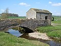
 Newfield Bridge - geograph.org.uk - 2860490.jpg 3,072 × 2,304; 1.35 MB
-
 Newfield Bridge - geograph.org.uk - 4453003.jpg 4,320 × 3,240; 3.62 MB
-
 Newfield Bridge - geograph.org.uk - 4644583.jpg 640 × 426; 106 KB
-
 Newfield Bridge - geograph.org.uk - 4644589.jpg 640 × 426; 106 KB
-
 Newfield Bridge - geograph.org.uk - 4644599.jpg 640 × 426; 100 KB
-
 Newfield Bridge - geograph.org.uk - 4644624.jpg 640 × 426; 112 KB
-
 Newfield Bridge - geograph.org.uk - 4644626.jpg 640 × 426; 101 KB
-
 Newfield Bridge - geograph.org.uk - 4644633.jpg 640 × 426; 89 KB
-
 Newfield Bridge - geograph.org.uk - 4928198.jpg 1,600 × 1,200; 591 KB
-
 Newfield Bridge - geograph.org.uk - 525288.jpg 640 × 480; 115 KB
-
 Newfield Bridge and the Aire - geograph.org.uk - 6401963.jpg 2,000 × 1,331; 2.64 MB
-
 Newfield Bridge over the River Aire - geograph.org.uk - 3312770.jpg 637 × 457; 43 KB
-
 Newfield Bridge Revisited - geograph.org.uk - 6080202.jpg 5,184 × 3,456; 7.27 MB
-
 Newfield Bridge, taking road over River Aire - geograph.org.uk - 6478190.jpg 1,024 × 683; 263 KB
-
 Newfield Laithe - geograph.org.uk - 4548336.jpg 640 × 426; 68 KB


_-_geograph.org.uk_-_6280862.jpg)
_-_geograph.org.uk_-_6280866.jpg)


_-_geograph.org.uk_-_3126717.jpg)


_-_geograph.org.uk_-_4928942.jpg)
_-_geograph.org.uk_-_4928954.jpg)


.jpg)


