Category:Airfields in Scotland
Jump to navigation
Jump to search
Wikimedia category | |||||
| Upload media | |||||
| Instance of | |||||
|---|---|---|---|---|---|
| Category combines topics | |||||
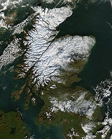
| Scotland | |||||
country in north-west Europe, part of the United Kingdom | |||||
| Instance of | |||||
| Part of | |||||
| Patron saint | |||||
| Location |
| ||||
| Capital | |||||
| Legislative body | |||||
| Executive body | |||||
| Official language | |||||
| Anthem |
| ||||
| Currency | |||||
| Head of state | |||||
| Head of government |
| ||||
| Highest point |
| ||||
| Population |
| ||||
| Area |
| ||||
| Replaces | |||||
| Top-level Internet domain |
| ||||
| Different from | |||||
| Partially coincident with |
| ||||
| official website | |||||
 | |||||
Subcategories
This category has the following 25 subcategories, out of 25 total.
A
- Auchleven airfield (2 F)
B
- RAF Banff (7 F)
- Broadford Airfield (11 F)
C
- Coll Aerodrome (12 F)
D
- Dornoch Airfield (25 F)
G
- Glenforsa Airfield (9 F)
L
M
- RNAS Merganser (5 F)
P
- Plockton Airfield (14 F)
- Portmoak airfield (10 F)
R
- RAF Drem (13 F)
- RAF Fearn (9 F)
- RAF Milltown (20 F)
S
- Strathallan Airfield (4 F)
T
- Twatt Airfield (13 F)
Media in category "Airfields in Scotland"
The following 73 files are in this category, out of 73 total.
-
A Loch Doon gunnery range airfield site feature, Dalmellington, East Ayrshire.jpg 4,896 × 2,752; 6.73 MB
-
A846 Port Ellen to Bowmore road - geograph.org.uk - 17274.jpg 640 × 456; 109 KB
-
Aerodrome Field - geograph.org.uk - 224296.jpg 640 × 480; 53 KB
-
Aerodrome field - geograph.org.uk - 623599.jpg 640 × 480; 53 KB
-
XM412 (8501638192) (2).jpg 1,024 × 683; 651 KB
-
Bogton Airfield site, Dalmellington, East Ayrshire. Buildings foundations & runways.jpg 4,896 × 2,192; 1.99 MB
-
Brackla Aerodrome perimeter track - geograph.org.uk - 372312.jpg 640 × 480; 88 KB
-
Cairngorm Gliding Club - geograph.org.uk - 215466.jpg 640 × 480; 138 KB
-
Concrete ruins - geograph.org.uk - 372332.jpg 640 × 480; 59 KB
-
Control Tower, Upper Kenly - geograph.org.uk - 231860.jpg 640 × 424; 58 KB
-
Deeside Gliding Club - geograph.org.uk - 235671.jpg 640 × 442; 73 KB
-
Drome Workshops - geograph.org.uk - 724750.jpg 640 × 369; 41 KB
-
Easter Poldar Farm Runway 1 - geograph.org.uk - 441742.jpg 640 × 487; 71 KB
-
Errol Airfield (disused) - geograph.org.uk - 329588.jpg 640 × 480; 58 KB
-
Evanton Airfield - geograph.org.uk - 96495.jpg 640 × 399; 83 KB
-
Falgunzeon airfield - geograph.org.uk - 480591.jpg 640 × 450; 94 KB
-
Falgunzeon airfield - geograph.org.uk - 480594.jpg 640 × 428; 61 KB
-
G-ATNI at Fordoun airfield - geograph.org.uk - 472670.jpg 640 × 480; 94 KB
-
Garioch Aero Club - geograph.org.uk - 1412212.jpg 640 × 398; 30 KB
-
Garioch Aero Club - geograph.org.uk - 258654.jpg 640 × 400; 40 KB
-
Gliding Competition at Aboyne Airfield - geograph.org.uk - 4832.jpg 640 × 418; 208 KB
-
Hangar notice - geograph.org.uk - 269897.jpg 640 × 480; 135 KB
-
Highland Gliding Club - geograph.org.uk - 6350.jpg 640 × 293; 143 KB
-
Jura Airstrip - geograph.org.uk - 164695.jpg 640 × 480; 190 KB
-
Loch Doon gunnery range airfield site feature, Dalmellington, East Ayrshire.jpg 3,362 × 2,665; 2.17 MB
-
North side of tower - geograph.org.uk - 231862.jpg 640 × 425; 69 KB
-
Ready for take off - geograph.org.uk - 729512.jpg 640 × 480; 72 KB
-
Runway, East Fortune - geograph.org.uk - 139880.jpg 640 × 480; 39 KB
-
Upper Kenly - geograph.org.uk - 231857.jpg 640 × 424; 51 KB
-
Upper Kenly buildings - geograph.org.uk - 231859.jpg 640 × 424; 75 KB
-
West Freugh Airfield - geograph.org.uk - 434249.jpg 640 × 434; 58 KB
-
Aboyne Airfield - geograph.org.uk - 254741.jpg 640 × 480; 76 KB
-
Balado Airfield - geograph.org.uk - 354030.jpg 640 × 480; 120 KB
-
Bute, Airfield - geograph.org.uk - 112518.jpg 640 × 480; 71 KB
-
Connel Airport - geograph.org.uk - 469456.jpg 640 × 427; 51 KB
-
Deeside Gliding Club - geograph.org.uk - 236671.jpg 640 × 427; 251 KB
-
Disused Airfield at Kinnell - geograph.org.uk - 254229.jpg 352 × 196; 22 KB
-
Disused Castletown airfield - geograph.org.uk - 551858.jpg 640 × 480; 73 KB
-
Eastern edge of Longside Airfield - geograph.org.uk - 260710.jpg 640 × 480; 80 KB
-
Easterton Airfield - geograph.org.uk - 12792.jpg 640 × 340; 197 KB
-
Zero Nine - geograph.org.uk - 160360.jpg 640 × 480; 53 KB
-
Forlorn Gannet - geograph.org.uk - 143643.jpg 640 × 480; 56 KB
-
Girvan Golf Course-Airport - geograph.org.uk - 22643.jpg 640 × 480; 62 KB
-
Gliding Club tow plane - geograph.org.uk - 262419.jpg 640 × 410; 88 KB
-
Grass runway on the Kilkerran estate - geograph.org.uk - 264561.jpg 640 × 480; 96 KB
-
Highland Gliding Club - geograph.org.uk - 227283.jpg 640 × 296; 163 KB
-
Highland Gliding Club - geograph.org.uk - 227287.jpg 640 × 290; 173 KB
-
Highland Gliding Club - geograph.org.uk - 227290.jpg 640 × 218; 127 KB
-
Insch "Airport" - geograph.org.uk - 459843.jpg 640 × 480; 92 KB
-
Kirknewton Airfield - geograph.org.uk - 46984.jpg 640 × 480; 63 KB
-
Kirknewton Airfield. - geograph.org.uk - 46982.jpg 640 × 424; 61 KB
-
Landing strip - geograph.org.uk - 323017.jpg 640 × 480; 96 KB
-
Longside Airfield - geograph.org.uk - 442319.jpg 640 × 480; 70 KB
-
Memorial for RNAS Lenabo - geograph.org.uk - 466212.jpg 640 × 480; 121 KB
-
Old Airfield at RM Condor - geograph.org.uk - 111591.jpg 640 × 475; 54 KB
-
Revetment at Tain Range - geograph.org.uk - 703972.jpg 640 × 457; 384 KB
-
RNAS Lenabo - geograph.org.uk - 466221.jpg 640 × 480; 113 KB
-
Runway construction - geograph.org.uk - 165767.jpg 640 × 480; 105 KB
-
Runway Junction - geograph.org.uk - 442208.jpg 640 × 495; 58 KB
-
Strathallan runway - geograph.org.uk - 538318.jpg 640 × 479; 62 KB
-
The airstrip at Strathaven - geograph.org.uk - 57022.jpg 640 × 480; 52 KB
-
Winfield Airfield - geograph.org.uk - 434622.jpg 640 × 480; 84 KB


