Category:Aigburth Vale
Jump to navigation
Jump to search
| Object location | | View all coordinates using: OpenStreetMap |
|---|

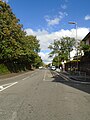
Aigburth Vale runs south from Queens Drive at the southeast corner of Sefton Park to Aigburth Road. Its southern end was a terminus for trams, and is nowadays a bus terminus.
Subcategories
This category has the following 2 subcategories, out of 2 total.
A
- Aigburth People's Hall (4 F)
- Aigburth Vale playground (2 F)
Media in category "Aigburth Vale"
The following 18 files are in this category, out of 18 total.
-
 1st Allerton Scout Hall.jpg 4,165 × 3,013; 6.62 MB
-
 Aigburth Vale 1.jpg 5,064 × 3,601; 11.43 MB
-
 Aigburth Vale 2.jpg 3,824 × 3,528; 3.89 MB
-
 Aigburth Vale 201703-1.jpg 4,508 × 3,594; 7.43 MB
-
 Aigburth Vale 201703-2.jpg 5,152 × 3,864; 8.59 MB
-
 Aigburth Vale 3.jpg 5,152 × 3,864; 4.55 MB
-
 Aigburth Vale 4.jpg 5,152 × 3,864; 4.92 MB
-
 Aigburth Vale 5.jpg 4,768 × 3,696; 3.46 MB
-
 Aigburth Vale 6.jpg 4,730 × 3,018; 7.36 MB
-
 Aigburth Vale from Queens Drive 1.jpg 5,152 × 3,864; 7.27 MB
-
 Aigburth Vale from Queens Drive 2.jpg 5,152 × 3,864; 7.86 MB
-
 Arriva buses in Aigburth Vale Bus Terminus, Liverpool 11 July 2007.jpg 640 × 480; 120 KB
-
 Benchmark at Aigburth Vale & Park Avenue.jpg 3,972 × 3,052; 7.35 MB
-
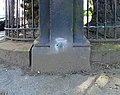 Benchmark at junction of Elmswood Road & Aigburth Vale.jpg 4,332 × 3,432; 3.41 MB
-

-
 Park Cafe, Aigburth Vale.jpg 4,704 × 3,608; 2.8 MB
-
 Substation, Aigburth Vale.jpg 5,152 × 3,864; 1.98 MB
-
 View up Aigburth Vale.jpg 3,864 × 5,152; 1.46 MB


