Category:Agricultural maps of Africa
Jump to navigation
Jump to search
Subcategories
This category has only the following subcategory.
A
Media in category "Agricultural maps of Africa"
The following 8 files are in this category, out of 8 total.
-
 Baumwollkarte Kamerun 1909.jpg 2,461 × 2,323; 503 KB
-
 GambiaAgriculture.jpg 1,200 × 525; 65 KB
-
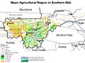 Mali ag map 2001 USDA.jpg 787 × 590; 130 KB
-
 Map of Africa marked with cattle areas. Wellcome M0018127.jpg 3,176 × 3,520; 529 KB
-
 Niger ag land use map USGS.png 800 × 267; 131 KB
-
 Niger sorghum map and season.png 400 × 636; 70 KB
-
 PICS Countries.png 1,225 × 619; 573 KB
-
 Stages and phases Bura Irrigation Project (Kenya).png 1,088 × 1,129; 188 KB


.png)