Category:Aglish (County Kilkenny)
Jump to navigation
Jump to search
Aglish is a civil parish in South County Kilkenny consisting of the townlands Aglish North, Aglish South, Curraghmartin, Cussana, Mountneill and Portnahully.

civil parish in County Kilkenny, Ireland | |||||
| Upload media | |||||
| Instance of | |||||
|---|---|---|---|---|---|
| Location | Barony of Iverk, County Kilkenny, Leinster, Ireland | ||||
 | |||||
Media in category "Aglish (County Kilkenny)"
The following 28 files are in this category, out of 28 total.
-
 2022-07-19 47a Lenehan Aglish South.png 3,008 × 2,000; 8.87 MB
-
 46 Lenehan Aglish South.png 2,877 × 1,902; 8.77 MB
-
 A view of the River Suir Bridge - geograph.org.uk - 5536317.jpg 640 × 480; 222 KB
-
 Castles of Leinster, Corluddy, Kilkenny (1) - geograph.org.uk - 4570947.jpg 1,024 × 683; 1.02 MB
-
 Castles of Leinster, Corluddy, Kilkenny (2) - geograph.org.uk - 4570950.jpg 1,024 × 703; 965 KB
-

-
 Castles of Leinster, Granagh, Kilkenny (2) - geograph.org.uk - 6525973.jpg 1,024 × 805; 1.04 MB
-
 Granagh Castle 1 - Mooncoin, County Kilkenny - geograph.org.uk - 6306503.jpg 1,024 × 626; 126 KB
-
 Granagh Castle 2 - Mooncoin, County Kilkenny - geograph.org.uk - 6306509.jpg 1,024 × 668; 195 KB
-
 Granagh Castle 3 - Mooncoin, County Kilkenny - geograph.org.uk - 6306513.jpg 1,024 × 628; 116 KB
-
 Granagh Castle 4 - Mooncoin, County Kilkenny - geograph.org.uk - 6306518.jpg 1,024 × 628; 145 KB
-
 Granagh Castle 5 - Mooncoin, County Kilkenny - geograph.org.uk - 6306524.jpg 1,024 × 663; 184 KB
-
 Grannagh Castle - geograph.org.uk - 6438190.jpg 3,200 × 2,133; 6.01 MB
-
 M9 Motorway, north of Junction 12 - geograph.org.uk - 6092293.jpg 800 × 533; 536 KB
-
 Newtown thatched cottage 2.png 3,000 × 1,500; 4.04 MB
-
 Newtown thatched cottage 3.png 1,702 × 3,000; 4.02 MB
-
 Newtown thatched cottage detail.png 1,665 × 1,497; 4.03 MB
-
 Newtown thatched cottage.png 3,000 × 1,604; 4.73 MB
-

-
 Paddy's Cottage Aglish South.png 2,691 × 1,913; 8.51 MB
-
 River Suir - Thomas Francis Meagher Bridge - geograph.org.uk - 5926264.jpg 576 × 1,024; 59 KB
-
 River Suir Bridge, Waterford - geograph.org.uk - 6091859.jpg 800 × 533; 506 KB
-
 River Suir Bridge, Waterford Bypass - geograph.org.uk - 5614739.jpg 5,184 × 2,920; 6.29 MB
-
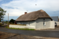
 Thatched cottage near Aglish - geograph.org.uk - 1480959.jpg 640 × 479; 98 KB
-
 The M9 Northbound - geograph.org.uk - 4793070.jpg 1,200 × 799; 294 KB
-
 The M9 Northbound junction 11 - geograph.org.uk - 4793078.jpg 1,200 × 799; 311 KB
-
 The N9 at Quarry Roundabout, Waterford - geograph.org.uk - 4793067.jpg 1,200 × 799; 263 KB
-


_-_geograph.org.uk_-_4570947.jpg)
_-_geograph.org.uk_-_4570950.jpg)
_-_geograph.org.uk_-_6525971.jpg)
_-_geograph.org.uk_-_6525973.jpg)


,_Exit_W1_-_geograph.org.uk_-_6091870.jpg)


,_River_Suir_Bridge_-_geograph.org.uk_-_6091862.jpg)