Category:Afon Iwrch
Jump to navigation
Jump to search
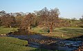
English: The Afon Iwrch is a river near Llanrhaeadr-ym-Mochnant in Clwyd, Wales. Its headwaters lie on the eastern slopes of Cadair Berwyn, the highest peak of the Berwyn range, and the river flows broadly southeastwards to join the River Tanat, itself a tributary of the River Vyrnwy. (→Afon Iwrch)

river near Llanrhaeadr-ym-Mochnant in Clwyd, Wales  | |||||
| Upload media | |||||
| Instance of | |||||
|---|---|---|---|---|---|
| Location | Powys, Wales | ||||
 | |||||
Media in category "Afon Iwrch"
The following 11 files are in this category, out of 11 total.
-
 Afon Iwrch - geograph.org.uk - 698350.jpg 640 × 398; 84 KB
-
 Afon Iwrch at Pont Maesmochnant - geograph.org.uk - 477097.jpg 640 × 480; 244 KB
-
 B4396 Bridge - geograph.org.uk - 692540.jpg 640 × 398; 105 KB
-
 Fenced Water - geograph.org.uk - 711600.jpg 640 × 427; 131 KB
-
 Pont Cefnhir - geograph.org.uk - 711609.jpg 640 × 399; 119 KB
-
 River Iwrch - geograph.org.uk - 711647.jpg 640 × 427; 130 KB
-
 Shallow Water - geograph.org.uk - 711586.jpg 364 × 640; 117 KB
-
 Slight Rise - geograph.org.uk - 698345.jpg 640 × 398; 94 KB
-
 Stone Bridge - geograph.org.uk - 698343.jpg 640 × 398; 99 KB
-
 Waterfall near Blaen-y-cwm - geograph.org.uk - 270048.jpg 640 × 480; 91 KB
-
 Pont Cefnhir - geograph.org.uk - 707909.jpg 640 × 388; 107 KB


