
Category:Aerial photographs of the Philippines
Aerial photographs of the Philippines.
Subcategories
This category has the following 12 subcategories, out of 12 total.
A
C
T
Media in category "Aerial photographs of the Philippines"
The following 119 files are in this category, out of 119 total.
-
 Aerial photo Lebak Hills.jpg 720 × 540; 104 KB
-
 Aerial Photo of Siargao Island (Coast Guard1).jpg 1,200 × 800; 202 KB
-
 Aerial Photo of Surigao City (Coast Guard2).jpg 1,600 × 1,200; 269 KB
-
 Aerial photo ricefields and Sea.jpg 720 × 540; 93 KB
-
 Aerial photo wit roundball.jpg 720 × 540; 196 KB
-
 Aerial shot of Cape Bojeador Lighthouse Landscape.jpg 4,000 × 2,250; 1.78 MB
-
 Aerial shot of General Santos City Port in South Cotabato.jpg 3,072 × 2,304; 1.33 MB
-
 Aerial View of Golden Haven Cebu.jpg 4,000 × 3,000; 11.88 MB
-
 Aerial view of IRRI compound (1-2ps 00238).jpg 3,216 × 2,136; 1.85 MB
-
 Aerial view of Simunul Island.jpg 1,920 × 1,080; 257 KB
-
 Aerial view of Surigao del Norte.jpg 1,922 × 1,281; 566 KB
-
 Aerial view Olangapo Naval Station 1928 NARA 19-LC-19C.jpg 4,807 × 3,642; 7.56 MB
-
 Altavas - aerial view.jpg 2,270 × 1,600; 1.24 MB
-

-

-

-

-
 Angono Rizal.JPG 1,650 × 1,100; 1.02 MB
-
 Bacoor Aerial View Talaba2.jpg 4,608 × 3,456; 2.35 MB
-
 Bacoor Cavite.JPG 2,500 × 1,667; 1.81 MB
-
 Balidbid Lagoon.jpg 2,836 × 3,781; 2.14 MB
-
 Balidbid Lagoons.jpg 2,880 × 3,840; 1.72 MB
-
 BanguiPhilippines.jpg 1,024 × 615; 219 KB
-
 Barangay Panungyanan.jpg 4,819 × 3,739; 10.63 MB
-
 Batad houses.jpg 2,992 × 3,992; 16.08 MB
-
 Boac - Mogpog - Santa Cruz - Torrijos Rd, Torrijos, Marinduque, Philippines - panoramio.jpg 3,888 × 2,592; 2.92 MB
-
 Buenavista Bohol 1.JPG 1,200 × 800; 733 KB
-
 Cabas-An Aerial View by Gerald Mondala.jpg 4,000 × 6,000; 11.93 MB
-
 Cabra Island.jpg 2,118 × 2,048; 790 KB
-
 Camella Homes Tierra Nevada General Trias Cavite Aerial Photo.jpg 798 × 425; 121 KB
-
 Camiguin White Island.jpg 4,000 × 2,250; 9.11 MB
-
 Campinsa Hills.jpg 4,000 × 2,667; 9.51 MB
-
 Cape Bojeador Lighthouse 2021.jpg 4,000 × 2,250; 1.75 MB
-
 Cape Bojeador Lighthouse Aerial shot.jpg 4,000 × 2,250; 2.21 MB
-
 Capul lighthouse in Northen samar.jpg 3,200 × 4,000; 4.03 MB
-
 Carmen Cebu.JPG 1,080 × 1,080; 602 KB
-
 Catching the Wave.jpg 3,733 × 2,800; 11.75 MB
-
 CCLEX-PANORAMA-PHOTO-BART SAKWERDA BUDOSMEDIA 2021.png 1,440 × 577; 880 KB
-
 Cebu City (Aerial).jpg 4,000 × 3,000; 1.82 MB
-
 Cebucity-airview.JPG 768 × 576; 63 KB
-
 Changtandao.jpg 1,519 × 1,007; 76 KB
-
 Chocolate Hills Bohol.JPG 1,441 × 1,095; 655 KB
-
 Clark1967.jpg 596 × 469; 163 KB
-
 Clark1970.jpg 470 × 416; 151 KB
-
 Cloud Nine.JPG 2,592 × 1,944; 956 KB
-
 Corregidor DN-ST-86-01667.JPEG 2,890 × 1,850; 1.33 MB
-
 CPU Church Aerial View.JPG 831 × 354; 176 KB
-
 Danao Cebu.jpg 1,280 × 851; 225 KB
-
 Dauis Bohol 1.JPG 1,638 × 1,229; 782 KB
-
 Dewey Drydock with USS Jason 1928 NARA 19-LC-19C (2).jpg 4,827 × 3,644; 3.83 MB
-
 Dewey Drydock with USS Jason 1928 NARA 19-LC-19C.jpg 4,827 × 3,644; 2.54 MB
-
 DWCSJ (aerial).jpg 604 × 401; 34 KB
-
 Eagle Cement Mine.jpg 2,732 × 1,990; 3.4 MB
-
 Fort Drum and Mariveles Range.jpg 3,996 × 2,247; 2.19 MB
-
 Fort San Antonio (15350850805).jpg 1,000 × 773; 131 KB
-
 Grande Island.JPEG 2,800 × 1,870; 3.94 MB
-
 Higatangan Island Aerial Shot.jpg 959 × 671; 219 KB
-
 Hills of Campinsa.jpg 4,000 × 3,000; 8.68 MB
-
 Igbon Island.JPG 3,200 × 2,133; 2.63 MB
-
 Ilagan City 2.JPG 2,000 × 1,333; 903 KB
-
 Ilig iligan area.jpg 560 × 330; 33 KB
-
 Imus Cavite Aerial Photograph.jpg 1,920 × 1,440; 449 KB
-
 Imus Cavite.JPG 1,944 × 2,592; 2.72 MB
-
 Jones Isabela.JPG 1,940 × 1,293; 1.16 MB
-
 LakeTaal.jpg 2,592 × 1,944; 680 KB
-
 Lambug Beach Shores.jpg 2,309 × 3,463; 1.22 MB
-
 Lambug Beach.jpg 1,951 × 2,926; 867 KB
-
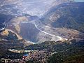
 Landslidephilippines.jpg 1,632 × 2,464; 444 KB
-
 Laur Nueva Ecija.JPG 1,361 × 1,814; 708 KB
-
 Legazpi Grand Central Terminal aerial.jpg 720 × 480; 92 KB
-
 Lopez Quezon Finest.jpg 2,688 × 1,530; 1.78 MB
-
 Mactan-from-above.jpg 3,072 × 2,304; 3.29 MB
-
 Maddela Quirino.JPG 1,500 × 1,000; 376 KB
-
 ManilaBilibid001.jpg 1,613 × 1,154; 1.4 MB
-
-
 Mt Banahaw.jpg 1,600 × 1,200; 595 KB
-
 Naga 1935 skyview photo nkaag sa Wikipedia pinaputi cropped2.jpg 941 × 657; 313 KB
-
 Naga in 1935.jpg 960 × 720; 134 KB
-
 Odehavsoy.jpg 477 × 225; 14 KB
-
 ORG, Cotabato City bird eye view.jpg 960 × 607; 330 KB
-
 Paete Laguna.JPG 1,250 × 750; 465 KB
-
 Palawan, Aircraft wheel in flight, Philippines.jpg 4,000 × 2,667; 5.99 MB
-

-
 Palawan, Puerto Princesa Runway, Antonio Bautista Air Base, PAF, Philippines.jpg 4,000 × 2,667; 6.69 MB
-
 Pangasinan Provincial Capitol Park at Lingayen.jpg 676 × 482; 137 KB
-
 PH10-122716 FRIAS2-1.jpg 3,600 × 2,400; 2.45 MB
-
 Philippine island of Binuluanguan Following Typhoon Haiyan MOD 45156472.jpg 3,600 × 2,400; 9.87 MB
-
 Philippines, Munoz- tanbo art 2016 2.jpg 860 × 560; 272 KB
-

-
 Picturesque Guyam Island, Siargao.jpg 3,375 × 2,250; 7.83 MB
-
 Pinatubo 1991-06-29 Pyroclastic flow deposits of Marella River Valley.jpg 2,933 × 1,732; 5.29 MB
-
 Pinatubo91ash covered clark air base.jpg 1,024 × 768; 270 KB
-
 Pinatubo92pinatubo caldera crater lake.jpg 1,024 × 673; 275 KB
-
 Polillo Island.JPG 2,429 × 1,619; 1.23 MB
-
 Qc-welcome-rotonda-2010.JPG 3,264 × 2,448; 5.65 MB
-
 RAAF C-130J Hercules flies over the city of Tacloban (10916806943).jpg 2,538 × 3,600; 1.5 MB
-
 Sabang Wharf.jpg 2,938 × 1,810; 346 KB
-
 San Antonio (15350526152).jpg 1,000 × 780; 124 KB
-
 San Carlos NegOcc - aerial.JPG 2,559 × 1,706; 1.78 MB
-
 San Jose Oco Aerial View - Viga Catanduanes.jpg 2,048 × 1,152; 711 KB
-
 San Jose Oco and Bordang Bridge.jpg 2,048 × 1,152; 634 KB
-
 San juanico bridge.jpg 4,000 × 3,000; 3.57 MB
-
 San Mariano Isabela.JPG 1,500 × 1,874; 916 KB
-
 San Vicente NorSam.jpg 2,638 × 1,759; 1.46 MB
-
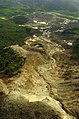
 Southern Leyte mudslide 2006 pic01.jpg 3,225 × 2,141; 4.61 MB
-
 Southern Leyte mudslide 2006 pic02.jpg 1,632 × 2,464; 677 KB
-
 SubicHospital.JPEG 2,740 × 1,820; 2.36 MB
-
 Taal Volcano aerial 2013.jpg 3,255 × 1,831; 1.36 MB
-
 The Hills of Campinsa.jpg 4,000 × 3,000; 7.75 MB
-
 The PPSRNP or locally known as Puerto Princesa Underground River.jpg 2,793 × 1,744; 318 KB
-
 Thunderstorms-Philippines.jpg 6,194 × 7,420; 7.14 MB
-
 Toledo Cebu 1.JPG 2,788 × 1,858; 1.32 MB
-
 Toledo Cebu 2.JPG 2,918 × 2,189; 2.28 MB
-
 Tubigon Bohol 1.JPG 2,048 × 1,536; 1.19 MB
-
 Underground River of Puerto Princesa City.jpg 3,008 × 1,813; 353 KB
-

-
 USMC-060219-N-5067K-113.jpg 1,632 × 2,464; 761 KB
-
 View from an airplane.jpg 640 × 480; 69 KB
-
 View of Buhi from Mt. Asog.jpg 500 × 375; 52 KB

.jpg)
.jpg)


.jpg)


.jpg)


.jpg)

.jpg)


.jpg)


.gif)


.jpg)

.jpg)


_makes_an_aerial_assessment_of_the_deadly_Feb._17_landslide_during_over-flight_of_the_area.jpg)


.jpg)