Category:Aerial photographs of the Cascade Range in Washington (state)
Jump to navigation
Jump to search
English: Aerial photographs of the portion of the Cascade Range that falls in Washington (state), U.S.
Subcategories
This category has the following 4 subcategories, out of 4 total.
Media in category "Aerial photographs of the Cascade Range in Washington (state)"
The following 17 files are in this category, out of 17 total.
-
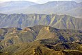
 Aerial - Cascade Mountains from somewhere near Enumclaw, WA 01 (9796383775).jpg 4,288 × 2,848; 4.48 MB
-
-
 Aerial - Cascade Mountains from somewhere near Enumclaw, WA 02 (9796418303).jpg 2,848 × 4,288; 4.11 MB
-

-
 Aerial - Cascade Mountains from somewhere near Enumclaw, WA 03 (9796326686).jpg 2,848 × 4,288; 4.51 MB
-

-
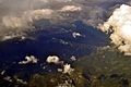
 Aerial - clouds over the Cascade Mountains 05 (9796102903).jpg 2,848 × 4,288; 4.49 MB
-

-
 Aerial - clouds over the Cascade Mountains 05 - white balanced (9796125793).jpg 2,848 × 4,288; 5.87 MB
-
 Aerial - clouds over the Cascade Mountains 06 (9796019636).jpg 4,288 × 2,848; 4.56 MB
-
 Aerial - clouds over the Cascade Mountains 06 - white balanced (9796026214).jpg 4,288 × 2,848; 5.97 MB
-
 Cascade Range & Lake Chelan aerial 01.jpg 4,288 × 2,848; 4.47 MB
-
 Cascade Range & Lake Chelan aerial 01A.jpg 4,288 × 2,848; 8.6 MB
-
 Glacier Peak (aerial view).jpg 2,592 × 1,944; 1.41 MB
-
 Mount Rainier and other Cascades mountains poking through clouds.jpg 7,362 × 4,920; 23.87 MB
-
 Northwestern Washington (5406376857).jpg 4,272 × 2,848; 1.44 MB
-
 Orcas Island aerial view EPA photo.jpg 1,600 × 1,064; 380 KB
.jpg)
.jpg)
.jpg)
.jpg)
.jpg)
.jpg)
.jpg)
.jpg)
.jpg)
.jpg)
.jpg)


.jpg)

.jpg)
