Category:Aerial photographs of populated places in Greenland
Jump to navigation
Jump to search
Media in category "Aerial photographs of populated places in Greenland"
The following 10 files are in this category, out of 10 total.
-
 Aasiat - panoramio.jpg 1,280 × 960; 414 KB
-
 Atammik-aerial.jpg 3,872 × 2,176; 2.49 MB
-
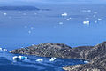
 Ilimanaq-aerial.jpg 3,000 × 1,776; 1.33 MB
-
 Kullorsuaq1.jpg 1,000 × 667; 446 KB
-
 Napasoq-aerial.jpg 3,872 × 2,176; 2.2 MB
-
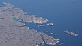
 Nuuk overhead.jpg 666 × 499; 68 KB
-
 Qaarsut aerial.jpg 3,377 × 1,697; 1.19 MB
-
 Qasigiannguit-aerial.jpg 3,200 × 1,676; 1.5 MB
-
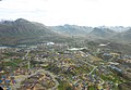 Sisimiut aerial.jpg 2,983 × 2,067; 3.29 MB
-
 Sisimiut aerial2.jpg 3,872 × 2,592; 6.43 MB


