Category:Aerial photographs of islands of Japan
Jump to navigation
Jump to search
Subcategories
This category has the following 3 subcategories, out of 3 total.
T
Media in category "Aerial photographs of islands of Japan"
The following 26 files are in this category, out of 26 total.
-
 20101212初島.jpg 640 × 480; 151 KB
-
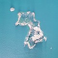
 Aerial of Yushima, Kamiamakusa, Kumamoto, Japan.jpg 3,431 × 2,287; 6.87 MB
-
 Aerial photograph of Kurakake Island.jpg 1,500 × 1,500; 1.41 MB
-
 Aerial photograph of Yabase-Kihan Island 2008.jpg 1,800 × 2,100; 2.4 MB
-
 Chousyudejima.jpg 3,648 × 2,736; 4.33 MB
-
 Hegurajima 1975.jpg 2,477 × 1,505; 3.44 MB
-
 Isokazura island 1976.jpg 649 × 808; 211 KB
-
 Ja island 1975.jpg 436 × 672; 43 KB
-
 Karasu island 1975.jpg 462 × 426; 27 KB
-
 Ke island 1976.jpg 1,824 × 1,992; 842 KB
-
 Kuchinoshima20010925-crop.jpg 593 × 558; 103 KB
-
 Mifune-jima island Aerial Photograph.JPG 1,376 × 1,029; 840 KB
-
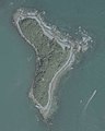
 Minami-jima Island Karst.JPG 3,177 × 2,228; 3.89 MB
-
 Mutsure.island.jpg 3,648 × 2,736; 7.58 MB
-
 Nanatsu-jima island north.JPG 2,617 × 1,964; 2.12 MB
-
 Nanatsu-jima island southeast.JPG 2,610 × 1,962; 2.58 MB
-
 Nanatsu-jima island southwest.JPG 2,613 × 1,958; 2.89 MB
-
 Notojima.jpg 1,024 × 768; 413 KB
-
 Okikazura island 1976.jpg 417 × 643; 77 KB
-
 Oshima island.jpg 3,648 × 2,736; 5.65 MB
-
 Portion of the island of nagannu.jpg 3,840 × 2,160; 5.28 MB
-
 Shikanoshima aerial shoot.jpg 3,648 × 2,736; 5.86 MB
-
 Takesakijima.jpg 3,648 × 2,736; 2.83 MB
-
 Tarama.airports.Aerial Shoot.jpg 3,840 × 2,160; 3.27 MB
-
 Toshitori island 1975.jpg 520 × 496; 57 KB
-
 舳倉島地割.png 861 × 856; 1.21 MB


