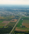
Category:Aerial photographs of Woolwich, Ontario
Jump to navigation
Jump to search
Media in category "Aerial photographs of Woolwich, Ontario"
The following 6 files are in this category, out of 6 total.
-
Aerial Woolwich.jpg 3,872 × 2,592; 7.72 MB
-
Grand River north of Waterloo.png 3,264 × 2,448; 10.86 MB
-
Highway 85 southbound into Conestoga Parkway.png 2,448 × 2,877; 7.68 MB
-
Highways Woolwich.jpg 3,828 × 1,897; 4.91 MB
-
Maryhill, Ontario.png 3,264 × 2,448; 14.13 MB
-
Waterloo Regional Road 17.png 3,264 × 2,359; 9.15 MB


