
Category:Aerial photographs of Visakhapatnam
Media in category "Aerial photographs of Visakhapatnam"
The following 27 files are in this category, out of 27 total.
-
 Aerial top down view of BRTS road at Purushothapuram.jpg 4,000 × 2,250; 8.43 MB
-
 Aerial view of BRTS road and Pendurthi college.jpg 4,000 × 2,250; 9.44 MB
-
 Aerial view of Ramanaidu Studios.jpg 3,047 × 1,714; 5.03 MB
-
 Aerial view of Sujatha Nagar and Pendurthi.jpg 4,000 × 2,250; 9.09 MB
-
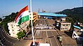 Aerial view of the Indian flag.jpg 683 × 384; 119 KB
-
 Aerial view of Thotlakonda Buddhist Complex.jpg 1,410 × 917; 1.6 MB
-
 BRTS Road and Sujatha Nagar sky line.jpg 4,000 × 2,250; 8.57 MB
-
 Chinnamushidiwada junction aerial view.jpg 4,000 × 2,250; 8.59 MB
-
 Coast Line (9561625691).jpg 3,264 × 4,928; 9.77 MB
-
 Kailasagiri and MVP colony captured from Flight.jpg 3,204 × 1,796; 2.62 MB
-
 Kanithi Balancing Reservoir aerial view.jpg 4,032 × 2,471; 988 KB
-
 Pendurthi government college aerial view.jpg 4,000 × 2,250; 9.54 MB
-
 Pendurthi junction aerial view 01.jpg 4,000 × 2,250; 4.04 MB
-
 Pendurthi sky line and college aerial view.jpg 4,000 × 2,250; 8.22 MB
-
 Purushothapuram junction aerial view.jpg 3,880 × 2,246; 9.93 MB
-
 Sarada river joining bay of bengal.jpg 4,032 × 3,024; 1.49 MB
-
 Sujatha Nagar junction aerial view.jpg 4,000 × 2,250; 8.79 MB
-
 Visakhapatnam city from a Flight 1.jpg 4,032 × 3,024; 3.51 MB
-
 Visakhapatnam city from a Flight 2.jpg 2,050 × 1,536; 733 KB
-
 Visakhapatnam city from a Flight 3.jpg 2,048 × 1,536; 988 KB
-
 Visakhapatnam city from a Flight 4.jpg 2,048 × 1,536; 865 KB
-
 Visakhapatnam city from a Flight 5.jpg 2,048 × 1,536; 462 KB
-
 Vizag aerial view.jpg 800 × 532; 134 KB
-
 Vizag Coast Line and Bay of Bengal (9561646975).jpg 4,928 × 3,264; 13.06 MB
-
 Vizag Coast Line and Bay of Bengal (9564434434).jpg 4,928 × 3,264; 12.62 MB
-
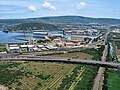
 Vizag Seaport aerial view.jpg 700 × 525; 35 KB
-
 Vizag seaport.jpg 700 × 525; 85 KB


.jpg)


.jpg)
.jpg)

