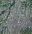
Category:Aerial photographs of Toyama
Appearance
Media in category "Aerial photographs of Toyama"
The following 20 files are in this category, out of 20 total.
-
1970年(昭和45年)当時の東富山駅周辺航空写真.jpg 1,485 × 1,465; 807 KB
-
20081207砺波平野.jpg 1,280 × 960; 242 KB
-
Abandoned Jinzū river side in Toyama city.jpg 1,669 × 1,241; 996 KB
-
Aerial photographs of Fugan canal in 2007.jpg 1,259 × 3,579; 1.73 MB
-
CB20001X-C1-8.jpg 4,103 × 3,779; 1.45 MB
-
Higashi-Iwase Station in 1975.jpg 1,249 × 1,131; 558 KB
-
Iwasehama Station in 1975.jpg 1,954 × 1,066; 816 KB
-
Kureha Country Club, Toyama Toyama Aerial photograph.2009.jpg 3,706 × 2,779; 3.47 MB
-
Sasazu station in 1969.jpg 1,255 × 1,617; 872 KB
-
The aerial photograph of Toyama - flickr(1).jpg 4,928 × 3,264; 6.16 MB
-
Toyama city center area Aerial photograph.1975.jpg 8,537 × 5,555; 45.66 MB
-
Toyama city center area Aerial photograph.2021.jpg 13,852 × 14,999; 170.71 MB
-
Toyama General Sports Center.png 405 × 430; 245 KB
-
Toyama Prefectural Baseball Stadium, GSI 2021.jpg 1,200 × 900; 303 KB
-
Toyama Station in 1946.jpg 1,459 × 1,293; 825 KB
-
Toyamakō Station in 1975.jpg 1,513 × 2,377; 1.64 MB
-
USA-M196-No2-231.jpg 3,780 × 3,937; 1.69 MB
-
Yatsuo Country Club, Toyama Toyama Aerial photograph.2009.jpg 3,284 × 2,463; 2.7 MB
-
Yatsuo district Toyama city Aerial photograph.1975.jpg 4,125 × 3,489; 12.73 MB
-
富山大橋.png 778 × 434; 865 KB


