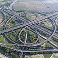
Category:Aerial photographs of Tainan
Jump to navigation
Jump to search
English: The aerial photographs of Tainan.
日本語: 台南の航空写真。
中文(臺灣):臺南的空拍照。
Subcategories
This category has the following 2 subcategories, out of 2 total.
Media in category "Aerial photographs of Tainan"
The following 98 files are in this category, out of 98 total.
-
1 aerial pano eternal golden castle tainan 2017.jpg 10,949 × 5,017; 34.12 MB
-
20231101 night overflight Taiwan cities 05.jpg 3,264 × 2,448; 581 KB
-
Academia Sinica South campus aerialphoto.jpg 1,479 × 1,108; 520 KB
-
Aerial photograph of downtown Tainan circa 1930.jpg 3,027 × 1,939; 8.43 MB
-
Aerial photograph of Tainan City circa 1916.jpg 960 × 552; 138 KB
-
Core of Tianjin city by NASA 20120930.JPG 4,256 × 2,832; 1.23 MB
-
Downtown Tainan(2012) (cropped).jpg 1,024 × 682; 591 KB
-
Downtown Tainan(2012).jpg 1,024 × 751; 601 KB
-
ICC Tainan 20220105.jpg 5,940 × 3,070; 13.49 MB
-
ITRI Green Energy Demonstration Site 2022.jpg 2,132 × 1,200; 2.27 MB
-
Shalun Smart Green Energy Science City aerialphoto.jpg 1,255 × 941; 501 KB
-
Shalun Smart Green Energy Science City.jpg 4,000 × 3,000; 4.74 MB
-
Taijiang National Park from sky.jpg 3,264 × 2,448; 1.6 MB
-
Taiwan, Tainan - Lioujia tanbo art 2017 1.jpg 1,377 × 1,080; 494 KB
-
Taiwan, Tainan - Lioujia tanbo art 2017 2.jpg 1,504 × 1,051; 506 KB
-
Taiwan, Tainan - Lioujia tanbo art 2017 3.jpg 1,650 × 876; 600 KB
-
Taiwan, Tainan - Lioujia tanbo art 2017 4.jpg 6,000 × 4,000; 6.4 MB
-
Taiwan, Tainan - Lioujia tanbo art 2017 5.jpg 6,000 × 4,000; 6.41 MB
-
Taiwan, Tainan - Lioujia tanbo art 2017 6.jpg 6,000 × 4,000; 5.96 MB
-
TNNUA campus aerialphoto.jpg 2,480 × 2,260; 2.3 MB
-
七股區大潮溝與海埔魚塭.jpg 4,096 × 2,300; 2.26 MB
-
七股區新浮崙汕附近.jpg 4,096 × 2,300; 1.68 MB
-
七股區新浮崙汕附近2.jpg 4,096 × 2,300; 1.88 MB
-
二重溪 ( 曾文溪、南瀛天文館 附近 ).jpg 4,096 × 2,299; 3.24 MB
-
位於七股區北堤堤坊的國聖燈塔.jpg 4,096 × 2,300; 2.84 MB
-
位於北安利多黃昏市場的北安路三段.jpg 2,295 × 2,295; 1.5 MB
-
健康路三段.jpg 4,096 × 2,300; 3.45 MB
-
傍晚的井仔腳瓦盤鹽田空拍實景.jpg 5,464 × 3,070; 10.62 MB
-
傍晚的井仔腳瓦盤鹽田空拍實景2.jpg 5,464 × 3,070; 10.28 MB
-
傍晚的北門水晶教堂.jpg 4,096 × 2,299; 3.22 MB
-
傍晚的台南北門區牡蠣養殖場.jpg 4,096 × 2,299; 2.6 MB
-
傍晚的安平漁港.jpg 1,242 × 697; 267 KB
-
傍晚的漁光島海邊.jpg 5,464 × 3,070; 11.08 MB
-
傍晚的青鯤鯓扇形鹽田.jpg 4,096 × 2,299; 2.56 MB
-
八田與一園區.jpg 4,096 × 2,300; 3.92 MB
-
八田與一紀念園區.jpg 4,096 × 2,300; 3.92 MB
-
北安路二、三段與安中路一段.jpg 3,067 × 3,067; 1.86 MB
-
半夜的台南新化系統交流道.jpg 4,096 × 2,300; 2.58 MB
-
半夜的台南系統交流道.jpg 5,464 × 3,070; 15.34 MB
-
半夜的官田系統交流道.jpg 4,096 × 2,300; 3.85 MB
-
半夜的東西向快速道路玉井線與縱貫公路.jpg 4,096 × 2,300; 3.2 MB
-
南科迎曦湖.jpg 5,464 × 3,070; 8.7 MB
-
參賽者Ivy Jie 台南北門井仔腳瓦盤鹽田.jpg 2,448 × 3,264; 1.21 MB
-
台南左鎮區二寮觀日亭.jpg 4,096 × 2,299; 3.19 MB
-
台南市大內區大內橋.jpg 4,096 × 2,299; 2.6 MB
-
台南漁光島.jpg 2,048 × 1,365; 1.9 MB
-
台水公司南化淨水場.jpg 998 × 748; 434 KB
-
台江國家公園遊客中心.jpg 4,096 × 2,299; 3.4 MB
-
四草大橋 ( 夜間 ).jpg 5,464 × 3,070; 13.37 MB
-
四草大橋、台江國家公園、鹽水溪.jpg 5,464 × 3,070; 12.46 MB
-
四草大道 ( 一 ).jpg 5,464 × 3,070; 13.4 MB
-
四草大道 ( 二 ).jpg 4,096 × 2,299; 3.8 MB
-
夜間歸仁圓環附近.jpg 4,096 × 2,299; 3.8 MB
-
夜間的正統鹿耳門聖母廟.jpg 4,096 × 2,300; 2.98 MB
-
夜間的歸仁圓環.jpg 4,096 × 2,299; 3.28 MB
-
夜間的臺86線與西部濱海公路.jpg 4,096 × 2,299; 2.83 MB
-
夜間的臺86線與西部濱海公路2.jpg 5,464 × 3,070; 12.48 MB
-
安億橋.jpg 4,096 × 2,300; 2.42 MB
-
官田、大崎 ( 南111鄉道、台南藝術大學 ).jpg 4,096 × 2,300; 3.78 MB
-
將軍區青鯤鯓.jpg 4,096 × 2,300; 3.07 MB
-
德陽艦附近.jpg 4,096 × 2,299; 2.96 MB
-
扇形鹽田.jpg 1,024 × 683; 803 KB
-
新化圓環.jpg 1,242 × 1,096; 588 KB
-
新市區和平路便橋附近.jpg 4,096 × 2,300; 4.19 MB
-
新市區和平路便橋附近2.jpg 4,096 × 2,300; 3.52 MB
-
新市區和平路便橋附近3.jpg 3,068 × 3,068; 4.11 MB
-
新港社大道空拍實景.jpg 4,096 × 2,300; 2.91 MB
-
東西向快速道路 台南關廟線.jpg 4,096 × 2,299; 4.06 MB
-
林默娘公園上空.jpg 4,096 × 2,300; 2.84 MB
-
林默娘公園上空二.jpg 4,096 × 2,300; 2.19 MB
-
流經台南市新市區的鹽水溪.jpg 4,096 × 2,300; 1.59 MB
-
海上消坡塊 ( 位於台南七股區國聖燈塔 ).jpg 3,068 × 3,068; 2.45 MB
-
消坡塊 ( 台南安平區漁光島 ).jpg 4,096 × 2,300; 3.2 MB
-
漁光島周圍風景.jpg 5,464 × 3,070; 11.8 MB
-
福爾摩沙公路 ( 官田區 ).jpg 4,096 × 2,300; 3.08 MB
-
福爾摩沙高速公路 ( 關廟區 ).jpg 3,067 × 3,067; 3.39 MB
-
福爾摩沙高速公路 ( 龍崎附近 ).jpg 3,067 × 3,067; 3.39 MB
-
臺南市學甲區三寮灣空拍圖1.jpg 5,472 × 3,078; 12.18 MB
-
臺南市學甲區三寮灣空拍圖2.jpg 5,472 × 3,078; 12.64 MB
-
臺南市學甲區三寮灣空拍圖3.jpg 5,472 × 3,078; 13.53 MB
-
臺南市學甲區二重港空拍圖1.jpg 5,472 × 3,078; 14.06 MB
-
臺南市學甲區二重港空拍圖2.jpg 5,472 × 3,078; 13.39 MB
-
臺南市學甲區二重港空拍圖3.jpg 5,472 × 3,078; 13.39 MB
-
臺南市學甲區渡子頭空拍圖1.jpg 5,472 × 3,078; 13.96 MB
-
臺南市學甲區渡子頭空拍圖2.jpg 5,472 × 3,078; 13.79 MB
-
臺南市學甲區渡子頭空拍圖3.jpg 5,472 × 3,078; 12.6 MB
-
臺南市學甲區溪底寮空拍圖1.jpg 5,472 × 3,078; 14.26 MB
-
臺南市學甲區溪底寮空拍圖2.jpg 5,472 × 3,078; 12.31 MB
-
臺南市學甲區溪底寮空拍圖3.jpg 5,472 × 3,078; 13.08 MB
-
臺南市學甲區灰磘港空拍圖1.jpg 5,472 × 3,648; 17.65 MB
-
臺南市學甲區灰磘港空拍圖2.jpg 5,472 × 3,648; 17.07 MB
-
臺南市學甲區灰磘港空拍圖3.jpg 5,472 × 3,648; 15.95 MB
-
臺南系統交流道.jpg 3,068 × 3,068; 3.12 MB
-
臺灣臺南市學甲區頂洲國小校舍.jpg 5,472 × 3,078; 13.53 MB
-
關廟區 往西 ( 關廟大埤潭公園上方 ).jpg 4,096 × 2,299; 2.35 MB
-
關廟大埤潭公園.jpg 3,067 × 3,067; 3.11 MB
-
青鯤鯓扇形鹽田.jpg 5,464 × 3,070; 8.99 MB
-
鹿耳門溪附近.jpg 5,464 × 3,070; 15.49 MB


