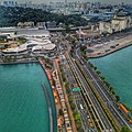
Category:Aerial photographs of Sentosa
Jump to navigation
Jump to search
Subcategories
This category has the following 2 subcategories, out of 2 total.
Media in category "Aerial photographs of Sentosa"
The following 20 files are in this category, out of 20 total.
-
1 sentosa aerial 2016.jpg 6,976 × 3,071; 14.08 MB
-
1 sentosa aerial panorama 2016 from south.jpg 7,688 × 2,835; 12.84 MB
-
Aerial perspective of Sentosa Island.jpg 3,992 × 2,992; 5.54 MB
-
Aerial perspective of Sentosa's Bridge.jpg 2,992 × 2,992; 4.46 MB
-
Aerial view of Palawan Beach, Sentosa, Singapore - 20140213.jpg 1,200 × 753; 733 KB
-
Capella Singapore aerial view.jpg 1,253 × 575; 820 KB
-
Coastline drone view 1 (Unsplash).jpg 3,991 × 2,661; 987 KB
-
Palawan Beach Sentosa Singapore (36712573736).jpg 3,734 × 2,097; 5.15 MB
-
Sentosa 1.jpg 3,800 × 2,533; 5.06 MB
-
Sentosa Ferry Terminal 3.JPG 1,600 × 1,200; 757 KB
-
Sentosa viewed from the Carlsberg Sky Tower, Singapore - 20060716-01.jpg 1,600 × 1,200; 639 KB
-
Sentosa viewed from the Carlsberg Sky Tower, Singapore - 20060716-02.jpg 1,200 × 1,600; 982 KB
-
Sentosa viewed from the Carlsberg Sky Tower, Singapore - 20060716-03.jpg 1,600 × 1,200; 647 KB
-
Sentosa, Singapore (Unsplash 1jZdlMyuIog).jpg 3,991 × 2,661; 1.01 MB
-
Sentosa, Singapore (Unsplash CosqisUHl14).jpg 2,760 × 1,840; 674 KB
-
Sentosa, Singapore (Unsplash EPvKIvboTDM).jpg 3,991 × 2,661; 1.08 MB
-
Sentosa, Singapore (Unsplash pVHKVqQDtPw).jpg 3,991 × 2,661; 834 KB
-
SG Sentosa 01.jpg 1,024 × 768; 91 KB


