Category:Aerial photographs of Sault Ste. Marie, Ontario
Jump to navigation
Jump to search
Media in category "Aerial photographs of Sault Ste. Marie, Ontario"
The following 10 files are in this category, out of 10 total.
-
 Sault Ste. Marie satellite.jpg 900 × 900; 735 KB
-
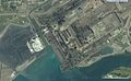 Algoma Steel Sault Ste Marie USGS.jpg 1,254 × 775; 297 KB
-
 Bushplane heritage centre.jpg 1,229 × 712; 301 KB
-
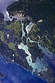
 ISS-56 Michigan and Ontario, St. Mary's River.jpg 3,712 × 5,568; 4.06 MB
-
 Neebish Island, Michigan.JPG 1,936 × 2,608; 6.03 MB
-
 Sault Ste Marie, Ontario and Michigan.JPG 2,848 × 4,288; 8.47 MB
-
 Sault-Ste Marie banner).png 511 × 73; 22 KB
-
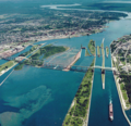
 Soo Locks International Bridge 2010-04 USACE.jpg 6,144 × 4,088; 8.66 MB
-
 Soo Locks-Sault-Ste Marie.png 511 × 494; 132 KB
-
 St Marys Paper Sault Ste Marie ON National Map.jpg 1,278 × 774; 313 KB


.png)