Category:Aerial photographs of Saltdal
Jump to navigation
Jump to search
English: Aerial photographs of Saltdal municipality, Nordland, Norway
Media in category "Aerial photographs of Saltdal"
The following 11 files are in this category, out of 11 total.
-
 Fiskvågvatnet nature reserve seen from the air.jpg 4,207 × 3,255; 3.59 MB
-
 Fylkesvei 515 seen from the air.jpg 4,375 × 2,497; 1.77 MB
-
 Gåsvatnan conservation area seen from the air.jpg 4,497 × 2,625; 2.03 MB
-
 Gåsvatnan Landscape Protection Area seen from the air.jpg 4,416 × 2,627; 6.15 MB
-
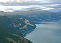 Kvænfloget and Saltdalsfjorden seen from the air.jpg 3,192 × 2,269; 3.67 MB
-
 Rognan in Saltdal seen from the air.jpg 4,793 × 2,977; 2.47 MB
-
 Russåga in Saltdal seen from the air.jpg 4,001 × 2,329; 1.58 MB
-
 Saltdal with Saltdalen Solvaagtind Örfjellet IMG 3494.JPG 3,212 × 1,475; 2.44 MB
-
 Saltdalselva seen from the air.jpg 3,841 × 2,402; 1.71 MB
-
 Setså village seen from the air.jpg 2,769 × 1,978; 2.65 MB
-
 Some of the peaks at Saltfjellet seen from the air.jpg 4,501 × 2,513; 1.82 MB


