Category:Aerial photographs of Patagonia
Jump to navigation
Jump to search
Media in category "Aerial photographs of Patagonia"
The following 39 files are in this category, out of 39 total.
-
 69.02572W 45.jpg 719 × 591; 99 KB
-
 Aster patagonia glacier lrg.jpg 2,412 × 1,925; 848 KB
-

-
 Cerro Huemul, Paso Huemul, Paso del Viento y Laguna Toro.jpg 1,241 × 1,241; 1.12 MB
-
 Circo de los Altares, Monte Fitz Roy, Cerro Torre y Cordón Adela.jpg 738 × 738; 378 KB
-
 Cordón Dos Codos, Campo de Hielo Patagónico Sur.jpg 1,504 × 1,001; 739 KB
-
 Cordón Piedrabuena, límite entre Argentina y Chile, Campo de Hielo Patagónico Sur.jpg 1,461 × 1,461; 555 KB
-
 Cordón Pietrobelli, límite entre Argentina y Chile, Campo de Hielo Patagónico Sur.jpg 1,871 × 1,871; 714 KB
-
 Dawson Island.jpg 2,000 × 2,600; 1.31 MB
-
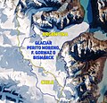 Glaciar Perito Moreno, Bismarck o Francisco Gormaz.jpg 2,276 × 2,184; 3.03 MB
-
 ISS-58 Argentina, Chile and the Andes mountains.jpg 5,568 × 3,712; 1.75 MB
-
 ISS030-E-091253 lrg.jpg 1,440 × 960; 429 KB
-
 Jorge Montt from Landsat, 2016.jpg 720 × 720; 270 KB
-
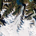
 Jorge Montt Glaciar (ISS016-E-12263).jpg 3,032 × 2,008; 1.24 MB
-
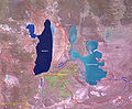
 Lago O'Higgins-San Martín (ISS010-E-5868).jpg 3,032 × 2,064; 1.05 MB
-
 Laguna del Viedma, Campo de Hielo Patagónico Sur, Argentina-Chile.jpg 1,402 × 1,411; 1.35 MB
-
 Laguna del Viedma.jpg 95 × 90; 3 KB
-
 Laguna Escondida y el océano Pacífico.jpg 1,387 × 957; 994 KB
-
 Laguna Escondida, Argentina-Chile, Campo de Hielo Patagónico Sur.jpg 700 × 700; 311 KB
-
 Monte Fitz Roy 19Mar2018 SkySat.jpg 2,050 × 2,050; 1.02 MB
-
 Npatagonia oli 2017106 lrg.jpg 7,200 × 9,600; 15.61 MB
-
 Patagonia aerial.jpg 2,592 × 1,944; 4.23 MB
-
 Patagonia Chilena rumbo a Punta Arenas Chile - panoramio.jpg 3,072 × 2,304; 4.89 MB
-
 Patagonia Snow.jpg 850 × 1,100; 903 KB
-
 Patagonia tmo 2011050 lrg.jpg 4,200 × 5,200; 3.05 MB
-
 Patagonian Bloom.jpg 3,608 × 6,088; 8.01 MB
-
 Patagonian-419px.png 419 × 599; 344 KB
-
 PIA15375 - MISR Where on Earth... MISR Mystery Image Quiz 28-rotated.jpg 3,300 × 4,200; 2.69 MB
-
 PIA15375 MISR Where on Earth...? MISR Mystery Image Quiz 28.jpg 4,200 × 3,300; 1.34 MB
-
 Río témpanos, laguna San Rafael y río San Tadeo.png 578 × 803; 495 KB
-
 San Jorge.jpg 784 × 477; 426 KB
-
 Sargentina amo 2008058 lrg.jpg 4,000 × 4,000; 3.14 MB
-
 Sección del límite entre Argentina y Chile en el Campo de Hielo Patagónico Sur.jpg 1,715 × 1,715; 1.18 MB
-
 Sierradesangra tm5 1986014 lrg.jpg 2,000 × 3,000; 4.06 MB
-
 Sothernpatagonia oli 2016120 2016145 2016122 lrg.jpg 12,000 × 30,000; 49.53 MB
-
 StraitOfMagellan.jpg 2,000 × 2,600; 1.81 MB
-
 Tyndall Glacier, Torres del Paine.jpg 3,032 × 2,008; 1.32 MB
-
 Viedma Glacier lake, Chile-Argentina (disappeared) by Planet Labs.jpg 2,400 × 1,800; 1.44 MB
-
 Viedma Glacier lake, Chile-Argentina by Planet Labs.jpg 2,400 × 1,800; 1.51 MB


.jpg)
.jpg)


_by_Planet_Labs.jpg)
