Category:Aerial photographs of Otsu, Shiga
Jump to navigation
Jump to search
日本語: 滋賀県大津市の航空写真
Media in category "Aerial photographs of Otsu, Shiga"
The following 18 files are in this category, out of 18 total.
-
 Aerial photograph of Ishiyamadera wollastonite and Kokubu district.jpg 3,420 × 2,565; 3.16 MB
-
 Aerial photograph of Otsu city Ishiyama elementary school.jpg 450 × 300; 104 KB
-
 Aerial photograph of Seta-higashi JCT 2008.jpg 2,100 × 1,500; 1.66 MB
-
 Biwako Rose Town - Aerial photograph.jpg 1,500 × 1,200; 1.33 MB
-
 Drone panorama of Mount Hiei beside Takano River valley.jpg 8,192 × 3,296; 10.19 MB
-
 Drone panorama of Mount Hiei from the north.jpg 8,192 × 3,292; 10.48 MB
-
 Drone panorama of Mount Hiei from the northeast.jpg 8,192 × 3,290; 9.41 MB
-
 Drone panorama of Mount Hiei from the south.jpg 8,192 × 3,294; 10.45 MB
-
 Drone panorama of Mount Hiei from the southwest.jpg 8,192 × 3,292; 10.93 MB
-
 Drone shot of Otsu and Lake Biwa 2.jpg 4,000 × 3,000; 11.03 MB
-
 Drone shot of Otsu and Lake Biwa.jpg 4,000 × 3,000; 10.65 MB
-
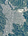 Hieidaira aerial photo 2020.jpg 2,100 × 2,700; 910 KB
-
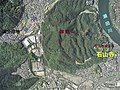
 Ojigaoka and Ojiyama aerial photo 2020.jpg 1,400 × 2,100; 447 KB
-
 Otsu city center area Aerial photograph.1987.jpg 7,185 × 6,585; 29.5 MB
-
 Seta Golf Course Otsu Shiga Aerial photograph.1995.jpg 1,928 × 1,423; 1.08 MB
-
 Shiga Arena.png 794 × 757; 1.53 MB
-
 TORAY Shiga Plant - aerial photograph.jpg 2,400 × 2,100; 4.09 MB
-
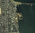 Zeze Castle air.jpg 1,129 × 1,064; 576 KB


