Category:Aerial photographs of Norwood, Massachusetts
Jump to navigation
Jump to search
Media in category "Aerial photographs of Norwood, Massachusetts"
The following 7 files are in this category, out of 7 total.
-
 Aerial view of Norwood, Massachusetts, July 2019.JPG 5,184 × 3,457; 3.5 MB
-
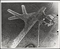 Norwood Airport - DPLA - 05988e03b5875a7324948152c2e7b9c1.jpg 981 × 800; 290 KB
-
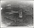
 Norwood Airport - DPLA - 17babb5acd0f19211c95c863c77cf814.jpg 980 × 800; 229 KB
-
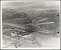
 Norwood Airport - DPLA - 3f2d60b7cb1753251147a02ec16edb01.jpg 982 × 800; 185 KB
-
 Norwood Airport - DPLA - 6a9efc417da16de457427e12f816d943.jpg 981 × 800; 252 KB
-
 Norwood Airport - DPLA - 8ac12a22bcc7e8a1cff1bbf4cafd1224.jpg 979 × 800; 289 KB
-
 Norwood Airport - DPLA - c3be10d1b7c52e577c82dca8e0666af4.jpg 982 × 800; 293 KB


