Category:Aerial photographs of Mittelrhein
Jump to navigation
Jump to search
Subcategories
This category has the following 34 subcategories, out of 34 total.
Media in category "Aerial photographs of Mittelrhein"
The following 103 files are in this category, out of 103 total.
-
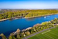 2020-04-13-Siegmündung-0367.jpg 5,330 × 3,551; 14.48 MB
-
 Aerial image of the Deutsches Eck.jpg 5,100 × 3,400; 6.1 MB
-
 Aerial image of the Lorelei.jpg 4,800 × 3,200; 4.42 MB
-
 Aerial image of the Upper Middle Rhine Valley.jpg 5,200 × 3,600; 5.2 MB
-
 Aerial view of Andernach.jpg 2,198 × 2,050; 5.86 MB
-
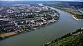
 Ahr, Mündung.jpg 3,648 × 2,052; 3.84 MB
-
 Andernach -Rheinhafen.jpg 4,032 × 2,268; 5.06 MB
-
 Andernach 022x.jpg 5,976 × 3,320; 2.51 MB
-
 Bacharach Luftbild 01.jpg 2,861 × 1,594; 2.09 MB
-
 Bacharach Luftbild 092.jpg 3,008 × 2,000; 4.16 MB
-
 Bad Honnef, Grafenwerth.jpg 2,067 × 1,465; 2.52 MB
-
 Bendorfer Brücke 001.jpg 6,016 × 3,384; 7.87 MB
-
 Bonn from the ISS.jpeg 679 × 1,024; 375 KB
-
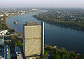 Bonn LangerEugen Posttower.jpg 1,252 × 881; 264 KB
-
 Bonn, Kennedy-Brücke.JPG 4,032 × 2,268; 5.07 MB
-
 Bonn-1277 Rheinaue, UN-Klimakonferenz in Bonn 2017, Bonn-Zone.jpg 6,016 × 3,384; 10.16 MB
-
 Bonn-1311, UN-Klimakonferenz in Bonn 2017, Bula-Zone.jpg 6,016 × 3,384; 9.53 MB
-
 Bonn-Friedrich-Ebert-Brücke, Pylon.jpg 4,032 × 2,272; 5.3 MB
-
 Bonn-Friedrich-Ebert-Brücke.jpg 4,032 × 2,272; 4.92 MB
-
 Bonner Bogen.JPG 3,648 × 2,736; 3.95 MB
-
 Brücke Urmitz.Rhein.JPG 2,816 × 2,112; 2.18 MB
-
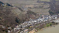
 Diebachtal und Lorch - panoramio.jpg 3,000 × 2,727; 3.06 MB
-
 Ehrenbreitstein 002.jpg 6,016 × 3,384; 9.4 MB
-
 Festung Ehrenbreitstein 043.jpg 6,016 × 3,384; 9.84 MB
-
 Festung Ehrenbreitstein 048.jpg 6,016 × 3,384; 9.46 MB
-
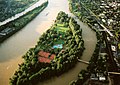
 Insel Nonnenwerth DE 2015.jpg 1,333 × 2,000; 1.33 MB
-
 Irlich 001.jpg 6,016 × 3,384; 8.49 MB
-
 Kennedybruecke-Bonn.jpg 4,320 × 3,240; 3.41 MB
-
 Kesselheim 001.jpg 6,016 × 3,384; 9.6 MB
-
 Koblenz - Koblenzer Brauerei.jpg 4,032 × 2,268; 5.15 MB
-
 Koblenz 130, Preußisches Regierungsgebäude (Koblenz).jpg 6,016 × 3,384; 7.05 MB
-
 Koblenz 19711.JPG 1,722 × 1,134; 1.82 MB
-
 Koblenz im Buga-Jahr 2011 - Luftbilder 02.jpg 4,500 × 3,000; 3.12 MB
-
 Koblenz, Deutsches Eck.jpg 3,648 × 2,736; 4.97 MB
-
 Koblenz, Rheinseilbahn, Luftaufnahme.jpg 3,648 × 2,052; 4.54 MB
-
 Königswinter aus südöstlicher Richtung.JPG 3,648 × 2,736; 3.9 MB
-
 Königswinter, Rheinfähre Königswinter IV, Luftaufnahme.jpg 4,032 × 2,268; 4.6 MB
-
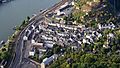
 Lahnstein - panoramio.jpg 3,046 × 2,229; 2.35 MB
-
 Leutesdorf 001.JPG 4,032 × 2,272; 5.95 MB
-
 Linz am Rhein.jpg 4,032 × 2,272; 5.16 MB
-
 Luftbild Festung Ehrenbreitstein Koblenz.jpg 2,000 × 1,500; 719 KB
-
 Neuendorf 006.jpg 6,016 × 3,384; 9.03 MB
-
 Neuwied 003.jpg 6,016 × 3,384; 8.33 MB
-
 Neuwied, Dyckerhoff (Zementhersteller) 001x.jpg 6,016 × 3,384; 8.84 MB
-
 Neuwied, Raiffeisenbrücke 001x.jpg 6,016 × 3,384; 9.42 MB
-
 Niederwerth 002.jpg 6,016 × 3,384; 9.53 MB
-
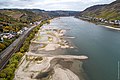
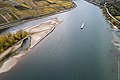
 Niedrigwasser am Jungferngrund im Rhein (32485435677).jpg 3,000 × 1,999; 7.23 MB
-
 Niedrigwasser am Jungferngrund im Rhein (32485436827).jpg 3,000 × 1,999; 6.03 MB
-
 Niedrigwasser am Jungferngrund im Rhein (32485437197).jpg 3,000 × 1,999; 6.4 MB
-
 Niedrigwasser am Jungferngrund im Rhein (32485437457).jpg 3,000 × 1,999; 6.38 MB
-
 Niedrigwasser am Jungferngrund im Rhein (32485437827).jpg 3,000 × 1,999; 6.98 MB
-
 Niedrigwasser am Jungferngrund im Rhein (32485439187).jpg 3,000 × 1,998; 5.9 MB
-
 Niedrigwasser am Jungferngrund im Rhein (32485439527).jpg 3,000 × 1,999; 7.01 MB
-
 Niedrigwasser am Jungferngrund im Rhein (40461600333).jpg 3,000 × 1,999; 7.11 MB
-
 Niedrigwasser am Jungferngrund im Rhein (40461600793).jpg 3,000 × 1,999; 6.11 MB
-
 Niedrigwasser am Jungferngrund im Rhein (40461602233).jpg 3,000 × 1,999; 6.45 MB
-
 Niedrigwasser am Jungferngrund im Rhein (40461605833).jpg 3,000 × 1,999; 7.31 MB
-
 Niedrigwasser am Jungferngrund im Rhein (46512162145).jpg 3,000 × 1,999; 8.42 MB
-
 Niedrigwasser am Jungferngrund im Rhein (46512162575).jpg 3,000 × 1,999; 6.11 MB
-
 Niedrigwasser am Jungferngrund im Rhein (46512164455).jpg 3,000 × 1,999; 5.4 MB
-
 Niedrigwasser am Jungferngrund im Rhein (46512164865).jpg 3,000 × 1,999; 6.36 MB
-
 Niedrigwasser am Jungferngrund im Rhein (47374445862).jpg 3,000 × 1,999; 7.15 MB
-
 Niedrigwasser am Jungferngrund im Rhein (47427273261).jpg 3,000 × 1,999; 5.3 MB
-
 Niedrigwasser am Jungferngrund im Rhein (47427277981).jpg 3,000 × 1,999; 6.16 MB
-
 Niedrigwasser am Jungferngrund im Rhein (47427278721).jpg 3,000 × 1,999; 6.36 MB
-
 Niedrigwasser am Jungferngrund im Rhein (47427279371).jpg 3,000 × 1,999; 6.32 MB
-
 Niedrigwasser am Jungferngrund im Rhein (47427280611).jpg 3,000 × 2,996; 9.94 MB
-
 Niedrigwasser am Jungferngrund im Rhein (47427281531).jpg 3,000 × 1,999; 5.96 MB
-
 Niedrigwasser am Jungferngrund im Rhein (47427282351).jpg 3,000 × 1,999; 5.81 MB
-
 Niedrigwasser am Jungferngrund im Rhein (47427283041).jpg 3,000 × 1,999; 6.94 MB
-
 Niedrigwasser am Jungferngrund im Rhein (47427283871).jpg 3,000 × 1,999; 7.11 MB
-
 Niedrigwasser am Jungferngrund im Rhein (47427284591).jpg 3,000 × 1,999; 6.33 MB
-
 Niedrigwasser am Jungferngrund im Rhein (47427285511).jpg 3,000 × 1,999; 6.53 MB
-
 Nonnenwerth-.jpg 3,648 × 2,736; 5.23 MB
-
 Pfaffendorfer Brücke 001.jpg 6,016 × 3,384; 7.83 MB
-
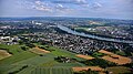
 Rhein bei Bad Honnef, Siebengebirge, aus Süden gesehen.jpg 4,032 × 2,272; 4.64 MB
-
 Rhein Boppard Bacharach DSC 8964.jpg 2,848 × 4,288; 3.73 MB
-
 Rhein und Sieg bei Niedrigwasser im Herbst 2018.jpg 4,070 × 2,636; 8.78 MB
-
 Rhein-Lahn-Kreis - The River Rhine - geo.hlipp.de - 27529.jpg 640 × 480; 56 KB
-
 Rhein-Lahn-Kreis - The River Rhine - geo.hlipp.de - 27530.jpg 640 × 480; 56 KB
-
 Rhein-Lahn-Kreis - The River Rhine - geo.hlipp.de - 27531.jpg 640 × 480; 60 KB
-
 Rheinfähre Linz - Remagen, Luftaufnahme (2014).jpg 4,032 × 2,268; 4.84 MB
-
 Rheinfähre Linz, Remagen-Kripp.jpg 4,032 × 2,268; 4.74 MB
-
 Rheingau-Taunus-Kreis - Bingen Scenery - geo.hlipp.de - 27276.jpg 640 × 425; 85 KB
-
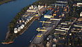
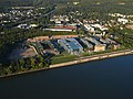
 Rheinhafen Koblenz 002.jpg 6,016 × 3,384; 8.52 MB
-
 Rheinhafen Koblenz 2003 (cropped).jpg 501 × 430; 94 KB
-
 Rheinhafen Koblenz 2003.jpg 1,000 × 750; 245 KB
-
 Ruine Nollig bei Lorch Luftbild 06.jpg 1,000 × 665; 809 KB
-
 Ruine Nollig bei Lorch Luftbild 07.jpg 1,000 × 665; 875 KB
-
 Ruine Nollig bei Lorch Luftbild 08.jpg 1,000 × 665; 696 KB
-
 Schloss Marienburg 005x, Leutesdorf.jpg 6,016 × 3,384; 9.28 MB
-
 Siebengebirge (Schiff, 2015) 001.jpg 4,032 × 2,272; 4.62 MB
-
 Siegmündung, Kemper Werth.jpg 3,648 × 2,736; 5.98 MB
-
 Siegmündung.jpg 3,648 × 2,736; 5.33 MB
-
 Snake - panoramio - Dg-505.jpg 3,648 × 2,736; 3.32 MB
-
 Spay and Rhine aerial.jpg 2,616 × 3,488; 1.98 MB
-
 St. Goarshauen – Fellen - Wellmich - panoramio.jpg 2,462 × 1,805; 1.89 MB
-
 StAL BA 34 (31051365995).jpg 2,728 × 2,032; 1.08 MB
-
 The River Rhine - panoramio (1).jpg 4,000 × 3,000; 2.02 MB
-
 Unkel 036.jpg 6,016 × 3,384; 8.88 MB
-
 Urmitz 002x.jpg 6,016 × 3,384; 8.85 MB
-
 Urmitzer Eisenbahnbrücke bei Urmitz.jpg 4,032 × 2,268; 4.99 MB
-
 Wied, Rheinmündung.jpg 4,032 × 2,268; 5.37 MB


.jpg)


_001x.jpg)


.jpg)
.jpg)
.jpg)
.jpg)
.jpg)
.jpg)
.jpg)
.jpg)
.jpg)
.jpg)
.jpg)
.jpg)
.jpg)
.jpg)
.jpg)
.jpg)
.jpg)
.jpg)
.jpg)
.jpg)
.jpg)
.jpg)
.jpg)
.jpg)
.jpg)
.jpg)
.jpg)


.jpg)


.jpg)


_001.jpg)


.jpg)
.jpg)


