Category:Aerial photographs of Middlesex County, Massachusetts
Jump to navigation
Jump to search
Subcategories
This category has the following 9 subcategories, out of 9 total.
A
C
N
Media in category "Aerial photographs of Middlesex County, Massachusetts"
The following 39 files are in this category, out of 39 total.
-
 Aerial panorama of Arlington, Massachusetts, June 2017.jpg 8,148 × 2,589; 5.57 MB
-
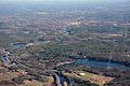
 Aerial picture of rail tracks near a water body.jpg 4,000 × 2,250; 7.45 MB
-
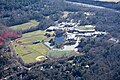
 Aerial view of Anderson RTC and surroundings, September 2024.JPG 5,184 × 3,888; 8.81 MB
-
 Aerial view of downtown Woburn, Massachusetts, September 2024.JPG 3,823 × 2,899; 5.76 MB
-
 Aerial view of Framingham, December 1985.jpg 3,664 × 2,448; 2.92 MB
-
 Aerial view of Iron Horse Park and surroundings, September 2024.JPG 4,715 × 3,541; 7.38 MB
-
 Aerial view of Mystic Generating Station, circa 1960s.jpg 4,053 × 2,741; 1.21 MB
-
 Aerial view of Pepperell, Massachusetts, September 2024.JPG 4,482 × 3,361; 7.14 MB
-

-
 Aerial view of Townsend, Massachusetts, September 2024.JPG 4,018 × 3,013; 9.19 MB
-
 Aerial view of Wellington station, September 2012.jpg 2,633 × 1,314; 899 KB
-
 Aggregate Industries rock quarry Littleton MA.JPG 6,000 × 4,000; 11.24 MB
-
 Assabet River Stow MA Aerial.JPG 6,000 × 4,000; 11.56 MB
-
 Ayer, MA aerial view.JPG 4,320 × 3,240; 3.95 MB
-
 Bedford High School aerial.JPG 6,000 × 4,000; 10.96 MB
-
 Belmont High School aerial.JPG 6,000 × 4,000; 11.18 MB
-
 Cavicchio Greenhouses Raytheon Sudbury MA.JPG 6,000 × 4,000; 11.61 MB
-
 Concord MA Town Center Aerial 1.JPG 6,000 × 4,000; 8.1 MB
-
 Concord MA Town Center Aerial 2.JPG 4,790 × 3,188; 8.13 MB
-
 Electrical Substation Ayer MA Aerial.JPG 6,000 × 4,000; 11.02 MB
-
 Everett, MA - Aerial (25669031348).jpg 2,400 × 1,600; 2.79 MB
-
 Food Project Sudbury River Lincoln MA Aerial.JPG 6,000 × 4,000; 11.69 MB
-
 Intel microchip manufacturing plant Hudson MA.JPG 6,000 × 4,000; 10.5 MB
-
 Littleton station and I-495 - Route 2 interchange aerial view.JPG 4,320 × 3,240; 5.25 MB
-
 Marlborough East Wastewater Treatment Plant Aerial.JPG 6,000 × 4,000; 10.2 MB
-
 Massachusetts Correctional Institute Concord Aerial.JPG 5,307 × 3,522; 9.63 MB
-
 MBTA Everett Shops satellite image, December 2010.JPG 520 × 507; 77 KB
-
 Middlesex School Concord MA aerial.JPG 6,000 × 4,000; 10.67 MB
-
 Mount Misery Sudbury River Lincoln MA Aerial.JPG 6,000 × 4,000; 12.12 MB
-
 Raytheon corporate campus Marlborough MA.JPG 6,000 × 4,000; 11.56 MB
-
 Reading, MA aerial view.JPG 4,320 × 3,240; 4.95 MB
-
 Route 3 and 128 interchange aerial view, December 2018.JPG 5,184 × 3,888; 7.83 MB
-
 Route 62 Highland Commons Massachusetts.JPG 6,000 × 4,000; 11.52 MB
-
 Solar panel array Weston aerial.JPG 6,000 × 4,000; 11.29 MB
-
 Stoneham, MA aerial view.JPG 3,863 × 2,897; 4.2 MB
-
 Sudbury River Wayland MA Aerial.JPG 4,000 × 6,000; 10.4 MB
-
 Wayland MA Town Center Aerial.jpg 6,000 × 4,000; 11.66 MB
-
 West Medford Aerial.JPG 4,320 × 3,240; 4.3 MB
-
 Weston High School aerial.JPG 6,000 × 4,000; 11.63 MB


.jpg)


