Category:Aerial photographs of Maricopa County, Arizona
Jump to navigation
Jump to search
Subcategories
This category has only the following subcategory.
P
Media in category "Aerial photographs of Maricopa County, Arizona"
The following 51 files are in this category, out of 51 total.
-
 2013 Arizona Scottsdale aerial.jpg 3,016 × 1,712; 1.07 MB
-
 231104-19 Kiwanis Park.jpg 8,064 × 6,048; 47.91 MB
-
 231105-1 TSMC Fab 21 construction.jpg 8,064 × 6,048; 40.78 MB
-
 231105-2 Loop 303 and 43rd Ave.jpg 8,064 × 6,048; 43.81 MB
-
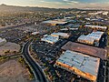 231105-6 Emerald Center.jpg 8,064 × 6,048; 44.49 MB
-
 231111-5 Mountain View Park and North Mountain.jpg 8,064 × 6,048; 46.02 MB
-
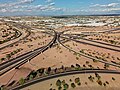
 231112-1 I-10 and US 60 intersection.jpg 8,064 × 6,048; 40.06 MB
-
 231112-2 Arizona Mills.jpg 8,064 × 6,048; 40.94 MB
-
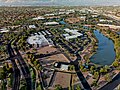 231118-10 ASU Research Park.jpg 8,064 × 6,048; 52.2 MB
-
 231118-2 Kiwanis Lake.jpg 8,064 × 6,048; 45.1 MB
-
 231118-9 ViaSat construction at ASU Research Park.jpg 8,064 × 6,048; 49.83 MB
-
 231119-11 Desert Breeze Lake.jpg 8,064 × 6,048; 50.76 MB
-
 231119-12 Chandler Fashion Center.jpg 7,884 × 5,800; 44.85 MB
-
 231119-14 I-10 and Loop 202 intersection.jpg 8,064 × 6,048; 41.53 MB
-
 231202-4 intersection of Loop 101 and US 60 from the southeast.jpg 8,064 × 6,048; 39.37 MB
-
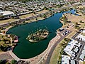 231203-2 Chaparral Lake.jpg 8,064 × 6,048; 47.15 MB
-
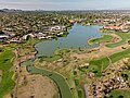 231203-5 McCormick Ranch Golf Club course and lake.jpg 8,064 × 6,048; 45.5 MB
-
 231209-2 Ahwatukee and South Mountain.jpg 8,064 × 6,048; 50.16 MB
-
 231217-5 1445 W Elliot Rd Costco Gasoline.jpg 8,064 × 6,048; 42.93 MB
-
 231221-2 I-10 and US-60 intersection.jpg 8,064 × 6,048; 46.47 MB
-
 Arizona 101 202 interchange in Mesa.jpg 1,512 × 2,688; 1.14 MB
-
 Arizona Aerial Image by PCHS-NJROTC.jpg 3,024 × 2,253; 1.55 MB
-
 Arizona route 303 interchange with I-10 in Goodyear.jpg 1,466 × 2,196; 928 KB
-
 AZ Racetrack n Airport.jpg 2,564 × 1,847; 3.3 MB
-
 Chandler Arizona aerial.jpg 2,816 × 2,112; 3.55 MB
-
 Errl Cup Drone View.jpg 3,979 × 2,988; 16.54 MB
-
 Firebird International Raceway Chandler Arizona.jpg 1,024 × 768; 578 KB
-
 Glendale, Arizona (101301394).jpg 1,600 × 1,200; 969 KB
-
 Hassayampa River aerial.jpg 1,085 × 2,314; 994 KB
-
 HohokamExpy-SkyHarborBlvd interchange.jpg 2,848 × 2,136; 2.15 MB
-
 HOPE in Tempe (cropped).jpg 588 × 685; 137 KB
-
 HOPE in Tempe.jpg 1,469 × 2,064; 588 KB
-
 Loop 202 Super Red Tan Stack - Aireal - 2008-01.JPG 2,640 × 2,028; 1.19 MB
-
 Maricopa Arizona.jpg 1,536 × 1,360; 425 KB
-
 Maryvale Baseball Park.jpg 3,048 × 2,503; 4.67 MB
-
 Minor drainage divide south of Buckeye Arizona aerial.jpg 2,688 × 1,512; 3.07 MB
-
 Northeast Buckeye AZ aerial.jpg 1,512 × 2,050; 972 KB
-
 North Mtn Shaw Butte Preserve.jpg 1,346 × 618; 253 KB
-

-
 Scottsdale, Arizona (101299903).jpg 1,600 × 1,200; 802 KB
-
 Sierra Estrella Mountains Near Phoenix, Arizona (101299107).jpg 1,600 × 1,200; 684 KB
-
 Sierra Estrella Mountains Near Phoenix, Arizona (101299200).jpg 1,600 × 1,200; 724 KB
-
 SMOG OVER PHOENIX - NARA - 546748.jpg 3,000 × 2,032; 980 KB
-
 SMOKE FROM COPPER SMELTERS IN GLOBE-MIAMI AREA DRIFTS TOWARD PHOENIX - NARA - 546764.jpg 3,000 × 2,041; 587 KB
-

-
 Sun City, Arizona (101300589).jpg 1,600 × 1,200; 1.15 MB
-
 Sun City, Arizona (101300784).jpg 1,600 × 1,200; 1.07 MB
-
 Tempe Town Lake - No Water 01 - 2010-08-06.jpg 4,000 × 3,000; 5.32 MB
-
 The Scottsdale Six, Sept. 2013.jpg 2,848 × 2,136; 1.88 MB
-
 View of Four Peaks from an airplane.jpg 4,032 × 3,024; 2.2 MB
-
 Waterman Wash, Goodyear, Arizona.jpg 2,688 × 1,512; 1.38 MB


.jpg)


.jpg)


.jpg)
.jpg)
.jpg)


.jpg)
.jpg)


