Category:Aerial photographs of Maastricht
Jump to navigation
Jump to search
Media in category "Aerial photographs of Maastricht"
The following 186 files are in this category, out of 186 total.
-
 1963 vm Ziekenhuis Calvariënberg.jpg 797 × 592; 260 KB
-
 1977 Luchtfoto Maastricht-Mariaberg.jpg 598 × 600; 189 KB
-
 Bouw Kennedybrug Maastricht, 1966 (0).jpg 796 × 580; 197 KB
-
 Bouw Kennedybrug Maastricht, 1966 (0a) (cropped).jpg 649 × 572; 148 KB
-
 Brug A2, Eyldergaard en De Heeg, Maastricht, 1982.jpg 800 × 559; 160 KB
-
 F-35 boven Maastricht.jpg 900 × 602; 102 KB
-
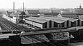
 Fabriekscomplexen Maastricht-Noordoost (1966) (cropped).jpg 1,465 × 897; 332 KB
-
 Fabriekscomplexen Maastricht-Noordoost (1966).jpg 1,734 × 1,041; 502 KB
-
 Geusseltrotonde (A2) en Geusseltpark, Maastricht, 1963.jpg 800 × 592; 204 KB
-
 Heiligdomsvaart Maastricht (1962), Vrijthof, openluchtmis.jpg 410 × 600; 96 KB
-
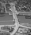
 John F. Kennedybrug Maastricht (cropped).jpg 1,024 × 509; 208 KB
-
 John F. Kennedybrug Maastricht (cropped2).jpg 711 × 419; 143 KB
-
 John F. Kennedybrug Maastricht (cropped3).jpg 938 × 680; 219 KB
-
 John F. Kennedybrug Maastricht (plan Céramique-toren).jpg 1,001 × 570; 176 KB
-
 John F. Kennedybrug Maastricht.jpg 1,024 × 681; 140 KB
-
 Knooppunt Europaplein (A2), Maastricht, 1969.jpg 798 × 600; 210 KB
-
 Knooppunt Europlein Maastricht.jpg 640 × 480; 54 KB
-
 Luchtfoto Heer-Maastricht in 1982 (GAM 39875).jpg 605 × 599; 190 KB
-
 Luchtfoto Kristalunie Maastricht, ca 1980.jpg 1,920 × 1,080; 931 KB
-
 Luchtfoto Maastricht, 1991.jpg 1,000 × 794; 400 KB
-

-
 Luchtfoto Maastricht, Koningsplein & Wittevrouwenveld, 1962.jpg 442 × 600; 144 KB
-
 Luchtfoto Maastricht-Boschpoort, 1965.jpg 800 × 597; 186 KB
-
 Luchtfoto Maastricht-Bosscherveld, 1962.jpg 602 × 600; 137 KB
-
 Luchtfoto Maastricht-Cabergerweg-Bosscherveld, 1962.jpg 602 × 600; 146 KB
-
 Luchtfoto Maastricht-Noordwest, 1962.jpg 598 × 600; 135 KB
-
 Luchtfoto Société Céramique, Maastricht, 1935 (crop1).jpg 3,021 × 1,897; 2.58 MB
-
 Luchtfoto Société Céramique, Maastricht, 1935 (crop2).jpg 1,587 × 833; 661 KB
-
 Luchtfoto Société Céramique, Maastricht, 1935.jpg 3,768 × 2,566; 5.27 MB
-
 Luchtopname Maastricht na de bevrijding (cropped).jpg 2,106 × 1,367; 630 KB
-
 Luchtopname Maastricht na de bevrijding.jpg 2,501 × 3,076; 737 KB
-
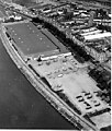
 Maas & Maasboulevard in 1965, GAM 20299.jpg 800 × 589; 179 KB
-
 Maastricht (1960), Griend met helihaven.jpg 379 × 266; 59 KB
-
 Maastricht (1977), Griend met Eurohal.jpg 225 × 265; 49 KB
-
 Maastricht (1991), luchtopname centrum-west.jpg 709 × 563; 281 KB
-
 Maastricht, Bassin-omgeving, 1962.jpg 796 × 584; 236 KB
-
 Maastricht, Boschstraat, 1963.jpg 1,457 × 1,079; 514 KB
-
 Maastricht, Boschstraat, kloostercomplex Zusters Arme Kind Jezus, 1951.jpg 1,074 × 1,075; 364 KB
-
 Maastricht, Boschstraatkwartier, 1961 (1).jpg 1,070 × 1,077; 327 KB
-
 Maastricht, Boschstraatkwartier, 1961 (2).jpg 1,074 × 1,078; 382 KB
-
 Maastricht, Boschstraatkwartier, 1961 (cropped).jpg 1,464 × 773; 323 KB
-
 Maastricht, Boschstraatkwartier, 1961.jpg 1,464 × 1,077; 486 KB
-
 Maastricht, Boschstraatkwartier, 1962.jpg 1,080 × 1,549; 365 KB
-
 Maastricht, Boschstraatkwartier, 1966.jpg 1,465 × 1,077; 468 KB
-
 Maastricht, bouw Noorderbrug bij Bosscherweg & ZW-vaart.jpg 1,015 × 1,592; 364 KB
-
 Maastricht, bouw Noorderbrug bij Fransensingel, 1983.jpg 1,588 × 1,020; 302 KB
-
 Maastricht, bouw Noorderbrug, GAM 38414.jpg 1,536 × 932; 673 KB
-
 Maastricht, bouw Noorderbrug, GAM 38415.jpg 1,016 × 1,588; 427 KB
-
 Maastricht, bouw Noorderbrug, GAM 38522.jpg 1,592 × 1,023; 421 KB
-
 Maastricht, bouw Noorderbrug, GAM 38523.jpg 1,591 × 1,023; 419 KB
-
 Maastricht, bouw Noorderbrug, GAM 38528.jpg 1,024 × 1,592; 323 KB
-
 Maastricht, bouw Scharnerwegtunnel, 1962 (cropped).jpg 659 × 541; 127 KB
-
 Maastricht, bouw Scharnerwegtunnel, 1962.jpg 659 × 898; 231 KB
-
 Maastricht, Calvariënbergterrein, 1964 (cropped).jpg 800 × 369; 194 KB
-
 Maastricht, Calvariënbergterrein, 1964.jpg 800 × 588; 234 KB
-
 Maastricht, Céramique-terrein na sloop, luchtopname.jpg 1,021 × 798; 367 KB
-
 Maastricht, De Geusselt, GAM 40510.jpg 1,588 × 1,028; 339 KB
-
 Maastricht, De Heeg, GAM 19745.jpg 1,078 × 1,023; 519 KB
-
 Maastricht, De Heeg, GAM 19754.jpg 1,023 × 1,144; 554 KB
-
 Maastricht, De Sphinx, luchtfoto's.jpg 3,764 × 2,514; 2.44 MB
-
 Maastricht, Herbenusstraat 87, GAM 39826 (cropped).jpg 697 × 584; 167 KB
-
 Maastricht, Herbenusstraat 87, GAM 39826 (cropped2).jpg 900 × 600; 230 KB
-
 Maastricht, Herbenusstraat 87, GAM 39826.jpg 900 × 861; 344 KB
-
 Maastricht, Hertogsingel, 1964.jpg 442 × 600; 129 KB
-
 Maastricht, kruispunt Viaductweg-Meerssenerweg, GAM 38265 (cropped).jpg 1,271 × 879; 354 KB
-
 Maastricht, kruispunt Viaductweg-Meerssenerweg, GAM 38265.jpg 1,592 × 1,023; 350 KB
-
 Maastricht, kruispunt Viaductweg-Meerssenerweg, GAM 38421.jpg 1,591 × 1,023; 335 KB
-
 Maastricht, kruispunt Viaductweg-Meerssenerweg, GAM 39015.jpg 1,591 × 1,019; 360 KB
-
 Maastricht, luchtfoto ca 1980 (cropped).jpg 933 × 588; 222 KB
-
 Maastricht, luchtfoto ca 1980.jpg 1,576 × 1,019; 446 KB
-
 Maastricht, luchtfoto Heerderweg eo, 1962 (cropped).jpg 478 × 236; 80 KB
-
 Maastricht, luchtfoto Heerderweg eo, 1962.jpg 597 × 600; 132 KB
-
 Maastricht, luchtfoto Koningsplein-Oranjeplein, 1962.jpg 592 × 600; 148 KB
-
 Maastricht, luchtfoto N2, Koningsplein & spoorlijn, 1962.jpg 796 × 590; 271 KB
-
 Maastricht, luchtfoto Nazareth, 1960.jpg 739 × 600; 128 KB
-
 Maastricht, luchtfoto noordelijke binnenstad, GAM 37494.jpg 1,576 × 657; 264 KB
-
 Maastricht, luchtfoto noordelijke binnenstad, GAM 37494a (cropped).jpg 866 × 551; 141 KB
-
 Maastricht, luchtfoto omgeving Bassin, 1927 (cropped).jpg 773 × 348; 255 KB
-
 Maastricht, luchtfoto omgeving Bassin, 1927.jpg 800 × 575; 237 KB
-
 Maastricht, luchtfoto Scharn, 1966 (1).jpg 800 × 592; 154 KB
-
 Maastricht, luchtfoto Scharn, 1966 (2).jpg 800 × 591; 163 KB
-
 Maastricht, luchtfoto Stationsemplacement, 1985 (cropped).jpg 536 × 355; 102 KB
-
 Maastricht, luchtfoto Stationsemplacement, 1985.jpg 779 × 554; 254 KB
-
 Maastricht, luchtfoto zwembad Dousberg.jpg 1,575 × 1,023; 527 KB
-
 Maastricht, luchtopname Kommelkwartier, 1963.jpg 800 × 593; 194 KB
-
 Maastricht, Maas en Kennedybrug, 1969.jpg 788 × 596; 205 KB
-
 Maastricht, Noorderbrug, GAM 38286.jpg 1,576 × 963; 344 KB
-
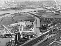
 Maastricht, omgeving Bassin, 1961.jpg 1,080 × 1,289; 333 KB
-
 Maastricht, omgeving Bassin, 1973.jpg 1,596 × 1,079; 555 KB
-
 Maastricht, omgeving Koestraat,.jpg 1,019 × 1,150; 549 KB
-
 Maastricht, omgeving Koningin Emmaplein, 1963.jpg 791 × 580; 181 KB
-
 Maastricht, omgeving Stationsplein, 1963 (cropped).jpg 800 × 381; 193 KB
-
 Maastricht, omgeving Stationsplein, 1963.jpg 800 × 585; 203 KB
-
 Maastricht, omgeving Tongerseweg, GAM 19965.jpg 1,028 × 1,083; 472 KB
-
 Maastricht, overstroming Maas bij Borgharen, 1993 (1).jpg 598 × 600; 64 KB
-
 Maastricht, overstroming Maas bij Borgharen, 1993 (2).jpg 598 × 559; 92 KB
-
 Maastricht, Pottenberg-Malpertuis-Malberg (RHCL 5849).jpg 797 × 560; 211 KB
-
 Maastricht, Prins Bisschopsingel, bouw politiebureau, 1976 (1).jpg 575 × 591; 146 KB
-
 Maastricht, Prins Bisschopsingel, rond-point (4).jpg 800 × 580; 250 KB
-
 Maastricht, Prins Bisschopsingel, rond-point (4a).jpg 800 × 442; 178 KB
-
 Maastricht, Randwyck, AZM, GAM 40509.jpg 1,592 × 1,040; 412 KB
-
 Maastricht, reconstructie Koningin Emmaplein, 1963.jpg 797 × 588; 224 KB
-
 Maastricht, Scharn, GAM 19744.jpg 1,025 × 1,139; 568 KB
-
 Maastricht, Scharn, GAM 19744a (cropped).jpg 1,025 × 911; 425 KB
-
 Maastricht, Sint-Pietersberg, ENCI-groeve, 1982.jpg 629 × 595; 143 KB
-
 Maastricht, spoorwegemplacement, 1926.jpg 4,696 × 3,493; 11.76 MB
-
 Maastricht, spoorwegovergang Duitse Poort (1935).jpg 744 × 595; 194 KB
-
 Maastricht, spoorzone & Wyckerpoort, GAM 39424.jpg 1,180 × 908; 394 KB
-
 Maastricht, spoorzone Wyck & Wyckerpoort, GAM 39348.jpg 1,200 × 896; 414 KB
-
 Maastricht, spoorzone, Stationsplein & Wyckerpoort, GAM 39349.jpg 1,200 × 887; 413 KB
-
 Maastricht, Statenkwartier, 1965.jpg 1,452 × 1,075; 477 KB
-
 Maastricht, Statensingel, GAM 38304.jpg 1,592 × 1,023; 337 KB
-
 Maastricht, Tongerseweg, GAM 2213.jpg 1,000 × 738; 321 KB
-
 Maastricht, Viaductweg-Meerssenerweg, GAM 38369.jpg 1,800 × 885; 435 KB
-
 Maastricht, Wilhelminabrug en -singel, 1965.jpg 800 × 583; 207 KB
-
 Maastricht, Wilhelminabrug en -singel, 1965a.jpg 800 × 394; 138 KB
-
 Maastricht, Wyckerpoort-Noord,.jpg 1,200 × 892; 403 KB
-
 Maastricht, Zuid-Willemsvaart met slachthuis.jpg 812 × 417; 128 KB
-
 Maastricht, zwembad Jekerdal, 1961.jpg 586 × 588; 151 KB
-
 Maastricht-Amby, luchtopname Hiuze Severen, ca 1960-65.jpg 796 × 600; 150 KB
-
 Maastricht-Limmel, luchtopname, GAM 8272.jpg 1,263 × 933; 440 KB
-
 Maastricht-Limmel, luchtopname, GAM 8275.jpg 1,300 × 960; 371 KB
-
 Maastricht-Meerssenhoven, luchtopname 1974.jpg 786 × 600; 220 KB
-
 Maastricht-Scharn (1950), Villa Roovers.jpg 674 × 502; 106 KB
-
 Maastricht-Wyck, luchtfoto Céramiqueterrein, 1974.jpg 800 × 567; 140 KB
-

-
 NIMH - 2011 - 0321 - Aerial photograph of Maastricht, The Netherlands - 1920 - 1940.jpg 3,500 × 2,579; 2.14 MB
-

-

-

-

-

-
-

-

-

-

-
 NIMH - 2011 - 0323 - Aerial photograph of Maastricht, The Netherlands - 1920 - 1940.jpg 3,500 × 2,548; 2.05 MB
-

-
 NIMH - 2011 - 0324 - Aerial photograph of Maastricht, The Netherlands - 1920 - 1940 (crop1).jpg 1,933 × 1,434; 1,012 KB
-
 NIMH - 2011 - 0324 - Aerial photograph of Maastricht, The Netherlands - 1920 - 1940.jpg 3,387 × 2,324; 2.13 MB
-
-
 NIMH - 2011 - 0325 - Aerial photograph of Maastricht, The Netherlands - 1920 - 1940.jpg 3,365 × 2,324; 2.63 MB
-
-

-

-

-
-

-

-

-

-
 NIMH - 2011 - 0326 - Aerial photograph of Maastricht, The Netherlands - 1937.jpg 3,500 × 2,520; 2.58 MB
-

-

-

-

-

-

-
-
 NIMH - 2011 - 0327 - Aerial photograph of Maastricht, The Netherlands - 1934 (edited).jpg 3,370 × 2,324; 2.62 MB
-
 NIMH - 2011 - 0327 - Aerial photograph of Maastricht, The Netherlands - 1934.jpg 3,500 × 2,552; 2.11 MB
-
 NIMH - 2011 - 0328 - Aerial photograph of Maastricht, The Netherlands - 1920 - 1940.jpg 3,359 × 2,317; 2.15 MB
-

-
 NIMH - 2011 - 0349 - Aerial photograph of Maastricht, The Netherlands - 1920 - 1940.jpg 3,500 × 2,543; 2.53 MB
-
-

-
 NIMH - 2011 - 1007 - Aerial photograph of Maastricht, The Netherlands - 1920 - 1940.jpg 3,500 × 2,525; 1.89 MB
-
 NIMH - 2011 - 1008 - Aerial photograph of Maastricht, The Netherlands - 1920 - 1940.jpg 3,500 × 2,559; 1.82 MB
-

-
-
 NIMH - 2011 - 1009 - Aerial photograph of Maastricht, The Netherlands - 1920 - 1940.jpg 3,500 × 2,544; 2.08 MB
-

-
 NIMH - 2011 - 1010 - Aerial photograph of Maastricht, The Netherlands - 1920 - 1940.jpg 3,500 × 2,559; 1.96 MB
-

-
 NIMH - 2011 - 5154 - Aerial photograph of Maastricht, The Netherlands (crop1).jpg 2,889 × 1,305; 1.12 MB
-
-
 NIMH - 2011 - 5154 - Aerial photograph of Maastricht, The Netherlands (crop3).jpg 2,311 × 1,519; 1.08 MB
-
 NIMH - 2011 - 5154 - Aerial photograph of Maastricht, The Netherlands (crop4).jpg 2,287 × 1,171; 831 KB
-
 NIMH - 2011 - 5154 - Aerial photograph of Maastricht, The Netherlands.jpg 4,000 × 2,647; 2.4 MB
-
 NIMH - 2155 013924 - Aerial photograph of Maastricht, Limburg, The Netherlands.jpg 3,520 × 2,402; 1.62 MB
-
 Royal Air Force- France, 1939-1940. C1500.jpg 800 × 582; 122 KB
-
 Sphinx fabrieksterrein Bosscherweg 247, 1961.jpg 788 × 600; 220 KB
-
 Sphinx fabrieksterrein Bosscherweg 247, 1963.jpg 800 × 596; 240 KB
-
 Tapijnkazerne, officiersmess, 1953.jpg 796 × 580; 198 KB
-
 Wiitevrouwenhof, luchtfoto 1920.jpg 498 × 350; 101 KB


.jpg)
_(cropped).jpg)


_(cropped).jpg)
.jpg)
_en_Geusseltpark,_Maastricht,_1963.jpg)
,_Vrijthof,_openluchtmis.jpg)
.jpg)
.jpg)
.jpg)
.jpg)

,_Maastricht,_1969.jpg)

.jpg)


.jpg)
.jpg)

.jpg)


,_Griend_met_helihaven.jpg)
,_Griend_met_Eurohal.jpg)
,_luchtopname_centrum-west.jpg)


.jpg)
.jpg)
.jpg)


.jpg)

.jpg)


.jpg)
.jpg)


.jpg)


.jpg)

.jpg)


.jpg)
.jpg)

.jpg)
.jpg)
.jpg)


.jpg)


.jpg)
.jpg)
.jpg)
.jpg)
.jpg)
.jpg)


.jpg)


.jpg)


,_Villa_Roovers.jpg)


.jpg)
.jpg)

.jpg)
.jpg)
.jpg)
.jpg)
.jpg)
.jpg)
.jpg)

.jpg)
.jpg)

.jpg)

.jpg)

.jpg)

.jpg)
.jpg)
.jpg)

.jpg)
.jpg)
.jpg)
.jpg)
.jpg)
.jpg)
.jpg)
.jpg)


.jpg)

.jpg)
.jpg)


_(cropped).jpg)
.jpg)

.jpg)

.jpg)
.jpg)
.jpg)
.jpg)
.jpg)


.jpg)
.jpg)