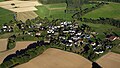
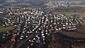
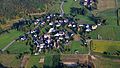
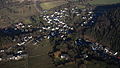
Category:Aerial photographs of Landkreis Altenkirchen (Westerwald)
Jump to navigation
Jump to search
Urban districts (cities): Coblenz · Ludwigshafen · Mainz · Neustadt an der Weinstrasse · Speyer · Trier ·
Deutsch: Luftaufnahmen aus dem Landkreis Altenkirchen, Rheinland-Pfalz
Subcategories
This category has the following 2 subcategories, out of 2 total.
A
L
- Aerial photographs of Burg Lahr (23 F)
Media in category "Aerial photographs of Landkreis Altenkirchen (Westerwald)"
The following 51 files are in this category, out of 51 total.
-
 Aerial image of Schloss Crottorf (view from the south).jpg 4,000 × 2,700; 5.57 MB
-
 Aerial image of the Betzdorf-Kirchen airfield.jpg 4,400 × 3,400; 6.82 MB
-
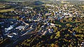 Altenkirchen (Westerwald) 003.JPG 4,032 × 2,272; 5.99 MB
-
 Am Menzenberg 5A, 57632 Peterslahr, Morlock Motors, 027.jpg 6,016 × 3,384; 10.58 MB
-
 Bachenberg 001.JPG 4,032 × 2,268; 5.63 MB
-
 Berod bei Hachenburg 001.jpg 6,016 × 3,384; 9.05 MB
-
 Birkenbeul Kratzhahn 001.jpg 6,016 × 3,384; 8.98 MB
-
 Birkenbeul-Weissenbrüchen 001.jpg 6,016 × 3,384; 9.15 MB
-
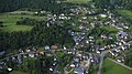
 Birnbach 001.JPG 4,032 × 2,268; 5.62 MB
-
 Birnbach, Evangelische Kirche 002.JPG 4,032 × 2,268; 5.47 MB
-
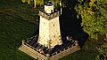 Bismarckturm (Altenkirchen) 002.JPG 4,032 × 2,272; 5.48 MB
-
 Burg Freusburg 004b - K.jpg 4,104 × 2,308; 7.27 MB
-
 Burg Wildenburg (Wildenburger Land), 007 wik k.jpg 1,200 × 675; 681 KB
-
 Burglahr 001-.jpg 4,032 × 2,268; 5.38 MB
-
 Druidenstein 001 - K.jpg 5,472 × 3,078; 11.09 MB
-
 Eichen (Westerwald) 001.jpg 6,016 × 3,384; 9.89 MB
-
 Epgert 001.jpg 6,016 × 3,384; 9.2 MB
-
 Epgert, Luftaufnahme 2015.jpg 4,032 × 2,268; 4.98 MB
-
 Eulenberg (Westerwald).JPG 4,032 × 2,268; 5.08 MB
-
 Fiersbach 001.JPG 4,032 × 2,272; 5.34 MB
-
 Flammersfeld 001.jpg 6,016 × 3,384; 10.04 MB
-
 Gollershoben 001.jpg 6,016 × 3,384; 9.92 MB
-
 Helmeroth 001.jpg 6,016 × 3,384; 10.07 MB
-
 Hemmelzen 001.jpg 6,016 × 3,384; 10.08 MB
-
 Hilgenroth 001.jpg 6,016 × 3,384; 9.83 MB
-
 Horhausen (Westerwald).JPG 4,032 × 2,272; 5.46 MB
-
 Kausen 002.jpg 6,016 × 3,384; 9.47 MB
-
 Kettenhausen 001.JPG 4,032 × 2,268; 5.29 MB
-
 Kloster Marienthal (Westerwald) 005.jpg 6,016 × 3,384; 9.91 MB
-
 Krunkel 001.jpg 6,016 × 3,384; 9.69 MB
-
 Krunkel, Luftaufnahme 2015.jpg 4,032 × 2,268; 4.96 MB
-
 Luchert 001.jpg 6,016 × 3,384; 10.38 MB
-
 Mehren - Westerwald.jpg 3,648 × 2,052; 3.89 MB
-
 Mehren, Westerwald, Romanische Kirche.jpg 3,648 × 2,736; 4.92 MB
-
 Niedersteinebach 001.jpg 6,016 × 3,384; 9.52 MB
-
 Oberlahr, Luftaufnahme 2015.jpg 4,032 × 2,268; 5 MB
-
 Obersteinebach 001.jpg 6,016 × 3,384; 10.73 MB
-
 Peterslahr, Luftaufnahme 2015.JPG 4,032 × 2,268; 4.99 MB
-
 Pleckhausen 001.jpg 6,016 × 3,384; 10.12 MB
-
 Racksen 001.jpg 6,016 × 3,384; 10.08 MB
-
 Reiferscheid 001.jpg 6,016 × 3,384; 10.45 MB
-
 Reuffelbach 001.JPG 4,032 × 2,268; 4.5 MB
-
 Rott (Westerwald) 001.jpg 6,016 × 3,384; 10.02 MB
-
 Schloss Crottorf, 026, wik k.jpg 1,200 × 675; 623 KB
-
 Schloss Schönstein 005b.jpg 4,720 × 2,655; 6.28 MB
-
 Schürdt 001.jpg 6,016 × 3,384; 9.83 MB
-
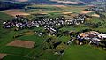
 Seifen (Westerwald) Niederähren.jpg 4,032 × 2,268; 5.14 MB
-
 Willroth 001.jpg 6,016 × 3,384; 9.71 MB
-
 Wissen (Stadt) 001.jpg 6,016 × 3,384; 10.54 MB
-
 Wissen (Stadt), Glatteneichen 001.jpg 6,016 × 3,384; 10.08 MB
-
 Ölsen 001.jpg 6,016 × 3,384; 10.16 MB
.jpg)

_003.JPG)


_002.JPG)

,_007_wik_k.jpg)


_001.jpg)


.JPG)


.JPG)


_005.jpg)


_001.jpg)


_Nieder%C3%A4hren.jpg)

_001.jpg)
,_Glatteneichen_001.jpg)
