Category:Aerial photographs of Lake Huron
Jump to navigation
Jump to search
Media in category "Aerial photographs of Lake Huron"
The following 23 files are in this category, out of 23 total.
-
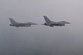
 180th FW flies training sortie 150625-F-FY748-287.jpg 7,360 × 4,912; 5.23 MB
-
 180th FW trains in Michigan 150625-F-FY748-215.jpg 4,950 × 3,300; 2.28 MB
-
 180th FW trains in Michigan 150626-F-FY748-552.jpg 5,210 × 3,477; 2.79 MB
-
 180th FW trains in Michigan 150626-F-FY748-673.jpg 5,188 × 3,462; 3.34 MB
-
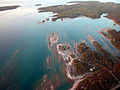
 Aerial view of Kettle Point -a.jpg 4,368 × 2,912; 10.77 MB
-
 Aerial view of Kettle Point -b.jpg 4,024 × 2,222; 8.77 MB
-
 Aerial view of Kettle Point -c.jpg 3,864 × 2,350; 8.05 MB
-
 Aerial view of Kettle Point -d.jpg 3,654 × 1,976; 7.06 MB
-
 Aerial view of Kettle Point -e.jpg 4,368 × 2,912; 11.69 MB
-
 Arthur J in Lake Huron 120720-G-AW789-051.jpg 2,784 × 1,848; 2.64 MB
-
 Arthur J in Lake Huron 120720-G-AW789-061.jpg 2,784 × 1,848; 2.75 MB
-
 Bayfield River enters Lake Huron.jpg 1,111 × 1,555; 1.66 MB
-
 Brucesky.jpg 800 × 600; 101 KB
-
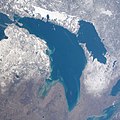
 ISS067-E-14016 Lake Michigan–Huron.jpg 5,568 × 3,712; 2.62 MB
-
 ISS067-E-7704 Islands between Manitoulin Island and the Bruce Peninsula.jpg 5,568 × 3,712; 1.97 MB
-
 ISS067-E-7705 northwestern Bruce Peninsula.jpg 5,568 × 3,712; 2.42 MB
-
 ISS067-E-7710.jpg North Channel in Lake Huron.jpg 5,568 × 3,712; 2.66 MB
-
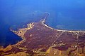 Kettle Point on Lake Huron.jpg 3,504 × 2,336; 8.47 MB
-
 Lake Huron in winter.jpg 2,400 × 2,400; 883 KB
-
 Lake Huron NASA.jpg 914 × 887; 561 KB
-
 Lakes Michigan and Huron (MODIS 2021-09-07).jpg 3,280 × 2,449; 4.8 MB
-
 Let it snow (Satellite image).jpg 10,980 × 15,613; 44.38 MB
-
 North Channel on March 20, 2022, cropped from R2AWF03202022280038, IRS AWiFS.png 4,858 × 2,486; 9.11 MB


.jpg)
.jpg)
