Category:Aerial photographs of Kalimantan
Jump to navigation
Jump to search
Media in category "Aerial photographs of Kalimantan"
The following 14 files are in this category, out of 14 total.
-
 2017-11-10 Batakan BPN.jpg 1,280 × 720; 146 KB
-
 2017-11-14 Batakan Aerial.jpg 4,000 × 3,000; 4.82 MB
-
 2017-11-14 Batakan.jpg 4,000 × 3,000; 4.81 MB
-
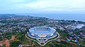
 A bird's eye view of Samarinda International Airport.jpg 1,280 × 720; 243 KB
-
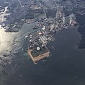
 Aerial of Badak NGL natural gas refinery.jpg 1,357 × 564; 861 KB
-
 Aerial of Derawan 2017-09-16.jpg 4,000 × 3,000; 4.88 MB
-
 Bontang aerial 2014.jpg 1,600 × 1,600; 704 KB
-
 Construction of Balikpapan-Samarinda Toll Expressway (aerial).jpg 4,000 × 2,447; 1.37 MB
-
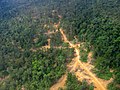 Logging road East Kalimantan 2005.jpg 2,272 × 1,704; 1.6 MB
-
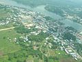 Malinau City.jpg 600 × 450; 48 KB
-
 PT Badak Aerial 2014.jpg 1,600 × 1,600; 475 KB
-
 Pupuk Kalimantan Timur aerial 2014.jpg 1,600 × 1,600; 364 KB
-
 Pupuk Kalimantan Timur Factory Complex Area.jpg 1,349 × 662; 888 KB
-
 Tanjung Bara KPC 1.jpg 3,264 × 2,448; 1.88 MB


.jpg)


