Category:Aerial photographs of Jamaica
Jump to navigation
Jump to search
Countries of North America: The Bahamas · Barbados · Belize · Canada · Costa Rica · Cuba · Dominica · Dominican Republic · El Salvador · Grenada · Guatemala · Haiti · Honduras · Jamaica · Mexico · Nicaragua · Panama · Saint Kitts and Nevis · Trinidad and Tobago‡ · United States of America‡
Other territories: Anguilla · Bermuda · British Virgin Islands · Cayman Islands · Florida Keys · Greenland · Guadeloupe · Martinique · Montserrat · Puerto Rico · Saint Barthélemy · Saint Pierre and Miquelon · Turks and Caicos Islands · United States Virgin Islands
‡: partly located in North America
Other territories: Anguilla · Bermuda · British Virgin Islands · Cayman Islands · Florida Keys · Greenland · Guadeloupe · Martinique · Montserrat · Puerto Rico · Saint Barthélemy · Saint Pierre and Miquelon · Turks and Caicos Islands · United States Virgin Islands
‡: partly located in North America
Subcategories
This category has only the following subcategory.
Media in category "Aerial photographs of Jamaica"
The following 10 files are in this category, out of 10 total.
-
 CHARLEMONT HIGH SCHOOL.jpg 1,800 × 1,200; 2.89 MB
-
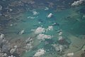
 Flight from Miami to Quito, Ecuador - clouds over Jamaica (16471477350).jpg 3,312 × 2,208; 2.44 MB
-
 JM Jamaica 1010 (1) (17231050246).jpg 800 × 535; 71 KB
-
 JM Jamaica 1010 (2) (16634562644).jpg 800 × 535; 84 KB
-
 Kingston (1907).jpg 752 × 564; 216 KB
-
 MBJ-MIA Coral Gardens (1).jpg 3,024 × 4,032; 2.13 MB
-
 MBJ-MIA Coral Gardens (2).jpg 3,024 × 4,032; 2.87 MB
-
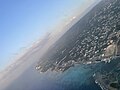 MBJ-MIA Coral Gardens.jpg 4,032 × 3,024; 1.94 MB
-
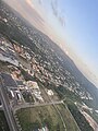
 MBJ-MIA Providence Dr-Northern Coastal Hwy.jpg 4,032 × 3,024; 3.5 MB
-
 NASA спутниктік фотосуреті. Кубаның оңтүстігіндегі Ямайка аралы.jpg 200 × 150; 15 KB

.jpg)
_(17231050246).jpg)
_(16634562644).jpg)
.jpg)
.jpg)
.jpg)


