Category:Aerial photographs of Hudson Bay
Jump to navigation
Jump to search
Media in category "Aerial photographs of Hudson Bay"
The following 12 files are in this category, out of 12 total.
-
 Frlight FRA - SFO - panoramio.jpg 3,072 × 2,304; 2.8 MB
-
 Frozen Moonrise.jpg 5,568 × 3,712; 4.2 MB
-
 Frozen Moonrise1.jpg 720 × 480; 248 KB
-
 Hudson Bay aerial view late summer gjb.jpg 4,032 × 3,024; 2.92 MB
-
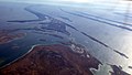
 Mouth of the Churchill River at Hudson Bay (7461042054).jpg 1,280 × 853; 300 KB
-
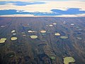 Permafrost thaw ponds in Hudson Bay Canada near Greenland (cropped).jpg 3,869 × 2,912; 5.18 MB
-
 Permafrost thaw ponds in Hudson Bay Canada near Greenland.jpg 4,088 × 2,912; 5.44 MB
-
 Sanikiluaq peneplain.JPG 2,400 × 1,514; 1.62 MB
-
 Sanikiluaq rocks -d.jpg 2,164 × 1,792; 1.1 MB
-
 Sanikiluaq rocks -e.jpg 2,394 × 1,362; 685 KB
-
 Sea ice on Hudson Bay near Cape Churchill.JPG 3,008 × 2,000; 2.62 MB
-
 Weißwal 8-1999.jpg 922 × 583; 108 KB


.jpg)
.jpg)


