Category:Aerial photographs of Guthrie County, Iowa
Jump to navigation
Jump to search
Counties of Iowa: Allamakee · Appanoose · Black Hawk · Boone · Buena Vista · Carroll · Cass · Cedar · Cerro Gordo · Chickasaw · Clay · Clayton · Clinton · Crawford · Dallas · Davis · Decatur · Des Moines · Dickinson · Dubuque · Fremont · Guthrie · Hamilton · Harrison · Henry · Howard · Humboldt · Iowa · Jackson · Jasper · Jefferson · Johnson · Keokuk · Kossuth · Lee · Linn · Louisa · Lucas · Madison · Mahaska · Marion · Mills · Mitchell · Monona · Monroe · Montgomery · Muscatine · Page · Palo Alto · Plymouth · Pocahontas · Polk · Pottawattamie · Ringgold · Scott · Shelby · Sioux · Story · Union · Van Buren · Wapello · Warren · Washington · Wayne · Webster · Winneshiek · Woodbury · Worth · Wright
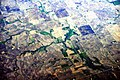
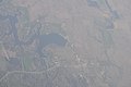
Media in category "Aerial photographs of Guthrie County, Iowa"
The following 8 files are in this category, out of 8 total.
-
 Aerial 10 km SSW of Bayard, Iowa 01.jpg 4,288 × 2,848; 3.49 MB
-
 Aerial 10 km SSW of Bayard, Iowa 01A.jpg 4,288 × 2,848; 9.58 MB
-
 East Branch Panther Creek, Iowa aerial 01.jpg 4,288 × 2,848; 3.12 MB
-
 East Branch Panther Creek, Iowa aerial 01A.jpg 4,288 × 2,848; 9.55 MB
-
 Lake Panorama, Iowa aerial 01.jpg 2,848 × 4,288; 3.58 MB
-
 Lake Panorama, Iowa aerial 01A.jpg 2,848 × 4,288; 9.04 MB
-
 Panora, Iowa aerial 01.jpg 4,288 × 2,848; 3.84 MB
-
 Panora, Iowa aerial 01A.jpg 4,288 × 2,848; 8.8 MB


