Category:Aerial photographs of Essex County, Massachusetts
Jump to navigation
Jump to search
Subcategories
This category has the following 11 subcategories, out of 11 total.
Media in category "Aerial photographs of Essex County, Massachusetts"
The following 9 files are in this category, out of 9 total.
-
 Aerial view of Marblehead Harbor, August 2017.jpg 3,600 × 2,400; 3.39 MB
-
 Aerial view of Newburyport Branch causeway in Lynnfield, March 2022.JPG 2,827 × 2,121; 3.43 MB
-
 Aerial view of Swampscott Quarry, March 2022.JPG 3,880 × 2,911; 6.35 MB
-
 Aerial view of Swampscott, March 2022.JPG 4,034 × 3,027; 7.39 MB
-
 Greenwood farm 1920, Ipswich, Mass.jpg 1,045 × 1,404; 136 KB
-
 Northshore Mall aerial photo, July 2016.JPG 1,900 × 1,433; 709 KB
-
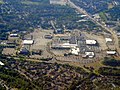 Northshore Mall and surroundings aerial photo, July 2016.JPG 3,301 × 2,481; 1.87 MB
-
 Swampscott, MA aerial view.JPG 4,320 × 3,240; 5.94 MB
-
 The Crane Estate at Castle Hill in Ipswich, Massachusetts.jpg 5,472 × 3,648; 10.49 MB


