Category:Aerial photographs of Bolivia
Jump to navigation
Jump to search
Subcategories
This category has the following 3 subcategories, out of 3 total.
C
- Aerial views of Cochabamba (12 F)
Media in category "Aerial photographs of Bolivia"
The following 59 files are in this category, out of 59 total.
-
 01042020-DJI 0618.jpg 4,000 × 2,250; 2.73 MB
-
 2021oct.18-sin título00003.jpg 1,024 × 682; 947 KB
-

-

-

-
 Agitando hola - panoramio.jpg 1,024 × 680; 384 KB
-
 Aldea de Beni - panoramio.jpg 1,024 × 680; 339 KB
-
 Aldea de Beni 2 - panoramio.jpg 1,024 × 680; 348 KB
-
 Aérea de Beni - panoramio.jpg 1,024 × 680; 345 KB
-
 Aérea de bosque - panoramio.jpg 680 × 1,024; 602 KB
-
 Beni - panoramio.jpg 1,024 × 680; 462 KB
-
 Beni landscape - paisaje - panoramio.jpg 1,024 × 680; 388 KB
-
 Bolivian farm land (aerial) - panoramio.jpg 1,024 × 680; 319 KB
-
 BrückeTahuamanu.jpg 2,164 × 1,380; 2.85 MB
-
 Cattle ranch - rancho de vacas - panoramio.jpg 1,024 × 680; 383 KB
-
 Cocha en el río - panoramio.jpg 1,024 × 680; 386 KB
-
 Comunidad de Piso Firme en Bolivia.png 720 × 481; 590 KB
-
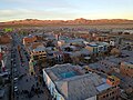
 Copacabana.jpg 900 × 647; 140 KB
-
 Edificios de la ciudad de La Paz desde Plaza Murillo 2018.jpg 1,380 × 1,033; 820 KB
-
 El Porvenir - aérea - panoramio.jpg 1,024 × 680; 339 KB
-
 Este de San Borja - panoramio.jpg 1,024 × 680; 271 KB
-
 Forest, Santa Criz Dept, Bolivia.jpg 4,288 × 2,848; 8.14 MB
-
 Gran árbol - panoramio.jpg 1,024 × 680; 527 KB
-
 Is this swamp dying - panoramio.jpg 1,024 × 680; 286 KB
-
 Isla de la Luna.jpg 1,020 × 561; 366 KB
-
 Ixiamas aus der Luft.JPG 1,340 × 1,000; 627 KB
-
 Kacha Kacha y Porongo en el río Chico, Bolivia.JPG 2,170 × 1,659; 1.56 MB
-
 Lago Negro aérea - panoramio.jpg 1,024 × 680; 187 KB
-
 Lumber mill & yard - panoramio.jpg 1,024 × 680; 286 KB
-
 Mairana view north.JPG 1,536 × 2,048; 1.15 MB
-
 Pastizales de Beni - panoramio.jpg 1,024 × 680; 276 KB
-
 Photo 6553785 DJI 185 jpg 5506441 0 20221015104724 photo original.jpg 4,000 × 3,000; 5.25 MB
-
 Photo 6553790 DJI 190 jpg 5466303 0 20221015104832 photo original.jpg 4,000 × 3,000; 3.63 MB
-
 Plaza Alcibiades Velarde Cronembold en Colonia Japonesa San Juan - panoramio.jpg 1,024 × 680; 355 KB
-
 Plaza Murillo 2018.jpg 976 × 613; 333 KB
-
 Potosi air.jpg 2,000 × 1,490; 2.95 MB
-
 QuimsaCruz.jpg 1,593 × 951; 1.88 MB
-
 Rio madidi aus der Luft.JPG 1,920 × 2,560; 1.45 MB
-
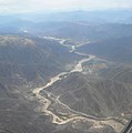 Río Chico und Ruta 5, Bolivia.JPG 1,920 × 1,936; 1.4 MB
-
 Río Maniqui - panoramio.jpg 1,024 × 680; 271 KB
-
 Río Tahuamanu aus der Luft.JPG 2,560 × 1,920; 1.44 MB
-
 Salt Flat Uyuni.png 2,383 × 1,227; 4.6 MB
-
 Samaipata, Bolivia - Aerial view.jpg 4,000 × 2,250; 2.61 MB
-
 San Borja aerial - panoramio.jpg 1,024 × 680; 319 KB
-
 San Borja, Bolivia aerial.jpg 4,288 × 2,848; 4.76 MB
-
 San Carlos, Buena Vista - panoramio.jpg 1,024 × 680; 436 KB
-
 San Juan de Yapacani - panoramio.jpg 1,024 × 680; 362 KB
-
 SLLP Airport.jpg 1,024 × 768; 418 KB
-
 SLLP El Alto Airport aerial view.jpg 480 × 640; 112 KB
-
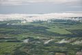 Soy and rice farms - panoramio.jpg 1,024 × 680; 239 KB
-
 Uyuni Potosi Ave Aerial.jpg 4,000 × 3,000; 5.34 MB
-
 UyuniAerialView2012.jpg 3,648 × 2,056; 4.5 MB
-
 Village de Beni - panoramio.jpg 1,024 × 680; 434 KB
-
 Village in Beni - panoramio.jpg 1,024 × 680; 425 KB
-
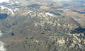
 Vista de cerros nevados desde el avión, Bolivia.jpg 2,136 × 4,624; 2.31 MB
-
 Vista de la comunidad de Buena Vista (Bolivia) sobre el río Iténez.png 1,572 × 876; 1.91 MB
-
 Viñedos de Bolivia (cropped).jpg 1,008 × 756; 289 KB
-
 Viñedos de Bolivia.jpg 1,080 × 1,278; 219 KB
-
 Yapacaní y Río Yapacaní - panoramio.jpg 1,024 × 680; 203 KB


_on_the_right_-_(24720465632).jpg)
_on_the_right_-_(24811969566).jpg)
_on_the_right_-_LPB_airport_(in_El_Alto)_at_4160m_-_(24720405392).jpg)


_-_panoramio.jpg)


_sobre_el_r%C3%ADo_It%C3%A9nez.png)
.jpg)

