Category:Aerial photographs of Beiarn
Jump to navigation
Jump to search
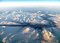
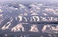
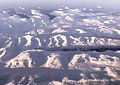
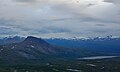
English: Aerial photographs of Beiarn municipality, Nordland, Norway
Media in category "Aerial photographs of Beiarn"
The following 15 files are in this category, out of 15 total.
-
 Beiarfjorden ytre deler seen from the air.jpg 4,163 × 3,028; 5.95 MB
-
 Beiarn IMG 4816 beiardalen valley.JPG 4,000 × 2,601; 1.92 MB
-
 Beiarn IMG 4819 beiardalen.JPG 4,000 × 2,893; 2.3 MB
-
 Beiarn IMG 4820 beiarn.JPG 3,000 × 4,000; 2.11 MB
-
 Beiarn IMG 4821 beiarn crop nordfjord.JPG 3,000 × 1,994; 1.06 MB
-
 Beiarn IMG 4821 beiarn.JPG 3,000 × 4,000; 2.36 MB
-
 Beiarn IMG 4826 beiarn lurfjellet mts 1286 m.JPG 4,000 × 2,703; 2.33 MB
-
 Beiarn Skjerstad IMG 4822 beiarn lurfjellet mts saltfjorden.JPG 3,686 × 2,001; 1.59 MB
-
 Beiarn Skjerstad IMG 4825 lurfjellet mts 1286 m.JPG 4,000 × 2,703; 2.34 MB
-
 Børvasstindan seen from aircraft over Beiarn seen from the air.jpg 4,594 × 3,023; 6.62 MB
-
 Gåsvatnan conservation area seen from the air.jpg 4,497 × 2,625; 2.03 MB
-
 Melöy Beiarn IMG 4810 glomfjorden skjelaatinden mt 1637 m beiardalen.JPG 4,000 × 2,574; 2.11 MB
-
 Melöy Beiarn IMG 4811 glomfjorden skjelaatinden mt 1637 m beiardalen.JPG 4,000 × 2,833; 2.36 MB
-
 Ramsgjelvatnet seen from the air.jpg 3,462 × 2,066; 3.57 MB
-
 Øvre Nævervatnet og Namnlausvatnet.JPG 3,648 × 2,736; 2.98 MB


