Category:Aerial photographs of Bad Laasphe
Jump to navigation
Jump to search
Deutsch: Luftbilder aus Bad Laasphe
English: Aerial photographs of Bad Laasphe
Media in category "Aerial photographs of Bad Laasphe"
The following 17 files are in this category, out of 17 total.
-
 Bad Laasphe Kernstadt Panorama.jpg 28,875 × 6,653; 109.42 MB
-
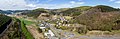
 Bermershausen Panorama.jpg 21,866 × 8,106; 108.01 MB
-
 Brunnenplatz Niederlaasphe.jpg 3,072 × 2,304; 2.52 MB
-
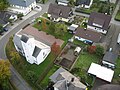 KircheNiederlaasphe.jpg 1,500 × 1,125; 586 KB
-
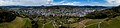
 Luftaufnahme von Bad Laasphe.jpg 910 × 611; 400 KB
-
 Luftaufnahme von Fischelbach bei Bad Laasphe.jpg 1,000 × 750; 331 KB
-
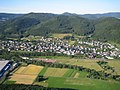
 NiederlaaspheVonOsten.jpg 1,500 × 1,125; 527 KB
-
 NiederlaaspheVonSüden (1).jpg 1,000 × 750; 376 KB
-
 NiederlaaspheVonSüden.jpg 1,500 × 1,125; 622 KB
-
 NiederlaaspheWinter.jpg 3,072 × 2,304; 2.03 MB
-
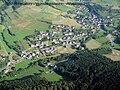
 OrtBanfe.jpg 1,000 × 713; 736 KB
-
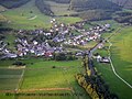
 OrtFeudingen1.jpg 1,000 × 750; 476 KB
-
 OrtHerbertshausen1.jpg 1,000 × 750; 360 KB
-
 OrtHesselbach1.jpg 1,000 × 714; 275 KB
-
 OrtLaaspherhütte.jpg 1,000 × 750; 411 KB
-
 OrtPuderbach1.jpg 1,000 × 750; 432 KB
-
 Sassmannshausen Pano.jpg 16,737 × 5,447; 61.26 MB


.jpg)


