Category:Aerial photographs of Bad Homburg vor der Höhe
Jump to navigation
Jump to search
Template:Hochtaunuskreis municipalities
| NO WIKIDATA ID FOUND! Search for Aerial photographs of Bad Homburg vor der Höhe on Wikidata | |
| Upload media |
Media in category "Aerial photographs of Bad Homburg vor der Höhe"
The following 10 files are in this category, out of 10 total.
-
 Bad Homburg Berliner Siedlung 2017-03-13-18-31-00.jpg 5,464 × 3,640; 20.51 MB
-
 Bad Homburg Gartenfeldsiedlung 2017-03-11-11-30-37.jpg 4,856 × 3,640; 15.19 MB
-
 Bad Homburg Gartenfeldsiedlung 2017-03-23-12-28-41.jpg 5,472 × 3,078; 14 MB
-
 Bad Homburg Gustavsgarten 2017-03-16-10-34-30.jpg 2,998 × 1,631; 5.79 MB
-
 Bad Homburg Herzberg 2017-05-10-17-27-15.jpg 4,000 × 2,250; 8.27 MB
-
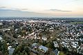
 Bad Homburg Stadtmitte West 2017-03-18-13-20-51.jpg 5,464 × 3,250; 19.15 MB
-
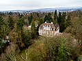 Bad Homburg Villa Adelheidswert 2017-03-09-07-42-13.jpg 4,856 × 3,640; 19.81 MB
-
 Bad Homburg-2-1954.jpg 1,778 × 1,412; 492 KB
-
 Hochtaunuskreis - Bad Homburg & Scenery - geo.hlipp.de - 27543.jpg 640 × 480; 66 KB
-
 Schloss und Schlossgarten - Bad Homburg vor der Höhe.jpg 2,561 × 2,600; 3.27 MB


