Category:Aerial photograph by User:Capricorn4049
Jump to navigation
Jump to search
English: Aerial photograph by Capricorn4049, done with a Quadrocopter DJI Phantom 2 Vision+ V3, a DJI Inspire with Zenmuse X5 PRO or a DJI Mavic 2 Pro.
Deutsch: Fotos aus der Luft von Capricorn4049, gemacht mit einem Quadrocopter des Typs DJI Phantom 2 Vision+ V3, DJI Inspire mit Zenmuse X5 PRO oder DJI Mavic 2 Pro.
Rumantsch: Fotografia or da l'aria digl utilisader Capricorn4049, piglia se cun en Quadrocopter digl tip DJI Phantom 2 Vision+ V3, DJI Inspire cun Zenmuse X5 PRO u DJI Mavic 2 Pro.
Italiano: Fotografia aerea dell'utente Capricorn4049, fatta con un quadricottero di tipo DJI Phantom 2 Vision+ V3, DJI Inspire con Zenmuse X5 PRO o DJI Mavic 2 Pro.

Media in category "Aerial photograph by User:Capricorn4049"
The following 146 files are in this category, out of 146 total.
-
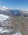
 Alp Flix as seen from a helicopter 1.jpg 5,312 × 2,988; 3.29 MB
-
 Alp Flix as seen from a helicopter 2.jpg 5,312 × 2,988; 4.27 MB
-
 Belfort Castle as seen from South (aerial photo) 1.jpg 4,384 × 3,288; 13.01 MB
-
 Belfort Castle as seen from South (aerial photo) 2.jpg 2,128 × 2,112; 5.49 MB
-
 Belfort Castle as seen from South (aerial photo) 3.jpg 2,559 × 2,159; 6.68 MB
-
 Belfry of Ziteil.jpg 4,384 × 3,288; 7.62 MB
-
 Big House and Greenhouse, Summit Camp Greenland, aerial photography.jpg 4,000 × 2,250; 2.57 MB
-
 Bivio and Marmorera as seen from a helicopter above Plang Camfer.jpg 2,984 × 3,688; 2.96 MB
-
 Bivio as seen from a helicopter 1.jpg 5,312 × 2,988; 2.81 MB
-
 Bivio as seen from a helicopter 2.jpg 5,312 × 2,988; 5.17 MB
-
 Bridges of Solis 1, aerial photography.jpg 4,000 × 2,250; 3.67 MB
-
 Bridges of Solis 2, aerial photography.jpg 4,000 × 2,250; 3.42 MB
-
 Bridges of Solis 3, aerial photography.jpg 4,000 × 2,250; 3.48 MB
-
 Bridges of Solis 4, aerial photography.jpg 4,000 × 2,250; 3.54 MB
-
 Brinzauls, Igl Rutsch, Spherical Panorama.jpg 23,040 × 11,520; 44.1 MB
-
 Burg Riom, aerial photography 1.jpg 4,384 × 3,288; 4.6 MB
-
 Burg Riom, aerial photography 10.jpg 4,384 × 3,288; 5.57 MB
-
 Burg Riom, aerial photography 11.jpg 4,384 × 3,288; 5.4 MB
-
 Burg Riom, aerial photography 2.jpg 4,384 × 3,288; 4.48 MB
-
 Burg Riom, aerial photography 3.jpg 4,384 × 3,288; 5.53 MB
-
 Burg Riom, aerial photography 4.jpg 4,384 × 3,288; 4.87 MB
-
 Burg Riom, aerial photography 5.jpg 4,384 × 3,288; 5.03 MB
-
 Burg Riom, aerial photography 6.jpg 4,384 × 3,288; 4.92 MB
-
 Burg Riom, aerial photography 7.jpg 4,384 × 3,288; 5.08 MB
-
 Burg Riom, aerial photography 8.jpg 4,384 × 3,288; 4.37 MB
-
 Burg Riom, aerial photography 9.jpg 4,384 × 3,288; 5.42 MB
-
 Cadra Riom, Spherical Panorama.jpg 23,040 × 11,520; 38.81 MB
-
 Piz Campagnung, aerial photography from south.jpg 4,384 × 3,288; 8.78 MB
-
 Piz Campagnung, aerial photography from west 1.jpg 4,384 × 3,288; 10.58 MB
-
 Piz Campagnung, aerial photography from west 2.jpg 4,384 × 3,288; 10.02 MB
-
 Piz Campagnung, aerial photography from west.jpg 4,384 × 3,288; 8.88 MB
-
 Castle ruin Campell 16.jpg 4,000 × 2,250; 3.86 MB
-
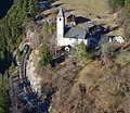
 Church S. Gieri, Salouf with Motta Vallac, aerial photography.jpg 4,000 × 2,250; 3.84 MB
-
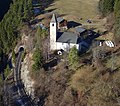
 Church S. Gieri, Salouf, aerial photography.jpg 3,891 × 2,160; 3 MB
-
 Church Son Roc, Del with Mon and Lenz in the background, aerial photography 1.jpg 4,000 × 2,250; 3.49 MB
-
 Church Son Roc, Del, aerial photography.png 3,840 × 2,160; 11.79 MB
-
 Corn Jenatsch and Piz Jenatsch as seen from a helicopter.jpg 5,312 × 2,988; 3.74 MB
-
 Crap Furo, aerial photography 2.jpg 2,508 × 3,288; 3.63 MB
-
 Crap Furo, aerial photography 3.jpg 4,384 × 3,288; 7.17 MB
-
 Crap Furo, aerial photography 4.jpg 4,384 × 3,288; 5.58 MB
-
 Crap Furo, aerial photography 5.jpg 4,384 × 3,288; 6.18 MB
-
 Crap Furo, aerial photography 6.jpg 3,528 × 3,184; 4.34 MB
-
 Cross on the belfry of Ziteil 1.jpg 4,384 × 3,288; 5.3 MB
-
 Cross on the belfry of Ziteil 2.jpg 4,384 × 3,288; 6.04 MB
-
 Flüela Wisshorn from south as seen from a helicopter.jpg 5,312 × 2,988; 2.32 MB
-
 Former main building of SLF on Weissfluhjoch, aerial photography 1.jpg 4,056 × 3,288; 8.2 MB
-
 Former main building of SLF on Weissfluhjoch, aerial photography 2.jpg 3,296 × 2,344; 5 MB
-
 Former main building of SLF on Weissfluhjoch, aerial photography 3.jpg 3,552 × 2,464; 5.45 MB
-

-
 Keschhütte from south as seen from a helicopter.jpg 5,312 × 2,988; 2.3 MB
-
 Keschnadel as seen from a helicopter.jpg 3,584 × 2,976; 2.86 MB
-
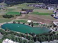
 Lai Barnagn in summer, Savognin, aerial photography 1.jpg 4,000 × 3,000; 3.17 MB
-
 Lai Barnagn in summer, Savognin, aerial photography 2.jpg 4,000 × 3,000; 3.49 MB
-
 Lai Barnagn in summer, Savognin, aerial photography 3.jpg 4,000 × 3,000; 3.61 MB
-
 Lai Barnagn in summer, Savognin, aerial photography 4.jpg 4,000 × 3,000; 2.95 MB
-
 Lai Barnagn in summer, Savognin, aerial photography 5.jpg 4,000 × 3,000; 3.52 MB
-
 Lai Barnagn in summer, Savognin, aerial photography 6.jpg 4,000 × 3,000; 3.47 MB
-
 Lai Barnagn in summer, Savognin, aerial photography 7.jpg 4,000 × 3,000; 3.52 MB
-
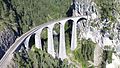
 Landwasserviadukt, aerial photography 1.jpg 4,000 × 2,250; 3.44 MB
-
 Landwasserviadukt, aerial photography 2.jpg 4,000 × 2,250; 3.48 MB
-
 Landwasserviadukt, aerial photography 3.jpg 4,000 × 2,250; 3.56 MB
-
 Landwasserviadukt, aerial photography 4.jpg 4,000 × 2,250; 3.69 MB
-
 Landwasserviadukt, aerial photography from northeast 1.jpg 4,000 × 2,250; 3.94 MB
-
 Landwasserviadukt, aerial photography from northeast 2.jpg 4,000 × 2,250; 3.78 MB
-
 Malojapass as seen from a helicopter above Val Bregaglia.jpg 5,312 × 2,988; 4.51 MB
-
 Marmels Castle, aerial photography 1.jpg 4,608 × 3,456; 9.19 MB
-
 Marmels Castle, aerial photography 10.jpg 4,333 × 3,745; 8.05 MB
-
 Marmels Castle, aerial photography 2.jpg 4,608 × 3,456; 10.42 MB
-
 Marmels Castle, aerial photography 3.jpg 4,608 × 3,456; 6.61 MB
-
 Marmels Castle, aerial photography 4.jpg 4,608 × 3,456; 6.27 MB
-
 Marmels Castle, aerial photography 5.jpg 4,608 × 3,456; 5.89 MB
-
 Marmels Castle, aerial photography 6.jpg 4,608 × 3,456; 6.43 MB
-
 Marmels Castle, aerial photography 7.jpg 4,608 × 3,456; 6.48 MB
-
 Marmels Castle, aerial photography 8.jpg 4,608 × 3,456; 6.86 MB
-
 Marmels Castle, aerial photography 9.jpg 4,608 × 3,456; 6.31 MB
-
 Mistail with canyon, aerial photography 1.jpg 4,000 × 2,250; 3.64 MB
-
 Mistail with canyon, aerial photography 2.jpg 2,161 × 2,226; 1.94 MB
-
 Mistail with train, aerial photography 1.jpg 2,238 × 1,944; 1.98 MB
-
 Mistail with train, aerial photography 2.jpg 2,355 × 2,247; 2.38 MB
-
 Mistail with train, aerial photography 3.jpg 1,848 × 2,067; 1.86 MB
-
 Mistail, aerial photography 1.jpg 4,000 × 2,250; 3.56 MB
-
 Mistail, aerial photography 2.jpg 4,000 × 2,250; 3.54 MB
-
 Mistail, aerial photography 3.jpg 4,000 × 2,250; 3.48 MB
-
 Mistail, aerial photography 4.jpg 4,000 × 2,250; 3.81 MB
-
 Mistail, aerial photography 5.jpg 4,000 × 2,250; 3.55 MB
-
 Mistail, aerial photography 6.jpg 4,000 × 2,250; 3.48 MB
-
 Mistail, aerial photography 7.jpg 2,289 × 2,025; 2.11 MB
-
 Mistail, aerial photography 8.jpg 2,805 × 2,238; 2.45 MB
-
 Motta da Sett and Piz dal Sasc as seen from a helicopter above Val Bregaglia.jpg 5,312 × 2,988; 2.49 MB
-
 Motta da Sett as seen from a helicopter.jpg 5,312 × 2,988; 3.68 MB
-
 Motta Vallac, aerial photography.jpg 4,000 × 2,250; 3.53 MB
-
 MSF and Swiss Tower, Summit Camp Greenland, aerial photography.jpg 3,371 × 2,478; 1.4 MB
-
 MSF, Summit Camp Greenland, aerial photography.jpg 4,000 × 2,250; 2.09 MB
-
 Piz d'Err and Piz Calderas as seen from a helicopter.jpg 5,312 × 2,988; 4.3 MB
-
 Piz d'Err from North as seen from a helicopter.jpg 5,312 × 2,988; 3.18 MB
-
 Piz d'Err from south as seen from a helicopter.jpg 5,312 × 2,988; 4.25 MB
-
 Piz Ela Spherical Panorama.jpg 28,672 × 14,336; 147.93 MB
-
 Piz Forbesch, aerial photography from northwest.jpg 4,384 × 2,989; 4.31 MB
-
 Piz Forbesch, aerial photography from southeast.jpg 4,384 × 3,288; 5.59 MB
-
 Piz Grialetsch and Fuorcla Vallorgia from west as seen from a helicopter.jpg 3,312 × 2,376; 1.29 MB
-
 Piz Julier from North as seen from a helicopter.jpg 5,312 × 2,988; 3.96 MB
-
 Piz Neir as seen from a helicopter 2.jpg 5,312 × 2,988; 3.34 MB
-
 Piz Neir, aerial recording 1.jpg 4,000 × 2,250; 3.82 MB
-
 Piz Neir, aerial recording 2.jpg 4,000 × 2,250; 4.08 MB
-
 Piz Neir, aerial recording 3.jpg 4,000 × 2,250; 3.95 MB
-
 Piz Neir, aerial recording 4.jpg 4,000 × 2,250; 3.52 MB
-
 Piz Picuogl as seen from a helicopter.jpg 5,312 × 2,988; 3.61 MB
-
 Piz Polaschin from North as seen from a helicopter.jpg 5,312 × 2,988; 4.19 MB
-
 Piz Surgonda (western summit), aerial photography.jpg 4,384 × 3,288; 9.69 MB
-
 Piz Surgonda from north as seen from a helicopter.jpg 7,275 × 2,317; 1.06 MB
-
 Piz Surgonda, aerial photography from E.jpg 3,968 × 2,624; 7.39 MB
-
 Piz Surgonda, aerial photography from S.jpg 4,216 × 3,072; 8.81 MB
-
 Piz Surgonda, aerial photography from W.jpg 4,384 × 3,288; 8.98 MB
-
 Piz Toissa, aerial photography.jpg 4,384 × 3,288; 5.93 MB
-
 Radüner Rothorn, Piz Radönt and Schwarzhorn from east as seen from a helicopter.jpg 5,312 × 2,988; 2.99 MB
-
 Reformed church of Davos Frauenkirch, aerial photography 1.jpg 2,592 × 1,842; 1.65 MB
-
 Reformed church of Davos Frauenkirch, aerial photography 2.jpg 3,992 × 2,242; 2.79 MB
-
 Reformed church of Davos Frauenkirch, aerial photography 3.jpg 3,992 × 2,242; 2.82 MB
-
 Riom, aerial photography.jpg 4,000 × 2,250; 3.82 MB
-
 Schmittentobel Viaduct, aerial photography.jpg 3,840 × 2,160; 1.5 MB
-
 Sotgôt as seen from Del, aerial photography.jpg 4,000 × 2,250; 3.54 MB
-
 Staudamm Solis, aerial photography.jpg 3,840 × 2,160; 726 KB
-
 Stausee Solis 1, aerial photography.jpg 3,840 × 2,160; 942 KB
-
 Stausee Solis 2, aerial photography.jpg 3,840 × 2,160; 809 KB
-
 Stugl, aerial photography 1.jpg 4,608 × 2,720; 3.75 MB
-
 Stugl, aerial photography 2.jpg 4,296 × 3,456; 3.36 MB
-
 Stugl, aerial photography 3.jpg 4,440 × 3,160; 3.37 MB
-
 Summit Camp Greenland, overview, aerial photography.jpg 4,236 × 1,753; 1.26 MB
-
 Summit Cross on Piz Cavardiras.jpg 1,920 × 1,080; 505 KB
-
 Swiss Camp (Greenland), aerial photography 1.jpg 4,384 × 3,288; 4.05 MB
-
 Swiss Camp (Greenland), aerial photography 2.jpg 4,384 × 3,288; 3.47 MB
-
 Swiss Camp (Greenland), aerial photography 3.jpg 4,384 × 3,288; 4.74 MB
-
 Swiss Camp (Greenland), aerial photography 4.jpg 4,384 × 3,288; 2.88 MB
-
 Swiss Camp (Greenland), aerial photography 5.jpg 4,384 × 3,288; 3.3 MB
-
 Swiss Camp (Greenland), aerial photography 6.jpg 4,384 × 3,288; 4.1 MB
-
 Swiss Tower, Summit Camp Greenland, aerial photography.jpg 4,000 × 2,250; 2.45 MB
-
 Test area of WSL Institute for Snow and Avalanche Research SLF, aerial photography.jpg 2,304 × 2,440; 3.63 MB
-
 Tinzenhorn south peak Spherical Panorama.jpg 28,672 × 14,336; 151.43 MB
-
 Tinzenhorn Spherical Panorama.jpg 28,672 × 14,336; 224.28 MB
-
 Train below Mistail, aerial photography.jpg 4,000 × 2,250; 3.64 MB
-
 Weissfluhjoch, aerial photography 1.jpg 3,016 × 1,744; 3.47 MB
-
 Weissfluhjoch, aerial photography 2.jpg 3,752 × 2,208; 5.16 MB
-
 Weissfluhjoch, aerial photography 3.jpg 4,384 × 3,288; 9.39 MB
-
 Weissfluhjoch, aerial photography 4.jpg 4,384 × 3,288; 10.28 MB
-
 Ziteil, aerial photography, from east.jpg 4,384 × 3,288; 6.87 MB
-
 Ziteil, aerial photography, front.jpg 4,384 × 3,288; 6.9 MB


_1.jpg)
_2.jpg)
_3.jpg)


,_aerial_photography.jpg)


,_aerial_photography_1.jpg)
,_aerial_photography_2.jpg)
,_aerial_photography_3.jpg)
,_aerial_photography_4.jpg)
,_aerial_photography_5.jpg)
,_aerial_photography_6.jpg)


