Category:Aerial panoramic photographs of Wagga Wagga
Jump to navigation
Jump to search
Media in category "Aerial panoramic photographs of Wagga Wagga"
The following 33 files are in this category, out of 33 total.
-
 360 degree aerial panorama of the flooding of low-lying areas in Moorong.jpg 8,192 × 4,096; 11.9 MB
-
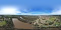
 360 Panorama above Marrambidya Wetland.jpg 9,516 × 4,758; 31.69 MB
-
 360° aerial panorama from North Wagga.jpg 8,192 × 4,096; 11.86 MB
-
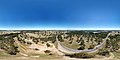
 360° aerial panorama from Rocky Hill.jpg 12,000 × 6,000; 56.03 MB
-
 360° aerial panorama from San Isidore.jpg 8,192 × 4,096; 12.92 MB
-
 360° aerial panorama from the Bomen Lagoon.jpg 8,192 × 4,096; 11.49 MB
-
 360° aerial panorama from the Wiradjuri Reserve.jpg 8,192 × 4,096; 13.43 MB
-
 360° aerial panorama from Wilks Park Wildlife Restoration Area (1).jpg 8,192 × 4,096; 13.69 MB
-
 360° aerial panorama from Wilks Park Wildlife Restoration Area.jpg 8,192 × 4,096; 14.45 MB
-
 360° aerial panorama from Willans Hill Reserve.jpg 8,192 × 4,096; 13.23 MB
-
 360° aerial panorama of Parkan Pregan Lagoon.jpg 8,192 × 4,096; 10.4 MB
-
 360° aerial panorama of the Brick Kiln Reserve.jpg 8,192 × 4,096; 11.39 MB
-
 360° aerial panorama of the flooding of low-lying areas in Moorong (1).jpg 8,192 × 4,096; 13 MB
-
 360° aerial panorama of the flooding of low-lying areas in Moorong (2).jpg 8,192 × 4,096; 11.68 MB
-
 360° aerial panorama of the flooding of low-lying areas in Moorong (3).jpg 8,192 × 4,096; 11.62 MB
-
 360° aerial panorama of the flooding of low-lying areas in Moorong (4).jpg 8,192 × 4,096; 11.59 MB
-
 360° aerial panorama of the floodplains at North Wagga 01.jpg 8,192 × 4,096; 11.49 MB
-
 360° aerial panorama of the floodplains at North Wagga 02.jpg 8,192 × 4,096; 11.01 MB
-
 360° aerial panorama of the floodplains at North Wagga 03.jpg 8,192 × 4,096; 10.51 MB
-
 360° aerial panorama of the floodplains at North Wagga 04.jpg 8,192 × 4,096; 12.12 MB
-
 360° aerial panorama of the Gobbagombalin Bridge and floodplains at Gobbagombalin.jpg 8,192 × 4,096; 11.56 MB
-
 360° aerial panorama of the Gobbagombalin Bridge and floodplains at North Wagga.jpg 8,192 × 4,096; 12.09 MB
-
 360° aerial panorama of the Wagga Wagga Multisport Cycling Complex (1).jpg 12,000 × 6,000; 56.89 MB
-
 360° aerial panorama of the Wagga Wagga Multisport Cycling Complex.jpg 12,000 × 6,000; 55.34 MB
-
 360° aerial panorama of Wagga Wagga over the Murrumbidgee River.jpg 12,000 × 6,000; 52.67 MB
-
 360° aerial panorama over a flooded Wilks Park Wildlife Restoration Area.jpg 8,192 × 4,096; 12.09 MB
-
 360° aerial panorama over a flooded Wiradjuri Reserve (1).jpg 8,192 × 4,096; 11.75 MB
-
 360° aerial panorama over a flooded Wiradjuri Reserve.jpg 8,192 × 4,096; 12.8 MB
-
 360° panorama aerial view of Duke of Kent Oval.jpg 9,000 × 4,500; 26.98 MB
-
 Aerial photograph of Bolton Park in Wagga Wagga.jpg 12,288 × 6,144; 49.17 MB
-
 Aerial view of the Brick Kiln Reserve.jpg 4,096 × 2,048; 2.44 MB
-
 New Wagga Wagga Wikivoyage banner 1.jpg 12,000 × 1,714; 19.1 MB
-
 Wagga Wagga panorama from Wiradjuri Reserve.jpg 4,096 × 2,048; 2.5 MB


.jpg)


.jpg)
.jpg)
.jpg)
.jpg)


.jpg)


.jpg)


