Category:Aerial images of Beaverton, Oregon
Jump to navigation
Jump to search
Media in category "Aerial images of Beaverton, Oregon"
The following 24 files are in this category, out of 24 total.
-
-
 Aerial view of Beaverton, 1930 (Beaverton, Oregon Historical Photo Gallery) (266).jpg 3,924 × 2,772; 1.87 MB
-
 Beaverton Airport, 1966 (Beaverton, Oregon Historical Photo Gallery) (207).jpg 2,250 × 2,850; 1.28 MB
-
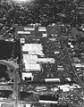 Beaverton Mall, August 1984 (Beaverton, Oregon Historical Photo Gallery) (206).jpg 2,232 × 2,850; 1.19 MB
-
 Bernard Beaverton Mall (Beaverton, Oregon Historical Photo Gallery) (30).jpg 1,280 × 536; 177 KB
-
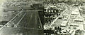
 Bernard Field, Cedar Street, 1931 (Beaverton, Oregon Historical Photo Gallery) (205).jpg 1,950 × 1,332; 518 KB
-
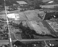 Bonita Road crossing I-5 (Beaverton, Oregon Historical Photo Gallery) (288).jpg 2,778 × 2,238; 847 KB
-
 Canyon Road in West Slope (Beaverton, Oregon Historical Photo Gallery) (290).jpg 2,910 × 2,208; 1.35 MB
-
 Center Street (Beaverton, Oregon Historical Photo Gallery) (287).jpg 2,928 × 2,058; 958 KB
-
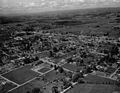
 City of Beaverton, circa 1922 (Beaverton, Oregon Historical Photo Gallery) (204).jpg 2,550 × 2,094; 1.17 MB
-

-
 Hall Street (Beaverton, Oregon Historical Photo Gallery) (291).jpg 2,802 × 2,232; 780 KB
-
 Looking east over Orenco (Beaverton, Oregon Historical Photo Gallery) (152).jpg 2,808 × 2,256; 594 KB
-

-

-
 Looking toward Aloha (Beaverton, Oregon Historical Photo Gallery) (269).jpg 2,600 × 1,808; 998 KB
-
 Looking toward Portland (Beaverton, Oregon Historical Photo Gallery) (154).jpg 2,910 × 2,052; 550 KB
-
 Looking West Toward Aloha (Beaverton, Oregon Historical Photo Gallery) (285).jpg 2,904 × 2,052; 1.09 MB
-

-
-

-
 SE View along Railroad Tracks (Beaverton, Oregon Historical Photo Gallery) (292).jpg 2,814 × 2,226; 1.08 MB
-

-
 View of Beaverton 1950's (Beaverton, Oregon Historical Photo Gallery) (10).jpg 2,052 × 1,484; 510 KB
_(265).jpg)
_(266).jpg)
_(207).jpg)
_(206).jpg)
_(30).jpg)
_(205).jpg)
_(288).jpg)
_(290).jpg)
_(287).jpg)
_(204).jpg)
_(202).jpg)
_(291).jpg)
_(152).jpg)
_(216).jpg)
_(268).jpg)
_(269).jpg)
_(154).jpg)
_(285).jpg)
_(289).jpg)
_(284).jpg)
_(270).jpg)
_(292).jpg)
_(153).jpg)
_(10).jpg)