Category:Advent, Cornwall
Jump to navigation
Jump to search
civil parish in Cornwall, England  | |||||
| Upload media | |||||
| Instance of | |||||
|---|---|---|---|---|---|
| Location | Cornwall, South West England, England | ||||
| Population |
| ||||
| Area |
| ||||
 | |||||
English: Advent is a civil parish on the north-western edge of Bodmin Moor in north Cornwall, United Kingdom. It is named for St Adwenna and lies in the Registration District of Camelford.
Subcategories
This category has the following 6 subcategories, out of 6 total.
A
- St Adwen's Church, Advent (9 F)
C
- Crowdy Reservoir (4 F)
L
- Lowertown Ford (5 F)
W
- Watergate, Advent (3 F)
Media in category "Advent, Cornwall"
The following 124 files are in this category, out of 124 total.
-
 A glimpse of Roughtor Farm - geograph.org.uk - 3178789.jpg 1,600 × 1,064; 403 KB
-
 Advent Parish Church - geograph.org.uk - 5267165.jpg 1,493 × 1,009; 343 KB
-
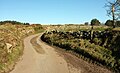
 Autumnal Country Lane - geograph.org.uk - 2874642.jpg 1,024 × 768; 414 KB
-
 Barn near Treclago - geograph.org.uk - 2874634.jpg 1,024 × 768; 220 KB
-
 Barn, field and feeder near Pencarrow - geograph.org.uk - 5459536.jpg 3,072 × 1,780; 1.03 MB
-

-
 Bible Christian Chapel, Highertown - geograph.org.uk - 5263917.jpg 3,072 × 2,048; 1.2 MB
-

-
 Bridge over Tregoodwell Brook - geograph.org.uk - 734726.jpg 640 × 480; 124 KB
-
 Buildings at Trewint - geograph.org.uk - 5267187.jpg 2,998 × 2,005; 1,009 KB
-
 By the Camel valley near Tresinney - geograph.org.uk - 5459598.jpg 3,072 × 2,048; 1.5 MB
-
 Carwether Down - geograph.org.uk - 846772.jpg 640 × 426; 99 KB
-
 Cattle Grid - geograph.org.uk - 3030353.jpg 1,600 × 1,064; 263 KB
-
 Cattle grid on road across Davidstow airfield - geograph.org.uk - 5761649.jpg 1,600 × 1,200; 732 KB
-
-
 Cattle in a field near Moorgate - geograph.org.uk - 3964506.jpg 640 × 480; 65 KB
-
 Clapper bridge, Trecarne - geograph.org.uk - 5460211.jpg 3,072 × 2,048; 1.42 MB
-
 Clapper bridge, Trecarne - geograph.org.uk - 5460284.jpg 2,048 × 3,072; 1.41 MB
-
 Cornish hedge near Moorgate - geograph.org.uk - 5459514.jpg 3,072 × 1,851; 1.06 MB
-
 Cottage and barn at Carcade - geograph.org.uk - 730232.jpg 640 × 453; 110 KB
-
 Cottages at Pencarrow - geograph.org.uk - 5459547.jpg 1,608 × 2,197; 661 KB
-
 Countryside southeast of Camelford - geograph.org.uk - 5459533.jpg 1,779 × 1,092; 436 KB
-
 Crowdy Reservoir at sunset - geograph.org.uk - 4450140.jpg 1,920 × 1,189; 418 KB
-
 Crowdy Reservoir dam - geograph.org.uk - 2005686.jpg 640 × 480; 39 KB
-
 Davidstow Airfield - geograph.org.uk - 3814170.jpg 1,056 × 793; 449 KB
-
 Davidstow radio station masts - geograph.org.uk - 5761651.jpg 1,600 × 800; 398 KB
-
 End of the road, Carcade - geograph.org.uk - 734912.jpg 640 × 480; 88 KB
-
 Farm at Trewint - geograph.org.uk - 5263955.jpg 2,692 × 1,793; 931 KB
-
 Farmland near Watergate - geograph.org.uk - 5767610.jpg 640 × 480; 52 KB
-
 Field at Pencarrow - geograph.org.uk - 5459582.jpg 3,068 × 1,943; 1.55 MB
-
 Field by the Watermill Walk - geograph.org.uk - 5460194.jpg 3,028 × 1,903; 1.29 MB
-
 Field by the Watermill Walk - geograph.org.uk - 5460203.jpg 3,064 × 1,992; 1.53 MB
-
 Field near Heneward - geograph.org.uk - 4209605.jpg 640 × 427; 87 KB
-
 Field near Trethin - geograph.org.uk - 3964515.jpg 640 × 480; 92 KB
-
 Fields near Carcade - geograph.org.uk - 734810.jpg 640 × 390; 76 KB
-
 Fields near Parkwalls - geograph.org.uk - 5691974.jpg 3,136 × 1,916; 1.05 MB
-

-
 Footbridge near Heneward - geograph.org.uk - 4209612.jpg 640 × 427; 144 KB
-
 Footbridge near Tresinney - geograph.org.uk - 4209610.jpg 640 × 427; 149 KB
-
 Footbridge over a Stream - geograph.org.uk - 2874621.jpg 1,024 × 768; 359 KB
-
 Footbridge over the River Camel - geograph.org.uk - 2874709.jpg 1,024 × 768; 388 KB
-
 Footpath at Trewint - geograph.org.uk - 5267225.jpg 1,744 × 2,420; 1.58 MB
-
 Ford and bridge near Lowertown Farm - geograph.org.uk - 5459169.jpg 3,000 × 1,710; 1.11 MB
-
 Ford and bridge near Lowertown Farm - geograph.org.uk - 5459178.jpg 3,060 × 1,859; 1.34 MB
-
 Ford, Trecarne - geograph.org.uk - 5460282.jpg 3,072 × 2,048; 1.56 MB
-
 Fork off B3266 for Trecarne - geograph.org.uk - 6609048.jpg 1,600 × 1,067; 529 KB
-
 Grazing land north of Roughtor Road - geograph.org.uk - 2821269.jpg 1,024 × 680; 233 KB
-
 Hedge, field and barn near Pencarrow - geograph.org.uk - 5459534.jpg 3,072 × 2,048; 1.51 MB
-
 Hogg hole near Furhouse Farm - geograph.org.uk - 5436827.jpg 3,072 × 2,048; 1.69 MB
-

-
 Junction on B3266 - geograph.org.uk - 5460301.jpg 2,657 × 1,446; 512 KB
-
 Junction southeast of Trewint - geograph.org.uk - 5460110.jpg 3,028 × 1,803; 1.44 MB
-
 Junction, Watergate - geograph.org.uk - 5437010.jpg 3,072 × 2,048; 1.57 MB
-
 Kenningstock Mill - geograph.org.uk - 3964543.jpg 640 × 480; 100 KB
-
 Lane at Highertown - geograph.org.uk - 5436989.jpg 3,068 × 1,859; 1.12 MB
-
 Lane at Tresinney - geograph.org.uk - 5459647.jpg 3,072 × 2,048; 2.01 MB
-
 Lane at Trewint - geograph.org.uk - 5267203.jpg 2,036 × 2,912; 1.42 MB
-
 Lane from Watergate - geograph.org.uk - 5437106.jpg 2,718 × 1,506; 797 KB
-
 Lane junction and houses at Tresinney - geograph.org.uk - 5832614.jpg 1,024 × 768; 269 KB
-
 Lane leading N towards Wategate near Camelford - geograph.org.uk - 4285073.jpg 1,024 × 768; 174 KB
-

-
 Lane near New Hall - geograph.org.uk - 5460045.jpg 3,061 × 1,702; 1.11 MB
-
 Lane to Pencarrow - geograph.org.uk - 5459590.jpg 3,072 × 2,048; 1.46 MB
-
 Lane to Trethin - geograph.org.uk - 5459641.jpg 3,072 × 2,048; 1.74 MB
-
 Lane to Watergate - geograph.org.uk - 5436892.jpg 3,070 × 1,864; 1.12 MB
-
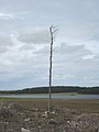 Lonesome pine - geograph.org.uk - 924024.jpg 480 × 640; 52 KB
-

-
 Looking upstream from the bridge at Lowertown ford - geograph.org.uk - 5459134.jpg 2,030 × 2,909; 1.31 MB
-
 Lowermoor Water Treatment Works - geograph.org.uk - 5554660.jpg 1,600 × 1,200; 424 KB
-
 Minor road near Watergate - geograph.org.uk - 5767613.jpg 640 × 480; 86 KB
-
 Old earthworks at the edge of Davidstow airfield - geograph.org.uk - 5511982.jpg 1,600 × 1,200; 378 KB
-
 Old Milestone by the B3266, Trecarne - geograph.org.uk - 5623164.jpg 533 × 800; 272 KB
-
 Passing place on Roughtor Road - geograph.org.uk - 2821256.jpg 1,024 × 680; 176 KB
-

-
 Pasture fields near Moorgate - geograph.org.uk - 5459524.jpg 2,489 × 1,320; 850 KB
-
 Pasture near Moorgate - geograph.org.uk - 5459532.jpg 3,072 × 2,048; 981 KB
-
 Poldue Downs Ford - geograph.org.uk - 4677512.jpg 6,000 × 4,000; 6.35 MB
-
 Road near Crowdy Reservoir - geograph.org.uk - 5691948.jpg 3,786 × 2,778; 1.01 MB
-
 Road past Lowermoor Water Treatment Works - geograph.org.uk - 5691956.jpg 4,273 × 2,570; 1.13 MB
-
 Road past Lowertown Farm - geograph.org.uk - 5459130.jpg 3,068 × 1,803; 1.08 MB
-
 Road through Davidstow Woods - geograph.org.uk - 4450123.jpg 1,920 × 1,440; 751 KB
-
 Road through Davidstow Woods - geograph.org.uk - 4705783.jpg 1,920 × 1,440; 703 KB
-
 Road to Crowdy Reservoir - geograph.org.uk - 5691892.jpg 3,775 × 1,744; 597 KB
-
 Road to Davidstow Woods - geograph.org.uk - 4705817.jpg 2,443 × 1,356; 707 KB
-
 Roughtor Road - geograph.org.uk - 2821235.jpg 1,024 × 680; 222 KB
-
 Roughtor Road - geograph.org.uk - 2821242.jpg 680 × 1,024; 197 KB
-
 Roughtor Road - geograph.org.uk - 3958142.jpg 640 × 480; 145 KB
-
 Roughtor Road and Roughtor Farm - geograph.org.uk - 2821283.jpg 1,024 × 680; 184 KB
-

-
 Sheep on the moor - geograph.org.uk - 3030349.jpg 1,600 × 1,064; 347 KB
-
 Sheep pasture above Trewint - geograph.org.uk - 5459702.jpg 2,758 × 1,581; 1.32 MB
-
 Sheep pasture above Trewint - geograph.org.uk - 5459891.jpg 2,976 × 1,618; 1.36 MB
-
 Sheep pasture above Trewint - geograph.org.uk - 5459900.jpg 2,706 × 1,720; 1,011 KB
-
 Sheep pasture above Trewint - geograph.org.uk - 5460141.jpg 2,091 × 839; 239 KB
-
 Sheep pasture above Trewint - geograph.org.uk - 5460158.jpg 3,060 × 1,879; 1.47 MB
-
 Stannon Stream valley - geograph.org.uk - 5436794.jpg 2,903 × 1,755; 1.28 MB
-
 Stile on Camelford Way - geograph.org.uk - 5459603.jpg 3,072 × 2,048; 1.65 MB
-

-

-
 Stream at Watergate - geograph.org.uk - 5767207.jpg 480 × 640; 144 KB
-
 Sunset over Davidstow Airfield - geograph.org.uk - 4450107.jpg 1,920 × 1,195; 486 KB
-
 Sunset over Davidstow Airfield - geograph.org.uk - 4704927.jpg 1,912 × 871; 205 KB
-
 The Dam at Crowdy Reservoir - geograph.org.uk - 380089.jpg 640 × 480; 78 KB
-
 The entrance to Tor Farm - geograph.org.uk - 5767607.jpg 640 × 480; 58 KB
-
 The masts of Davidstow radio station - geograph.org.uk - 5761650.jpg 1,600 × 800; 406 KB
-
 The River Camel at Kenningstock Mill - geograph.org.uk - 3964547.jpg 640 × 480; 140 KB
-
 The Rough Tor Car Park - geograph.org.uk - 2883444.jpg 1,024 × 768; 192 KB
-
 The track leading to Advent Church - geograph.org.uk - 3964518.jpg 640 × 480; 99 KB
-
 Towards the Camel valley - geograph.org.uk - 5459585.jpg 3,060 × 1,770; 1.25 MB
-
 Track heading off the lane near Aldermoor farm - geograph.org.uk - 5832617.jpg 1,024 × 768; 194 KB
-

-
 Trecarne Ford - geograph.org.uk - 4677595.jpg 6,000 × 4,000; 6.32 MB
-
 Tregoodwell Brook - geograph.org.uk - 735450.jpg 640 × 480; 146 KB
-
 Tregoodwell Brook - geograph.org.uk - 735451.jpg 640 × 480; 134 KB
-
 Tregoodwell Brook - geograph.org.uk - 735452.jpg 640 × 480; 142 KB
-
 Tyland Road - geograph.org.uk - 735233.jpg 640 × 490; 98 KB
-
 Tyland Road - geograph.org.uk - 735342.jpg 480 × 640; 139 KB
-
 Valleyside Pasture - geograph.org.uk - 2874628.jpg 1,024 × 768; 318 KB
-
 Walled bank near Carcade - geograph.org.uk - 734792.jpg 640 × 352; 62 KB
-
 Watercourse by Tyland Road - geograph.org.uk - 735253.jpg 640 × 480; 149 KB
-
 Watermill Walk west of Trewint - geograph.org.uk - 5460180.jpg 2,048 × 3,072; 1.25 MB
-
 Which way is the wind blowing^ - geograph.org.uk - 2223170.jpg 1,549 × 1,320; 133 KB
-
 Wind turbine at Higher Parklands - geograph.org.uk - 2821727.jpg 1,024 × 680; 196 KB
-
 Wood near Crowdy Reservoir - geograph.org.uk - 5666035.jpg 4,288 × 2,848; 1.3 MB


