Category:Adolph-Kolping-Denkmal (Börger)
Jump to navigation
Jump to search
| Object location | | View all coordinates using: OpenStreetMap |
|---|
Media in category "Adolph-Kolping-Denkmal (Börger)"
The following 5 files are in this category, out of 5 total.
-
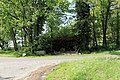 Börger - Im Wacholderhain - Adolph-Kolping-Denkmal 01 ies.jpg 5,616 × 3,744; 27.53 MB
-
 Börger - Im Wacholderhain - Adolph-Kolping-Denkmal 02 ies.jpg 5,616 × 3,744; 24.9 MB
-
 Börger - Im Wacholderhain - Adolph-Kolping-Denkmal 03 ies.jpg 5,616 × 3,744; 25.91 MB
-
 Börger - Im Wacholderhain - Adolph-Kolping-Denkmal 04 ies.jpg 5,616 × 3,744; 21.46 MB
-
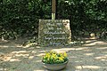
 Börger - Im Wacholderhain - Adolph-Kolping-Denkmal 05 ies.jpg 5,616 × 3,744; 18.99 MB


