Category:Admiralty Charts Region K: China and Korean Gulf
Jump to navigation
Jump to search
Media in category "Admiralty Charts Region K: China and Korean Gulf"
The following 51 files are in this category, out of 51 total.
-
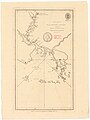
 Admiralty Chart No 1028 Pehoe, or Ponghou Islands, Published 1792.jpg 8,478 × 5,356; 8.51 MB
-
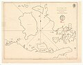
 Admiralty Chart No 1029 Aimoey Harbour Entrance of Chinchew River, Published 1792.jpg 3,236 × 4,152; 2.68 MB
-
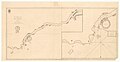
 Admiralty Chart No 1030 Hocsieu Bay and Mouths of the River Chang, Published 1784.jpg 3,057 × 4,088; 2.34 MB
-
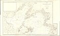
 Admiralty Chart No 1032 Kittow Point to Limpo River, Published 1783.jpg 5,058 × 3,972; 3.37 MB
-
 Admiralty Chart No 1033 Limpo or Ning-Po, with Entrance of Limpo River, Published 1784.jpg 7,882 × 4,062; 5.68 MB
-
 Admiralty Chart No 104 Korean Archipelago southern portion, Published 1871.jpg 12,349 × 8,284; 11.23 MB
-

-
 Admiralty Chart No 1255 Kiaochow Bay to Lai Chau Bay, Published 1906.jpg 16,170 × 11,094; 54.83 MB
-

-
 Admiralty Chart No 1256 China, east coast Yellow Sea and Gulf of Pe-chili, Published 1840.jpg 7,466 × 5,815; 15.37 MB
-
 Admiralty Chart No 1256 Gulfs of Pohai and Liaotung, Published 1862, Large Corrections to 1950.jpg 18,365 × 11,170; 33.99 MB
-
 Admiralty Chart No 1280 Gyu To and Tonai Kai, Published 1915.jpg 16,244 × 11,108; 39.51 MB
-
 Admiralty Chart No 1392 Pohai Strait, Published 1910.jpg 8,249 × 11,037; 18.83 MB
-

-
 Admiralty Chart No 1754 Tung-Yin Shan to Wen-Chou Wan, Published 1960.jpg 16,328 × 11,123; 42.65 MB
-

-
 Admiralty Chart No 1760 The Brothers to Ockseu Island, Published 1891.jpg 20,790 × 11,294; 67.52 MB
-

-
 Admiralty Chart No 1786 Approaches to Ch'uan-Chou Chiang, Published 1956.jpg 11,221 × 8,267; 27.2 MB
-
 Admiralty Chart No 1798 Kinchau to Terminal Head, Published 1909.jpg 20,452 × 11,478; 64.44 MB
-
 Admiralty Chart No 1957 Hao-Wang Chiao to Hsiung-Ti Tao, Published 1934, New Edition 1954.jpg 16,381 × 11,301; 45.62 MB
-
 Admiralty Chart No 1959 Wei-T'ou Ao and Shen-Hu Wan, Published 1849, Large Corrections 1954.jpg 8,247 × 11,259; 17.84 MB
-
 Admiralty Chart No 1968 Tai-Wan and Strait, Published 1966.jpg 16,365 × 11,235; 36.98 MB
-
 Admiralty Chart No 1985 Hai-T'an Hsia, Published 1959.jpg 11,068 × 16,307; 53.55 MB
-
 Admiralty Chart No 2105 Yaeyama Retto, Published 1852.jpg 11,279 × 8,203; 21.38 MB
-
 Admiralty Chart No 2376 Plans and Anchorages in Formosa, Published 1932.jpg 11,109 × 16,247; 43.66 MB
-

-
 Admiralty Chart No 2653 Plans in Po Hai and Liai-Tung Wan, Published 1960.jpg 18,417 × 11,303; 62.04 MB
-
 Admiralty Chart No 2833 Fort Head to Kinchau, Published 1912 (composite).jpg 12,974 × 16,419; 68.34 MB
-
 Admiralty Chart No 2833 Fort Head to Kinchau, Published 1912.jpg 11,298 × 16,521; 62.79 MB
-
 Admiralty Chart No 2946 Ch'ang Chiang Sheet 1, Published 1954.jpg 16,467 × 11,310; 35.11 MB
-
 Admiralty Chart No 2991 Liao River, Published 1909.jpg 16,394 × 11,243; 51.71 MB
-
 Admiralty Chart No 3230 Miyako Retto, Published 1966.jpg 16,467 × 11,342; 29.67 MB
-
 Admiralty Chart No 3236 Okinawa Gunto to Formosa, Published 1948.jpg 16,226 × 11,122; 40 MB
-
 Admiralty Chart No 3378 Chinwangtao, Published 1946.jpg 11,120 × 16,258; 56.12 MB
-
 Admiralty Chart No 3378 Gulf of Chihli Rocky Point to Temple Head, Published 1903.jpg 11,133 × 8,079; 29.76 MB
-
 Admiralty Chart No 3480 Shantung Promontory to Nagasaki, Published 1905.jpg 16,406 × 11,315; 53.69 MB
-
 Admiralty Chart No 3491 Shitau Bay to North East Promontory, Published 1966.jpg 11,276 × 16,490; 47.97 MB
-
 Admiralty Chart No 3554 Tau Tsui Head to Shitau Bay, Published 1973.jpg 18,494 × 11,213; 59.8 MB
-
 Admiralty Chart No 3694 Dairen Wan, Published 1908, Large Corrections 1927.jpg 16,277 × 11,095; 62.83 MB
-
 Admiralty Chart No 3694 Ta-Lien Wan, Published 1908, Large Corrections 1956.jpg 16,310 × 11,252; 58.4 MB
-
 Admiralty Chart No 3701 Plans in Okinawa Gunto, Published 1908.jpg 16,250 × 11,128; 49.94 MB
-
 Admiralty Chart No 3735 Cape Yatau to TauTsui Head, Published 1909.jpg 11,217 × 16,395; 36.32 MB
-
 Admiralty Chart No 857 Kiaochow Bay, Published 1865, New Edition 1917.jpg 16,139 × 11,057; 69.94 MB
-
 Admiralty Chart No 857 Kiaochow Bay, Published 1971.jpg 16,291 × 11,114; 34.44 MB
-
 Admiralty Chart No 873 Amami Gunto, Published 1891.jpg 11,101 × 8,155; 20.66 MB
-
 Admiralty Chart No 990 Naha Ko, Published 1897.jpg 16,432 × 11,279; 59.81 MB
-
 Admiralty Chart No 996 Views of Formosa & Bashee islands, Published 1781.jpg 10,310 × 5,380; 12.52 MB
-
 Gyu To (Udo Island) Cropped from Admiralty Chart No 1280 Gyu To and Tonai Kai, Published 1915.jpg 6,289 × 10,484; 17.91 MB
-

-


.jpg)


_Cropped_from_Admiralty_Chart_No_1280_Gyu_To_and_Tonai_Kai,_Published_1915.jpg)

_Cropped_from_Admiralty_Chart_No_1280_Gyu_To_and_Tonai_Kai,_Published_1915.jpg)