Category:Admiralty Charts
Jump to navigation
Jump to search
UK Admiralty charts were first published in 1800, and subsequently achieved worldwide coverage. They are covered by Crown Copyright, which expires 50 years after publication. Catalogues of available charts were produced over the years, including:
- (1825) A catalogue of charts, plans, and views, printed at the Admiralty Office, for the use of His Majesty's Navy; and now sold (wholesale and retail), for the use of navigators in general., London: Admiralty Office
- (1839) Catalogue of charts, plans, views, and sailing directions &c., London: Her Majesty's Stationery Office
- (1849) Catalogue of charts, plans, views, and sailing directions &c., London: Her Majesty's Stationery Office
- (1857) Catalogue of charts, plans, views, and sailing directions &c., London: Her Majesty's Stationery Office
- Dunsterville, Edward (1860) Admiralty Catalogue of Charts, Plans, Views, and Sailing Directions, &c., London: Her Majesty's Stationery Office
- Dunsterville, Edward (1864) Admiralty Catalogue of Charts, Plans, Views, and Sailing Directions, &c., London: Her Majesty's Stationery Office
- Dunsterville, Edward (1870) Admiralty Catalogue of Charts, Plans, Views, and Sailing Directions, &c., London: Her Majesty's Stationery Office
- Dunsterville, Edward (1877) Admiralty Catalogue of Charts, Plans, Views, and Sailing Directions, &c., London: Her Majesty's Stationery Office
- (1879) Catalogue of Admiralty charts, plans, and sailing directions, 1879, London: Her Majesty's Stationery Office
- (1880) Catalogue of Admiralty charts, plans, and sailing directions, 1880, London: Her Majesty's Stationery Office
- (1890) Catalogue of Admiralty charts, plans, and sailing directions, 1890, London: Her Majesty's Stationery Office
- (1898) Catalogue of Admiralty charts, plans, and sailing directions, 1898, London: Her Majesty's Stationery Office
- (1907) A Consecutive List of the Admiralty Charts 31st December 1906, London: Her Majesty's Stationery Office
- (1914) Catalogue of Admiralty charts, plans, London: His Majesty's Stationery Office
- (1955) Catalogue of Admiralty Charts(Abridged Edition), Hydrographer of the Navy
- (1961) Catalogue of Admiralty Charts and Hydrographic Publications. Complete world-wide edition, Hydrographer of the Navy
- (1967) Catalogue of Admiralty Charts and Hydrographic Publications. Home Edition covering the coasts of the British Isles and part of the coast of North-west Europe, Hydrographer of the Navy
- (1967) Catalogue of Admiralty Charts and Hydrographic Publications. Complete world-wide edition, Hydrographer of the Navy
brand of nautical chart | |||||
| Upload media | |||||
| Subclass of | |||||
|---|---|---|---|---|---|
| |||||
- List of UK Admiralty Charts by number from the 1967 world-wide catalogue
- Index maps from the 1967 world-wide catalogue
Index maps were also published in the Sailing Directions series. Some of these can be found in the category Admiralty Chart Indexes.
Subcategories
This category has the following 7 subcategories, out of 7 total.
A
- Admiralty Map Details (177 F)
B
L
- Lifeboat charts (6 F)
T
- The China Sea Directory (9 F)
V
- Views from Admiralty Charts (65 F)
Media in category "Admiralty Charts"
The following 84 files are in this category, out of 84 total.
-

-
 A plan of Cambridge Gulf, on the north west coast of Australia, Published 1826.jpg 5,703 × 7,529; 9.6 MB
-
 A plan of Exmouth Gulf, on the north west coast of Australia, Published 1826.jpg 9,648 × 7,296; 17.99 MB
-

-
 A Survey of the Inner And Outer Bays of Long Point.jpg 6,135 × 4,148; 4.77 MB
-
 Admiralty Chart Bass's Strait, Published 1803.jpg 5,912 × 3,980; 6.04 MB
-
 Admiralty Chart No D.6697 Standard Patterns, Published 1918, New Edition 1953.jpg 11,063 × 8,133; 8.93 MB
-
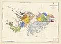 Admiralty Ordnance Survey Falklands, Published 1884 - 1928.jpg 16,410 × 11,880; 56.16 MB
-
 Alderney Harbour, plan of breakwater and Admiralty property. RMG F0258.tiff 7,211 × 6,175; 127.4 MB
-
 An Accurate Chart of the Coast of West Florida, and the Coast of Louisiana.jpg 30,000 × 5,992; 22.09 MB
-
 An Orometric Survey of Mayo.jpg 3,003 × 3,743; 2.55 MB
-
 An Orometric Survey of Sal.jpg 2,832 × 3,745; 2.64 MB
-
 Andros Island-1844.jpg 1,091 × 1,431; 178 KB
-

-
 America, N.W. Coast, Strait of Juan de Fuca (NYPL b20749013-5452691).jpg 7,329 × 7,954; 50.02 MB
-
 Bass Strait 1898 nautical chart.jpg 8,461 × 12,407; 40.97 MB
-
 Bass strait west.jpg 8,288 × 12,058; 46.51 MB
-

-
 Cape of Good Hope Her Majesty's Naval Establishments at Simon's Bay RMG F0507.tiff 7,416 × 5,639; 119.64 MB
-
 Chart F.081 Plans in the Kyles of Bute, Issued 1941.jpg 16,285 × 11,082; 40.19 MB
-

-

-
 Chart of Port Pegasus (Stewart Island) (16565091701).jpg 3,995 × 4,332; 4.66 MB
-
 Chart of Terra Australis - South Coast, sheet V. 1798, 1802 and 3. RMG F0109.tiff 7,505 × 4,946; 106.2 MB
-

-
 Chart of the Arctic regions from the Admiralty surveys. Third edition. RMG F0461.tiff 6,158 × 6,035; 106.33 MB
-
 Chart of the Bay of Sighajik - by Francis Beaufort F.R.S - 1811 and 1812 RMG L6252.tiff 4,800 × 3,801; 52.2 MB
-

-

-
 Chart of the North Polar Sea LOC 2018587008.jpg 9,505 × 7,527; 12.76 MB
-
 Chart of the North Polar Sea LOC 2018587008.tif 9,505 × 7,527; 204.69 MB
-
 Chart of the North Polar Sea. RMG F6344.tiff 6,331 × 6,400; 115.92 MB
-
 Chart of the North Polar Sea. RMG F9897.tiff 5,318 × 5,250; 79.88 MB
-

-

-

-

-

-

-
 Coast of Syria. Iyskanderin Latakiah and Markhab.jpg 8,037 × 6,006; 11.83 MB
-
 Discoveries in the Arctic Sea up to MDCCCLIV LOC 2018593012.jpg 14,224 × 11,760; 19.03 MB
-
 Discoveries in the Arctic Sea with additions and changes to 1909 11-c.170-1909b.png 24,267 × 19,917; 1.35 GB
-
 Fair Chart Kyrenia 01.jpg 5,844 × 5,246; 2.04 MB
-
 Fair Chart Kyrenia 02.jpg 3,944 × 3,335; 1.26 MB
-
 Flora Hongkongensis - Hong-Kong and the kowloon peninsula.png 2,464 × 3,537; 1.18 MB
-
 Forrest Chart of Kanary islands North of Mysol, Published 1781.jpg 3,120 × 4,000; 2.38 MB
-

-
 Forrest Chart Strait of Secockup, Mazular Island, Published 1782.jpg 3,288 × 4,184; 2.73 MB
-

-

-
 Gambier Islands 1826 map by Beechey.jpg 5,967 × 6,113; 3.98 MB
-
 IAN 0558 Cooling 1834 Preveza.jpg 7,528 × 5,834; 40.84 MB
-
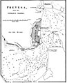 IAN 0559 Cooling 1834 Preveza.jpg 1,600 × 1,969; 885 KB
-
 Preveza map with the church of St John Chrysostom 1834.jpg 393 × 730; 399 KB
-
-
 Island and anchorages in the Southern Ocean - Maquarie Island - 1950 nautical chart.jpg 5,000 × 7,328; 17.12 MB
-
 Japan - Nipon, Kiusiu and Sikok, and a part of the coast of Korea LOC 2015588080.jpg 11,773 × 9,547; 12.43 MB
-
 Japan - Nipon, Kiusiu and Sikok, and a part of the coast of Korea LOC 2015588080.tif 11,773 × 9,547; 321.57 MB
-
 Karamania Chart I from Makry to Khelidonia - by Francis Beaufort F.R.S - 1811 RMG F8518.tiff 6,646 × 4,915; 93.46 MB
-
 Karamania Chart III from Cape Karaboornoo to Cape Anamour. RMG F0138.tiff 6,657 × 5,372; 102.31 MB
-
 Leopard Bank 1823.jpg 2,840 × 3,023; 2.13 MB
-

-

-
-
 Melinda chart 1873.jpg 2,874 × 3,121; 1.71 MB
-
 Melinda coast 1873.jpg 2,768 × 2,740; 1.64 MB
-
 Melinda in Melinda chart 1873.jpg 2,283 × 2,090; 993 KB
-

-

-
 America, N.W. Coast, Strait of Juan de Fuca (NYPL b20749013-5452692).jpg 7,364 × 7,988; 49.76 MB
-
 Perim Island 1858 chart by Walker Lamb.jpg 1,500 × 1,124; 153 KB
-
 Plan of Diu Island by John McCluer 1788 RMG L4267.tiff 6,000 × 4,827; 82.86 MB
-

-
 Plan of the harbours and fortifications of Valetta in the island of Malta RMG F0433.tiff 5,429 × 7,259; 112.75 MB
-
 Port Melinda reef 1867.jpg 2,396 × 3,473; 1.68 MB
-

-
 Santorini1848.jpg 2,691 × 3,249; 1.56 MB
-
 Wellington Channel Melville Island &c from Admiralty Chart 1862.jpg 2,257 × 1,200; 2.24 MB
-
 William Rea Furlong map collection. LOC 2016586588-3.jpg 8,021 × 11,872; 13.37 MB
-
 William Rea Furlong map collection. LOC 2016586588-3.tif 8,021 × 11,872; 272.44 MB
-
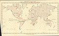 World Ocean Current Chart - August.jpg 8,426 × 5,091; 10.53 MB
-
 World Ocean Current Chart - February.jpg 8,403 × 5,120; 10.08 MB
-
 World Wind Chart fig 143 January February March.jpg 5,504 × 3,833; 5.17 MB
-
 World Wind Chart fig 144 July August September.jpg 5,504 × 3,833; 5.35 MB


.jpg)


_(16565091701).jpg)


_(3724751902).jpg)


.jpg)
.jpg)


