Category:Administrative maps of voivodeships of Poland
Jump to navigation
Jump to search
Subcategories
This category has only the following subcategory.
Media in category "Administrative maps of voivodeships of Poland"
The following 19 files are in this category, out of 19 total.
-
Greater Poland Voivodeship administrative map.svg 1,234 × 1,612; 5.08 MB
-
Kuyavian-Pomeranian Voivodeship administrative map.svg 1,231 × 936; 3.78 MB
-
Lesser Poland Voivodeship administrative map.svg 1,147 × 929; 4.82 MB
-
Lower Silesian Voivodeship administrative map.svg 1,140 × 1,044; 4.16 MB
-
Lublin Voivodeship administrative map.svg 1,133 × 1,194; 4.64 MB
-
Lubusz Voivodeship admi map (croped) - PL.svg 1,777 × 2,712; 2.65 MB
-
Lubusz Voivodeship administrative map.svg 848 × 1,008; 3.27 MB
-
Masovian Voivodeship administrative map.svg 1,500 × 1,493; 5.28 MB
-
Mazowieckie-administracja.png 1,652 × 1,687; 1.14 MB
-
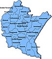
Podkarpackie powiaty.jpg 395 × 448; 34 KB
-
Podkarpackie Voivodeship administrative map.svg 1,034 × 992; 3.79 MB
-
Podlaskie Voivodeship administrative map.svg 1,125 × 1,522; 3.04 MB
-
Podział administracyjny województwa Białostockiego. .jpg 3,840 × 3,529; 4.2 MB
-
Pomeranian Voivodeship administrative map.svg 1,476 × 939; 3.34 MB
-
Silesian Voivodeship administrative map.svg 1,966 × 2,548; 4.04 MB
-
Warmian-Masurian Voivodeship administrative map.svg 1,786 × 885; 3.23 MB
-
West Pomeranian Voivodeship administrative map.svg 925 × 1,082; 3.48 MB
-
Łódź Voivodeship administrative map.svg 1,076 × 938; 3.99 MB
-
Świętokrzyskie Voivodeship administrative map.svg 1,550 × 885; 3 MB


