Category:Administrative maps of Syria
Appearance
Subcategories
This category has the following 2 subcategories, out of 2 total.
Pages in category "Administrative maps of Syria"
This category contains only the following page.
Media in category "Administrative maps of Syria"
The following 77 files are in this category, out of 77 total.
-
Syria (+Golan), administrative divisions - de - colored.svg 922 × 762; 308 KB
-
Syria districts.png 1,228 × 866; 25 KB
-
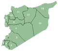
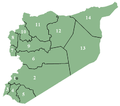
Syrnumbered.png 672 × 594; 20 KB
-
Al-Hasakah blank districts.png 494 × 318; 4 KB
-
Al-Hasakah districts (ku).PNG 788 × 599; 79 KB
-
Al-Hasakah districts.png 1,002 × 762; 19 KB
-
Al-Hasakah Governorate.svg 771 × 696; 22 KB
-
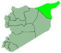
Al-Hasakah-map.png 672 × 594; 17 KB
-
Aleppo Governorate.svg 771 × 696; 22 KB
-
Ar-Raqqah blank districts.png 284 × 277; 3 KB
-
Ar-Raqqah districts.png 1,004 × 763; 19 KB
-
As-Suwayda blank districts.png 218 × 220; 13 KB
-
As-Suwayda districts.png 1,002 × 757; 18 KB
-
As-Suwayda Governorate.svg 771 × 696; 22 KB
-
Damascus Governorate.svg 771 × 696; 22 KB
-
Daraa blank districts.png 156 × 222; 8 KB
-
Daraa districts.png 1,005 × 760; 20 KB
-
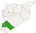
Daraa Governorate.svg 771 × 696; 22 KB
-
Deir ez-Zor blank districts.png 354 × 461; 4 KB
-
Deir ez-Zor districts.png 1,001 × 761; 19 KB
-
Deir ez-Zor Governorate.svg 771 × 696; 22 KB
-
Demographic map of the Golan Heights - Before 1967 - Legend.png 1,255 × 1,850; 136 KB
-
Demographic map of the Golan Heights - Before 1967.png 1,255 × 1,850; 106 KB
-
Demographic map of the Golan Heights - Legend.png 1,255 × 1,850; 140 KB
-
Demographic map of the Golan Heights.png 1,255 × 1,850; 96 KB
-
Golan Heights administrative Division - Legend.png 1,255 × 1,850; 100 KB
-
Golan Heights administrative Division.png 1,255 × 1,850; 85 KB
-
Hama blank districts.png 960 × 576; 48 KB
-
Hama districts.png 1,008 × 766; 19 KB
-
Hama Governorate.svg 771 × 696; 22 KB
-
Hama-map.png 672 × 594; 10 KB
-
Hasakah.PNG 672 × 594; 17 KB
-
Homs blank districts.png 561 × 413; 5 KB
-
Homs districts.png 1,002 × 763; 22 KB
-
Homs Governorate.svg 771 × 696; 22 KB
-
Jisr ash-Shugur district.png 988 × 751; 18 KB
-
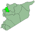
SyriaIdlib.PNG 672 × 594; 17 KB
-
Idlib blank districts.png 624 × 751; 43 KB
-
Idlib districts.png 988 × 751; 19 KB
-
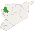
Idlib Governorate.svg 771 × 696; 22 KB
-
Arihah nahiyah.svg 130 × 150; 39 KB
-
Armanaz nahiyah.svg 130 × 150; 39 KB
-
Harem nahiyah.svg 130 × 150; 39 KB
-
Jisr ash-Shugur nahiyah.svg 130 × 150; 77 KB
-
Kafr Nabl nahiyah.svg 130 × 150; 77 KB
-
Kafr Takharim nahiyah.svg 130 × 150; 39 KB
-
Khan Shaykhun nahiyah.svg 130 × 150; 39 KB
-
Senjar nahiyah.svg 130 × 150; 39 KB
-
SyriaLatakia.PNG 672 × 594; 17 KB
-
Latakia blank districts.png 155 × 233; 14 KB
-
Latakia Governorate.svg 771 × 696; 22 KB
-
Quneitra blank districts.png 98 × 180; 7 KB
-
Quneitra districts.png 1,005 × 764; 18 KB
-
Quneitra Governorate.svg 771 × 696; 22 KB
-
Raqqa Governorate.svg 771 × 696; 22 KB
-
Rif Dimashq blank districts.png 457 × 340; 31 KB
-
Rif Dimashq districts.png 1,004 × 765; 26 KB
-
Rif-Dimashq Governorate.svg 771 × 696; 22 KB
-
Siria.PNG 399 × 353; 38 KB
-
SyriaAlQunaitira.PNG 672 × 594; 17 KB
-
SyriaArRaqqa.PNG 672 × 594; 17 KB
-
SyriaAsSuwaida.PNG 672 × 594; 17 KB
-
SyriaDair-az-Zaur.PNG 672 × 594; 17 KB
-
SyriaDara.PNG 672 × 594; 17 KB
-
SyriaHama.PNG 672 × 594; 17 KB
-
SyriaHasaka.PNG 672 × 594; 17 KB
-
SyriaHoms.png 672 × 594; 17 KB
-
SyriaMadinatDimasq.PNG 672 × 594; 17 KB
-
Syrian localities depopulated during and after the 1967 War - Golan Heights - Legend.png 1,255 × 1,850; 140 KB
-
Syrian localities depopulated during and after the 1967 War - Golan Heights.png 1,255 × 1,850; 107 KB
-
SyriaRifDimasq.PNG 672 × 594; 17 KB
-
SyriaTartus.PNG 672 × 594; 17 KB
-
Tartous districts.png 1,006 × 764; 17 KB
-
Tartus blank districts.png 264 × 427; 18 KB
-
Tartus Governorate.svg 771 × 696; 22 KB


