Category:Administrative maps of La Ferté-Imbault
Jump to navigation
Jump to search
Media in category "Administrative maps of La Ferté-Imbault"
The following 3 files are in this category, out of 3 total.
-
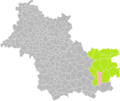
 La Ferté-Imbault dans son Arrondissement.png 2,000 × 1,684; 419 KB
-
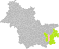
 La Ferté-Imbault dans son Canton.png 2,000 × 1,684; 414 KB
-
 La Ferté-Imbault dans son Intercommunalité.png 2,000 × 1,684; 412 KB


