Category:Acton, London
Jump to navigation
Jump to search
English: This category is for images of Acton (W3), west London, which is mainly in the London Borough of Ealing.
area of London and former civil parish  | |||||
| Upload media | |||||
| Instance of |
| ||||
|---|---|---|---|---|---|
| Part of |
| ||||
| Named after | |||||
| Location |
| ||||
| Area |
| ||||
 | |||||
Subcategories
This category has the following 28 subcategories, out of 28 total.
A
- Acton Lane, Acton (33 F)
- Acton Park, London (14 F)
- Acton Town Hall (16 F)
- Acton Town Mosque (7 F)
- Acton Works (24 F)
B
- Brian Acton (1 P)
C
E
- The Elms, Acton (2 F)
G
H
- Harlech Tower, Acton, London (2 F)
J
- Japanese School in London (8 F)
K
- King Street, Acton (5 F)
M
- Market Place, Acton (1 F)
P
S
- Salisbury Street, Acton (2 F)
V
Media in category "Acton, London"
The following 115 files are in this category, out of 115 total.
-

-
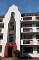 121-128 Ealing Village.jpg 592 × 896; 303 KB
-
 1904-07-10 front Old Steyne Acton.jpg 3,284 × 2,088; 1.21 MB
-
 1904-07-12 front Barons Pond Acton.jpg 3,312 × 2,100; 873 KB
-
 360202 and 56312 passes at Acton Bank 6th June 2016.jpg 3,264 × 2,448; 3.43 MB
-
 500px photo (31130071).jpeg 1,530 × 2,048; 847 KB
-
 59 201 & 66 009 Acton Yard.jpg 2,470 × 1,321; 700 KB
-
 Acton Green Terminus - geograph.org.uk - 721951.jpg 640 × 480; 121 KB
-
 Acton High Street Railway Bridge With Illuminated Sign.jpg 3,264 × 2,448; 2.19 MB
-
 Acton London Transport Museum Depot.jpg 640 × 480; 132 KB
-
 Acton Police Station and flats on Steyne Road - geograph.org.uk - 4398592.jpg 1,600 × 1,064; 247 KB
-
 Acton, Churchfields Road - geograph.org.uk - 4352756.jpg 2,816 × 2,112; 1.06 MB
-
 Acton, Cumberland Park - geograph.org.uk - 4402528.jpg 1,600 × 1,064; 377 KB
-
 Acton, Shaa Road - geograph.org.uk - 2113310.jpg 640 × 480; 107 KB
-
 Aggregate train, Acton yard - geograph.org.uk - 3539344.jpg 1,600 × 1,064; 402 KB
-
 Ashfield Road, Acton - geograph.org.uk - 4531894.jpg 2,304 × 1,728; 827 KB
-
 Avenue Rd - geograph.org.uk - 4054356.jpg 640 × 475; 84 KB
-
 Avenue Road - geograph.org.uk - 2645099.jpg 640 × 430; 146 KB
-
 Avenue Road, W3 - geograph.org.uk - 4397239.jpg 1,600 × 1,064; 460 KB
-
 Berrymead Gardens - geograph.org.uk - 4059557.jpg 640 × 430; 64 KB
-
 Berrymede Rd - geograph.org.uk - 4062850.jpg 640 × 430; 74 KB
-
 Billington Mews, Acton - geograph.org.uk - 3756472.jpg 1,034 × 1,600; 573 KB
-
 Birch Grove, Acton - geograph.org.uk - 3906539.jpg 2,304 × 1,728; 782 KB
-
 Bollo Bridge Rd - geograph.org.uk - 4059659.jpg 640 × 453; 68 KB
-
 Bollo Bridge Road - geograph.org.uk - 2766729.jpg 1,280 × 946; 528 KB
-
 Bridgman Road, Acton - geograph.org.uk - 4478720.jpg 2,304 × 1,728; 842 KB
-
 Bromyard Avenue - geograph.org.uk - 4086395.jpg 4,000 × 3,000; 4.36 MB
-
 Bromyard Avenue, Acton - geograph.org.uk - 4525071.jpg 2,304 × 1,728; 831 KB
-
 Building on Horn Lane - geograph.org.uk - 2767297.jpg 1,280 × 954; 406 KB
-
 Bulldozing homes.jpg 1,024 × 681; 181 KB
-
 Car park, Acton - geograph.org.uk - 3383246.jpg 640 × 364; 54 KB
-
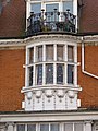
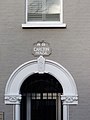 Carlton House detail - geograph.org.uk - 2765811.jpg 960 × 1,280; 331 KB
-
 Carlton House, Bollo Bridge Road - geograph.org.uk - 2765817.jpg 1,280 × 975; 451 KB
-
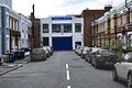
 Carphone warehouse main office.jpg 2,560 × 1,920; 1.49 MB
-

-
 Church Path, Acton - geograph.org.uk - 4478701.jpg 2,304 × 1,728; 862 KB
-
 Church Path, Acton - geograph.org.uk - 4478739.jpg 2,304 × 1,728; 832 KB
-
 Church Rd - geograph.org.uk - 4059545.jpg 640 × 430; 71 KB
-

-
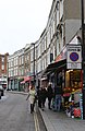
 Churchfield Road - geograph.org.uk - 2767313.jpg 1,280 × 960; 697 KB
-
 Churchfield Road - geograph.org.uk - 2767443.jpg 1,280 × 950; 618 KB
-
 Clovelly Rd - geograph.org.uk - 4059670.jpg 640 × 430; 78 KB
-
 Creffield Road - geograph.org.uk - 1273401.jpg 640 × 480; 68 KB
-
 Crown Street, London W3 - geograph.org.uk - 2215424.jpg 4,320 × 3,240; 4.05 MB
-
 Davis Road from The Vale, Acton - geograph.org.uk - 3067242.jpg 1,600 × 1,200; 594 KB
-
 Denehurst Gardens - geograph.org.uk - 4054399.jpg 640 × 430; 78 KB
-
 Denehurst Gardens, Acton - geograph.org.uk - 5561862.jpg 1,024 × 768; 163 KB
-
 Dog Grooming, Acton Central.jpg 3,674 × 3,673; 11.08 MB
-
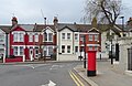
 Edward VII postbox on Winchester Street, Acton - geograph.org.uk - 6120219.jpg 2,129 × 4,103; 1.56 MB
-
 Enfield Road - geograph.org.uk - 2641568.jpg 640 × 449; 145 KB
-
 Fletcher Rd - geograph.org.uk - 4059666.jpg 640 × 430; 86 KB
-
 Fletcher Road - geograph.org.uk - 2765776.jpg 1,280 × 943; 606 KB
-
 Fletcher Road, Acton - geograph.org.uk - 4478738.jpg 2,304 × 1,728; 829 KB
-
 Former Guinness Brewery sidings at Park Royal on 14th July 2016 looking West.jpg 2,560 × 1,536; 1.88 MB
-
 Graham Rd - geograph.org.uk - 4062846.jpg 640 × 430; 64 KB
-
 Grove Road - geograph.org.uk - 2767380.jpg 1,280 × 960; 542 KB
-
 Hillcrest Rd - geograph.org.uk - 4054394.jpg 640 × 429; 71 KB
-
 Hillcrest Road, W3 - geograph.org.uk - 4397105.jpg 1,600 × 1,064; 387 KB
-
 Hillcrest Road, W3 - geograph.org.uk - 4397109.jpg 1,600 × 1,064; 414 KB
-
 Houses in Acton - geograph.org.uk - 17074.jpg 640 × 480; 102 KB
-
 Houses on Winchester Street, Acton - geograph.org.uk - 6120221.jpg 4,611 × 2,999; 2.57 MB
-
 Houses, Albert Road W3 - geograph.org.uk - 3598997.jpg 480 × 640; 169 KB
-
 Impress House, Mansell Road, Acton.jpg 5,580 × 3,720; 9.58 MB
-
 Japanese deli at West Acton.jpg 1,280 × 1,203; 882 KB
-
 Kings Parade (detail) - geograph.org.uk - 2766974.jpg 960 × 1,280; 329 KB
-
 Kings Parade - geograph.org.uk - 2766960.jpg 1,280 × 942; 552 KB
-
 Kingswood Road, Acton - geograph.org.uk - 4478726.jpg 2,304 × 1,728; 814 KB
-
 Leythe Rd - geograph.org.uk - 4059658.jpg 640 × 430; 82 KB
-
 Lillian Avenue - geograph.org.uk - 4054334.jpg 640 × 430; 76 KB
-
 Lillian Avenue - geograph.org.uk - 4054336.jpg 640 × 430; 85 KB
-
 London Underground C69 stock on Museum Way, London W3.jpg 3,264 × 2,448; 2.65 MB
-
 Londýn, Veľká Británia - panoramio (2).jpg 1,536 × 2,048; 861 KB
-

-
 Lynton Road Acton - geograph.org.uk - 3095671.jpg 640 × 480; 104 KB
-
 Main line railway, Acton - geograph.org.uk - 239091.jpg 640 × 480; 96 KB
-
 Mansell Road - geograph.org.uk - 2767409.jpg 1,280 × 960; 720 KB
-
 Market Place, Acton - geograph.org.uk - 2767022.jpg 1,280 × 960; 562 KB
-
 Market Place, Acton - geograph.org.uk - 3756495.jpg 1,044 × 1,600; 466 KB
-
 Mayfield Road, Acton - geograph.org.uk - 5351715.jpg 3,437 × 2,352; 1.74 MB
-
 Meon Rd - geograph.org.uk - 4059656.jpg 640 × 430; 83 KB
-
 Acton Hill Church 2015.jpg 960 × 728; 128 KB
-
 Michael Flanders Centre, Church Road, Acton - geograph.org.uk - 5561873.jpg 1,024 × 768; 120 KB
-
 Mill Hill - geograph.org.uk - 4054364.jpg 640 × 430; 105 KB
-
 Mill Hill Road - geograph.org.uk - 2646095.jpg 640 × 480; 174 KB
-
 Mill Hill Road, Acton - geograph.org.uk - 2759987.jpg 640 × 480; 74 KB
-
 Milton Road - geograph.org.uk - 2767446.jpg 1,280 × 960; 563 KB
-
-
 Narrow Street - geograph.org.uk - 2767307.jpg 1,280 × 960; 683 KB
-
 Nemoure Road, Acton - geograph.org.uk - 3383305.jpg 517 × 640; 69 KB
-
 Noel Road, W3 - geograph.org.uk - 2059021.jpg 3,504 × 2,336; 1.9 MB
-
 Noel Road, W3 - geograph.org.uk - 2214612.jpg 4,320 × 3,240; 3.75 MB
-
 Noel Road, W3 - geograph.org.uk - 2214619.jpg 4,320 × 3,240; 4.36 MB
-
 PassmoreEdwards.jpg 800 × 660; 321 KB
-
 Petersfield Rd - geograph.org.uk - 4059657.jpg 640 × 430; 71 KB
-
 Petersfield Road, Acton - geograph.org.uk - 4478745.jpg 2,304 × 1,728; 842 KB
-
 Pollarded trees on West Lodge Avenue - geograph.org.uk - 3906482.jpg 2,304 × 1,728; 830 KB
-
 Railway at Acton, with York Road beyond - geograph.org.uk - 138803.jpg 640 × 480; 105 KB
-
 Railway goods yard, Acton - geograph.org.uk - 139573.jpg 640 × 480; 70 KB
-
 Ramsay Road, Acton - geograph.org.uk - 2765801.jpg 1,280 × 952; 515 KB
-
 Ramsay Road, Acton - geograph.org.uk - 4478695.jpg 2,304 × 1,728; 828 KB
-
 Robert Spall VC birthplace plaque Acton UK.jpg 2,695 × 2,701; 899 KB
-
 Rosemont Road, Acton - geograph.org.uk - 3383279.jpg 501 × 640; 106 KB
-
 South end of Church Road, Acton - geograph.org.uk - 5561870.jpg 1,024 × 768; 237 KB
-
 Speldhurst Road, Acton - geograph.org.uk - 3529762.jpg 768 × 1,024; 218 KB
-
 Summerlands Avenue, Acton - geograph.org.uk - 5352963.jpg 3,888 × 2,592; 1.67 MB
-
 The Avenue, Acton - geograph.org.uk - 3529711.jpg 768 × 1,024; 225 KB
-
 The War Memorials of the First World War Q36995.jpg 800 × 597; 78 KB
-
 The War Memorials of the First World War Q36996.jpg 599 × 800; 75 KB
-
 Twyford Avenue, Acton - geograph.org.uk - 3906426.jpg 2,304 × 1,728; 803 KB
-
 West Lodge Avenue, Acton - geograph.org.uk - 3906486.jpg 1,728 × 2,304; 778 KB
-
 Whitehall Gardens, Acton - geograph.org.uk - 3906532.jpg 2,304 × 1,728; 852 KB
-
 Winchester St - geograph.org.uk - 4059646.jpg 640 × 430; 84 KB
-
 Winchester St - geograph.org.uk - 4059651.jpg 640 × 430; 74 KB
-
 Winchester Street at the junction of High Street Acton - geograph.org.uk - 3820584.jpg 2,304 × 1,728; 1.19 MB
-
 Winchester Street, London W5 - geograph.org.uk - 2215615.jpg 4,320 × 3,240; 4.54 MB


.jpeg)


_-_geograph.org.uk_-_2766974.jpg)


.jpg)


