Category:Achterstraat 48, Hattem
Jump to navigation
Jump to search
| Object location | | View all coordinates using: OpenStreetMap |
|---|
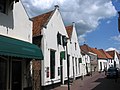
building in Hattem, Netherlands  | |||||
| Upload media | |||||
| Instance of | |||||
|---|---|---|---|---|---|
| Location | Hattem, Gelderland, Netherlands | ||||
| Street address |
| ||||
| Located on street |
| ||||
| Heritage designation |
| ||||
 | |||||
|
This is a category about rijksmonument number 20933
|
| Address |
|
Media in category "Achterstraat 48, Hattem"
The following 9 files are in this category, out of 9 total.
-
 A.achtergevel - Hattem - 20103217 - RCE.jpg 956 × 1,200; 268 KB
-
 Achtergevel - Hattem - 20103215 - RCE.jpg 803 × 1,200; 204 KB
-
 Hattem Achterstraat 46-48 Voerman Museum.JPG 2,272 × 1,704; 330 KB
-
 Hattem, Netherlands - panoramio (15).jpg 2,048 × 1,375; 324 KB
-
 Hattem, Netherlands - panoramio (17).jpg 2,048 × 1,375; 688 KB
-
 Hattem, Netherlands - panoramio (4).jpg 1,600 × 899; 428 KB
-
 HuisHattem.jpg 581 × 799; 160 KB
-
 Overzicht - Hattem - 20103216 - RCE.jpg 894 × 1,200; 162 KB
-
 Zicht op voorgevel Wal, achter de Kerkstraat - Hattem - 20103436 - RCE.jpg 884 × 1,200; 241 KB


.jpg)
.jpg)
.jpg)


