Category:Achter de Vismarkt 24, Gouda
Jump to navigation
Jump to search
| Object location | | View all coordinates using: OpenStreetMap |
|---|
 | |||||
| Upload media | |||||
| Instance of |
| ||||
|---|---|---|---|---|---|
| Location | Gouda, South Holland, Netherlands | ||||
| Street address |
| ||||
| Located on street | |||||
| Heritage designation |
| ||||
 | |||||
|
This is a category about rijksmonument number 16727
|
Media in category "Achter de Vismarkt 24, Gouda"
The following 3 files are in this category, out of 3 total.
-
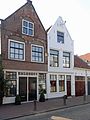 Achter de Vismarkt 22 en 24 Gouda.jpg 3,672 × 4,896; 840 KB
-
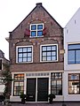 Achter de Vismarkt 24 Gouda.jpg 1,368 × 1,824; 414 KB
-
 Voorgevels - Gouda - 20082242 - RCE.jpg 804 × 1,200; 175 KB

